 |
|
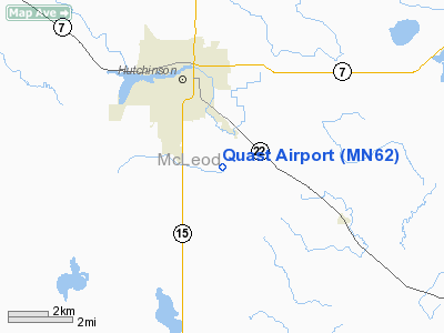
Location & QuickFacts
| FAA Information Effective: | 2008-09-25 |
| Airport Identifier: | MN62 |
| Airport Status: | Operational |
| Longitude/Latitude: | 094-21-00.9370W/44-50-59.8640N
-94.350260/44.849962 (Estimated) |
| Elevation: | 1050 ft / 320.04 m (Estimated) |
| Land: | 0 acres |
| From nearest city: | 3 nautical miles S of Hutchinson, MN |
| Location: | Mc Leod County, MN |
| Magnetic Variation: | 04E (1985) |
Owner & Manager
| Ownership: | Privately owned |
| Owner: | George Quast |
| Address: | 406 Main St S. Po Box 233
Hutchinson, MN 55350 |
| Phone number: | 612-587-2300 |
| Manager: | George Walter Quast |
| Address: | Po Box 233
Hutchinson, MN 55350 |
| Phone number: | 612-587-2300 |
Airport Operations and Facilities
| Airport Use: | Private |
| Wind indicator: | Yes |
| Segmented Circle: | No |
| Control Tower: | No |
| Landing fee charge: | No |
| Sectional chart: | Twin Cities |
| Region: | AGL - Great Lakes |
| Boundary ARTCC: | ZMP - Minneapolis |
| Tie-in FSS: | PNM - Princeton |
| FSS on Airport: | No |
| FSS Toll Free: | 1-800-WX-BRIEF |
Airport Services
| Airframe Repair: | NONE |
| Power Plant Repair: | NONE |
Runway Information
Runway E/W
| Dimension: | 2300 x 100 ft / 701.0 x 30.5 m |
| Surface: | TURF, |
| |
Runway E |
Runway W |
| Traffic Pattern: | Left | Left |
|
Radio Navigation Aids
| ID |
Type |
Name |
Ch |
Freq |
Var |
Dist |
| HCD | NDB | Hutchinson | | 209.00 | 04E | 1.5 nm |
| GYL | NDB | Glencoe | | 407.00 | 03E | 12.5 nm |
| ULM | NDB/DME | New Ulm | 050X | 272.00 | 04E | 32.6 nm |
| ILL | VOR/DME | Willmar | 084X | 113.70 | 04E | 35.3 nm |
| BDH | VOR/DME | Willmar | 84X | 113.70 | 04E | 36.7 nm |
| FCM | VOR/DME | Flying Cloud | 055X | 111.80 | 06E | 38.1 nm |
| RWF | VOR/DME | Redwood Falls | 080X | 113.30 | 07E | 40.4 nm |
| MKT | VOR/DME | Mankato | 045X | 110.80 | 07E | 42.3 nm |
| STC | VOR/DME | St Cloud | 058X | 112.10 | 03E | 43.8 nm |
| MSP | VOR/DME | Minneapolis | 100X | 115.30 | 02E | 47.5 nm |
| DWN | VORTAC | Darwin | 027X | 109.00 | 07E | 14.9 nm |
| GEP | VORTAC | Gopher | 120X | 117.30 | 06E | 45.2 nm |
| MSP | VOT | Minneapolis St Paul | | 111.00 | | 48.4 nm |
Remarks
Images and information placed above are from
http://www.airport-data.com/airport/MN62/
We thank them for the data!
| General Info
|
| Country |
United States
|
| State |
MINNESOTA
|
| FAA ID |
MN62
|
| Latitude |
44-50-59.864N
|
| Longitude |
094-21-00.937W
|
| Elevation |
1050 feet
|
| Near City |
HUTCHINSON
|
We don't guarantee the information is fresh and accurate. The data may
be wrong or outdated.
For more up-to-date information please refer to other sources.
|
|


