 |
|
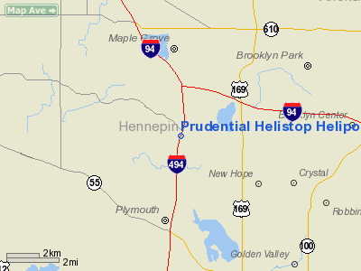
Prudential Helistop Heliport |
Location & QuickFacts
| FAA Information Effective: | 2008-09-25 |
| Airport Identifier: | MY20 |
| Airport Status: | Operational |
| Longitude/Latitude: | 093-26-54.8340W/45-03-49.8710N
-93.448565/45.063853 (Estimated) |
| Elevation: | 956 ft / 291.39 m (Estimated) |
| Land: | 0 acres |
| From nearest city: | 4 nautical miles NE of Plymouth, MN |
| Location: | Hennepin County, MN |
| Magnetic Variation: | 03E (1985) |
Owner & Manager
| Ownership: | Privately owned |
| Owner: | Prudential Ins Co Of America |
| Address: | 13001 County Road 10
Plymouth, MN 55442 |
| Phone number: | 763-553-8876 |
| Manager: | Terrie Jensen |
| Address: | 13001 County Road 10
Plymouth, MN 55442 |
| Phone number: | 763-553-8876 |
Airport Operations and Facilities
| Airport Use: | Private |
| Wind indicator: | Yes |
| Segmented Circle: | Yes |
| Control Tower: | No |
| Landing fee charge: | No |
| Sectional chart: | Twin Cities |
| Region: | AGL - Great Lakes |
| Boundary ARTCC: | ZMP - Minneapolis |
| Tie-in FSS: | PNM - Princeton |
| FSS on Airport: | No |
| FSS Toll Free: | 1-800-WX-BRIEF |
Runway Information
Helipad H1
| Dimension: | 90 x 90 ft / 27.4 x 27.4 m |
| Surface: | ASPH, |
| |
Runway H1 |
Runway |
| Traffic Pattern: | Left | Left |
|
Radio Navigation Aids
| ID |
Type |
Name |
Ch |
Freq |
Var |
Dist |
| MS | NDB | Narco | | 266.00 | 02E | 20.9 nm |
| PPI | NDB | Hopey | | 400.00 | 03E | 24.4 nm |
| CBG | NDB | Cambridge | | 350.00 | 03E | 30.7 nm |
| PNM | NDB | Princeton | | 368.00 | 03E | 30.8 nm |
| GYL | NDB | Glencoe | | 407.00 | 03E | 32.7 nm |
| OEO | NDB | Osceola | | 233.00 | 01E | 35.5 nm |
| RNH | NDB | New Richmond | | 257.00 | 02E | 39.1 nm |
| HCD | NDB | Hutchinson | | 209.00 | 04E | 41.7 nm |
| ROS | NDB | Rush City | | 282.00 | 02E | 43.4 nm |
| AHH | NDB | Ameron | | 278.00 | 01E | 47.5 nm |
| MSP | VOR/DME | Minneapolis | 100X | 115.30 | 02E | 13.5 nm |
| FCM | VOR/DME | Flying Cloud | 055X | 111.80 | 06E | 14.3 nm |
| STC | VOR/DME | St Cloud | 058X | 112.10 | 03E | 38.9 nm |
| GEP | VORTAC | Gopher | 120X | 117.30 | 06E | 5.9 nm |
| FGT | VORTAC | Farmington | 104X | 115.70 | 06E | 28.4 nm |
| DWN | VORTAC | Darwin | 027X | 109.00 | 07E | 42.7 nm |
| MSP | VOT | Minneapolis St Paul | | 111.00 | | 14.7 nm |
| STP | VOT | St Paul | | 114.40 | | 18.1 nm |
Remarks
- (E111-2) E111 CONT'D: NO NIGHT HEL OPNS ARE CONDUCTED UNLESS TOF/LNDG AREA & WIND INDCR ARE LGTD & A HELI IDENTIFICATION BEACON IS INSTALLED.
- NOT PLOWED IN WINTER
- E111: ALL APCH/DEP RTE HEL OPNS ARE CONDUCTED IN AN AREA 345 DEGS CLKWS TO 030 DEGS & FM 160 DEGS CLKWS TO 220 DEGS FM HELI, USING.... E111 CONT'D: TOUCHDOWN PAD AS CNTR OF A COMPASS ROSE; TKOF/LNDG AREA IS APROPLY MKD; NON-OBSTG WIND INDCR IS MAINTD ADJ TO TKOF LNDG AREA;
Images and information placed above are from
http://www.airport-data.com/airport/MY20/
We thank them for the data!
| General Info
|
| Country |
United States
|
| State |
MINNESOTA
|
| FAA ID |
MY20
|
| Latitude |
45-03-49.871N
|
| Longitude |
093-26-54.834W
|
| Elevation |
956 feet
|
| Near City |
PLYMOUTH
|
We don't guarantee the information is fresh and accurate. The data may
be wrong or outdated.
For more up-to-date information please refer to other sources.
|
|


