|
|
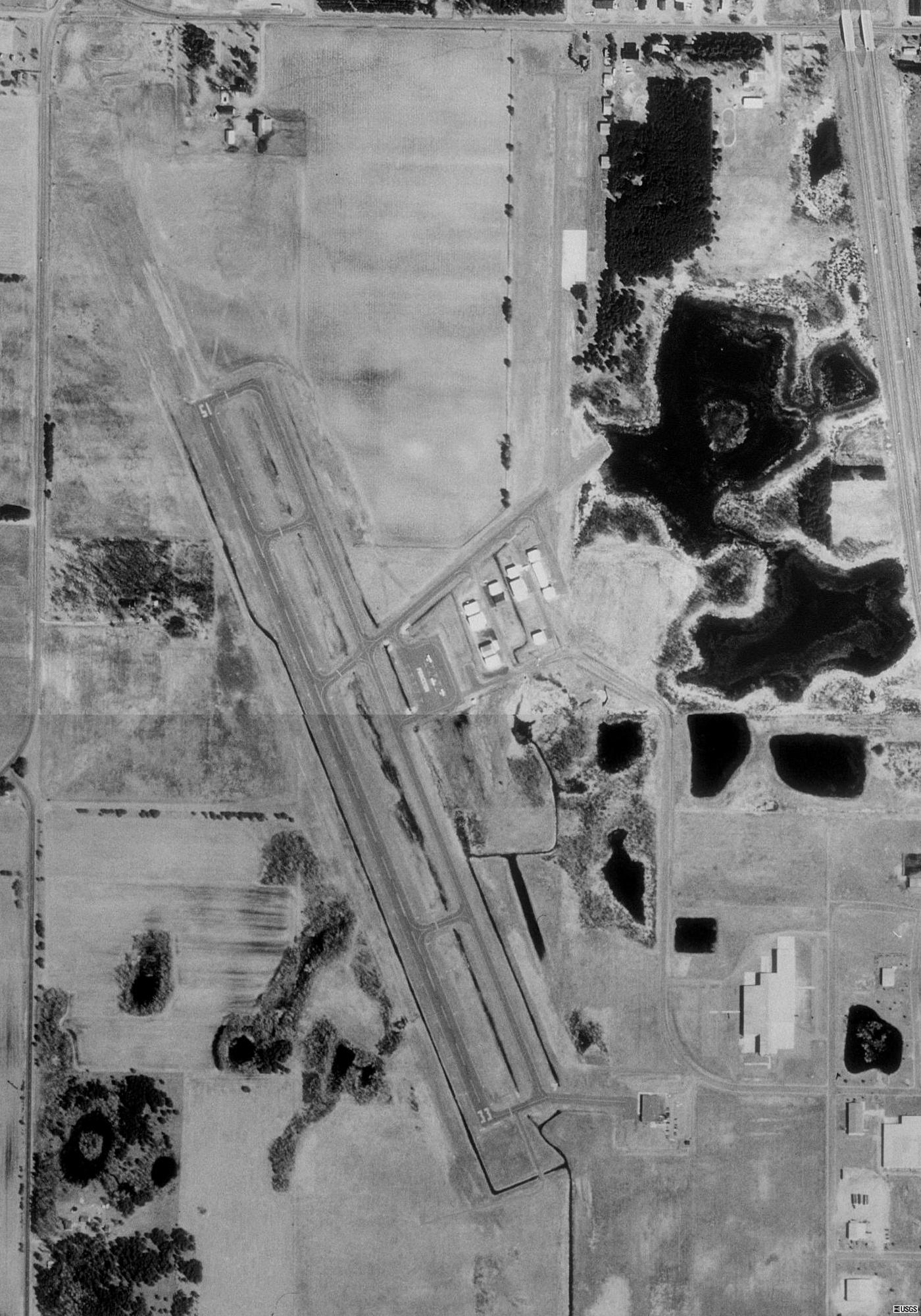
Princeton Municipal Airport |
| Princeton Municipal Airport |
 |
| USGS aerial image - 21 April 1991 |
| IATA: none – ICAO: KPNM – FAA LID: PNM |
| Summary |
| Airport type |
Public |
| Owner |
City of Princeton |
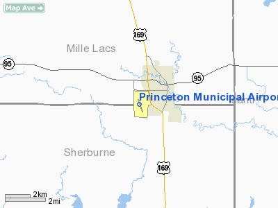
| Serves |
Princeton, Minnesota |
| Elevation AMSL |
980 ft / 299 m |
| Coordinates |
45°33′36″N 093°36′30″W / 45.56°N 93.60833°W / 45.56; -93.60833 |
| Runways |
| Direction |
Length |
Surface |
| ft |
m |
| 15/33 |
3,900 |
1,189 |
Asphalt |
| Statistics (2005) |
| Aircraft operations |
13,300 |
| Based aircraft |
34 |
| Sources: Minnesota DOT, FAA |
Princeton Municipal Airport (ICAO: KPNM, FAA LID: PNM) is a city-owned public-use airport located one nautical mile (1.85 km) southwest of the central business district of Princeton, a city in Mille Lacs County, Minnesota, United States. This airport is included in the FAA's National Plan of Integrated Airport Systems (2009-2013), which categorizes it as a general aviation airport.
Although most U.S. airports use the same three-letter location identifier for the FAA and IATA, this airport is assigned PNM by the FAA but has no designation from the IATA. History
The Federal Aviation Administration relocated the flight service station (FSS) for Minnesota to Princeton in 1987. The airport was completely renovated in 1988.
Facilities and aircraft
Princeton Municipal Airport covers an area of 304 acres (123 ha) at an elevation of 980 feet (299 m) above mean sea level. It has one runway designated 15/33 with an asphalt surface measuring 3,900 by 75 feet (1,189 x 23 m).
For the 12-month period ending August 31, 2005, the airport had 13,300 aircraft operations, an average of 36 per day: 98% general aviation and 2% military. At that time there were 34 aircraft based at this airport: 85% single-engine, 3% multi-engine, 3% helicopter and 8% ultralight.
The above content comes from Wikipedia and is published under free licenses – click here to read more.
Location & QuickFacts
| FAA Information Effective: | 2008-09-25 |
| Airport Identifier: | PNM |
| Airport Status: | Operational |
| Longitude/Latitude: | 093-36-29.5780W/45-33-35.5240N
-93.608216/45.559868 (Estimated) |
| Elevation: | 980 ft / 298.70 m (Surveyed) |
| Land: | 304 acres |
| From nearest city: | 1 nautical miles SW of Princeton, MN |
| Location: | Mille Lacs County, MN |
| Magnetic Variation: | 03E (1995) |
Owner & Manager
| Ownership: | Publicly owned |
| Owner: | City Of Princeton |
| Address: | 705 N 2nd St
Princeton, MN 55371 |
| Phone number: | 763-389-2040 |
| Manager: | Mark Karnowski |
| Address: | 705 N 2nd St
Princeton, MN 55371 |
| Phone number: | 763-389-2040 |
Airport Operations and Facilities
| Airport Use: | Open to public |
| Wind indicator: | Yes |
| Segmented Circle: | No |
| Control Tower: | No |
| Lighting Schedule: | DUSK-DAWN
ACTVT MIRL RY 15/33 - CTAF. |
| Beacon Color: | Clear-Green (lighted land airport) |
| Landing fee charge: | No |
| Sectional chart: | Twin Cities |
| Region: | AGL - Great Lakes |
| Boundary ARTCC: | ZMP - Minneapolis |
| Tie-in FSS: | PNM - Princeton |
| FSS on Airport: | Yes |
| FSS Toll Free: | 1-800-WX-BRIEF
OR LC389-5880. |
| NOTAMs Facility: | PNM (NOTAM-d service avaliable) |
| Federal Agreements: | NGY |
Airport Communications
| CTAF: | 123.000 |
| Unicom: | 123.000 |
Airport Services
| Fuel available: | 100LL
FUEL AVBL 24 HOURS WITH CREDIT CARD. |
| Airframe Repair: | MINOR |
| Power Plant Repair: | MINOR |
| Bottled Oxygen: | NONE |
| Bulk Oxygen: | NONE |
Runway Information
Runway 15/33
| Dimension: | 3900 x 75 ft / 1188.7 x 22.9 m |
| Surface: | ASPH, Good Condition |
| Edge Lights: | Medium |
| |
Runway 15 |
Runway 33 |
| Longitude: | 093-36-39.9008W | 093-36-19.2693W |
| Latitude: | 45-33-53.3623N | 45-33-17.6952N |
| Elevation: | 980.00 ft | 979.00 ft |
| Alignment: | 127 | 127 |
| Traffic Pattern: | Left | Left |
| Markings: | Non-precision instrument, Good Condition | Non-precision instrument, Good Condition |
| Crossing Height: | 41.00 ft | 41.00 ft |
| VASI: | 4-light PAPI on right side | 4-light PAPI on right side |
| Visual Glide Angle: | 3.00° | 3.00° |
| Runway End Identifier: | Yes | Yes |
| Centerline Lights: | No | No |
| Touchdown Lights: | No | No |
| Obstruction: | 30 ft trees, 201.0 ft from runway, 220 ft right of centerline
TREES +30, 0-200 FT FM RY END, 220 FT R. | 50 ft trees, 1040.0 ft from runway, 280 ft left of centerline, 16:1 slope to clear |
|
Radio Navigation Aids
| ID |
Type |
Name |
Ch |
Freq |
Var |
Dist |
| PNM | NDB | Princeton | | 368.00 | 03E | 0.3 nm |
| CBG | NDB | Cambridge | | 350.00 | 03E | 14.6 nm |
| JMR | NDB | Mora | | 327.00 | 03E | 24.5 nm |
| ROS | NDB | Rush City | | 282.00 | 02E | 28.6 nm |
| LXL | NDB | Little Falls | | 359.00 | 03E | 38.7 nm |
| OEO | NDB | Osceola | | 233.00 | 01E | 41.6 nm |
| XCR | NDB | Ripley | | 404.00 | 03E | 43.8 nm |
| MS | NDB | Narco | | 266.00 | 02E | 49.3 nm |
| PPI | NDB | Hopey | | 400.00 | 03E | 50.0 nm |
| RYM | TACAN | Camp Ripley | 048X | | 03E | 44.7 nm |
| STC | VOR/DME | St Cloud | 058X | 112.10 | 03E | 19.0 nm |
| MSP | VOR/DME | Minneapolis | 100X | 115.30 | 02E | 42.9 nm |
| FCM | VOR/DME | Flying Cloud | 055X | 111.80 | 06E | 44.6 nm |
| GEP | VORTAC | Gopher | 120X | 117.30 | 06E | 26.8 nm |
| DWN | VORTAC | Darwin | 027X | 109.00 | 07E | 45.6 nm |
| STP | VOT | St Paul | | 114.40 | | 43.9 nm |
| MSP | VOT | Minneapolis St Paul | | 111.00 | | 43.9 nm |
Remarks
- OCCASIONAL HOP LGTD HOSPITAL HELIPAD 1 NM ESE RY 15/33.
- ULTRALIGHTS ON & INVOF ARPT.
- RAMP & TWY IMMEDIATELY W OF AFSS BLDG CLSD PERMLY.
Images and information placed above are from
http://www.airport-data.com/airport/PNM/
We thank them for the data!
| General Info
|
| Country |
United States
|
| State |
MINNESOTA
|
| FAA ID |
PNM
|
| Latitude |
45-33-35.524N
|
| Longitude |
093-36-29.578W
|
| Elevation |
979 feet
|
| Near City |
PRINCETON
|
We don't guarantee the information is fresh and accurate. The data may
be wrong or outdated.
For more up-to-date information please refer to other sources.
|
|