 |
|
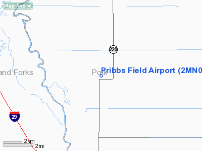
Location & QuickFacts
| FAA Information Effective: | 2008-09-25 |
| Airport Identifier: | 2MN0 |
| Airport Status: | Operational |
| Longitude/Latitude: | 097-00-58.4910W/48-04-55.6140N
-97.016247/48.082115 (Estimated) |
| Elevation: | 818 ft / 249.33 m (Estimated) |
| Land: | 160 acres |
| From nearest city: | 10 nautical miles N of East Grand Forks, MN |
| Location: | Polk County, MN |
| Magnetic Variation: | 06E (1995) |
Owner & Manager
| Ownership: | Privately owned |
| Owner: | Ernest Pribula |
| Address: | 13599 State Hwy 220 Nw
East Grand Forks, MN 56721-8937 |
| Phone number: | 218-773-2027
ADDITIONAL PHONE 218-773-7373. |
| Manager: | Ernest Pribula |
| Address: | 13599 State Hwy 220 Nw
East Grand Forks, MN 56721-8937 |
| Phone number: | 218-773-2027
ADDITIONAL PHONE 218-773-7373. |
Airport Operations and Facilities
| Airport Use: | Private |
| Wind indicator: | Yes |
| Segmented Circle: | No |
| Control Tower: | No |
| Lighting Schedule: | PHONE REQ
FOR ROTG BCN & LIRL RY 18/36 CALL 218-773-2027. |
| Beacon Color: | Clear-Green (lighted land airport) |
| Sectional chart: | Twin Cities |
| Region: | AGL - Great Lakes |
| Boundary ARTCC: | ZMP - Minneapolis |
| Tie-in FSS: | PNM - Princeton |
| FSS on Airport: | No |
| FSS Toll Free: | 1-800-WX-BRIEF |
Airport Services
| Fuel available: | 100LLMOGAS |
Runway Information
Runway 09/27
| Dimension: | 2600 x 60 ft / 792.5 x 18.3 m |
| Surface: | TURF, Good Condition |
| |
Runway 09 |
Runway 27 |
| Traffic Pattern: | Left | Left |
| Obstruction: | 15 ft road, 10.0 ft from runway | |
|
Runway 18/36
| Dimension: | 2200 x 72 ft / 670.6 x 21.9 m |
| Surface: | TURF, Good Condition |
| Edge Lights: | Low |
| |
Runway 18 |
Runway 36 |
| Traffic Pattern: | Left | Left |
|
Radio Navigation Aids
| ID |
Type |
Name |
Ch |
Freq |
Var |
Dist |
| CKN | NDB | Crookston | | 400.00 | 07E | 21.7 nm |
| RDR | TACAN | Red River | 111X | | 06E | 17.4 nm |
| GFK | VOR/DME | Grand Forks | 090X | 114.30 | 09E | 10.2 nm |
| TVF | VOR/DME | Thief River Falls | 021X | 108.40 | 08E | 33.3 nm |
| HML | VORTAC | Humboldt | 071X | 112.40 | 09E | 47.5 nm |
Remarks
- 500 FT RADIO TOWER 4 MI NW OF ARPT.
- PRVDD MIN 20:1 APCH OVER OBSTNS; 125 FT EITHER SIDE & 200 FT OFF RY ENDS CLEAR.
Images and information placed above are from
http://www.airport-data.com/airport/2MN0/
We thank them for the data!
| General Info
|
| Country |
United States
|
| State |
MINNESOTA
|
| FAA ID |
2MN0
|
| Latitude |
48-04-55.614N
|
| Longitude |
097-00-58.491W
|
| Elevation |
818 feet
|
| Near City |
EAST GRAND FORKS
|
We don't guarantee the information is fresh and accurate. The data may
be wrong or outdated.
For more up-to-date information please refer to other sources.
|
|


