 |
|
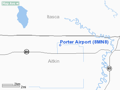
Location & QuickFacts
| FAA Information Effective: | 2008-09-25 |
| Airport Identifier: | 8MN8 |
| Airport Status: | Operational |
| Longitude/Latitude: | 093-23-37.7880W/47-00-45.8080N
-93.393830/47.012724 (Estimated) |
| Elevation: | 1125 ft / 342.90 m (Estimated) |
| Land: | 0 acres |
| From nearest city: | 4 nautical miles W of Jacobson, MN |
| Location: | Aitkin County, MN |
| Magnetic Variation: | 03E (1985) |
Owner & Manager
| Ownership: | Privately owned |
| Owner: | Warren W. Porter |
| Address: | Hc 02 Box 26
Jacobson, MN 55752 |
| Phone number: | 218-752-6663 |
| Manager: | Warren W. Porter |
| Address: | Hc 02 Box 26
Jacobson, MN 55752 |
| Phone number: | 218-752-6663 |
Airport Operations and Facilities
| Airport Use: | Private
PERSONAL USE. |
| Segmented Circle: | No |
| Control Tower: | No |
| Landing fee charge: | No |
| Sectional chart: | Twin Cities |
| Region: | AGL - Great Lakes |
| Boundary ARTCC: | ZMP - Minneapolis |
| Tie-in FSS: | PNM - Princeton |
| FSS on Airport: | No |
| FSS Toll Free: | 1-800-WX-BRIEF |
Runway Information
Runway 13L/31R
| Dimension: | 2800 x 100 ft / 853.4 x 30.5 m |
| Surface: | TURF, |
| |
Runway 13L |
Runway 31R |
| Traffic Pattern: | Left | Left |
|
Runway 13R/31L
| Dimension: | 1600 x 75 ft / 487.7 x 22.9 m |
| Surface: | TURF, |
| |
Runway 13R |
Runway 31L |
| Traffic Pattern: | Left | Left |
|
>
Radio Navigation Aids
| ID |
Type |
Name |
Ch |
Freq |
Var |
Dist |
| AIT | NDB | Aitkin | | 397.00 | 03E | 30.3 nm |
| XVG | NDB | Longville | | 392.00 | 04E | 33.3 nm |
| COQ | NDB | Cloquet | | 335.00 | 03E | 41.2 nm |
| MZH | NDB | Moose Lake | | 362.00 | 02E | 43.3 nm |
| DL | NDB | Pykla | | 379.00 | 02E | 43.8 nm |
| PWC | NDB | Pine River | | 330.00 | 03E | 44.2 nm |
| FOZ | NDB | Bigfork | | 345.00 | 02E | 47.5 nm |
| GPZ | VOR/DME | Grand Rapids | 051X | 111.40 | 06E | 9.9 nm |
| HIB | VOR/DME | Hibbing | 045X | 110.80 | 02E | 33.1 nm |
| EVM | VOR/DME | Eveleth | 019X | 108.20 | 01E | 44.1 nm |
| BRD | VORTAC | Brainerd | 116X | 116.90 | 03E | 47.7 nm |
Remarks
- RWY 13L/31R CLSD TO WHEEL ACFTS; RWY 13/31L CLSD FOR SPRING BREAKUP.
Images and information placed above are from
http://www.airport-data.com/airport/8MN8/
We thank them for the data!
| General Info
|
| Country |
United States
|
| State |
MINNESOTA
|
| FAA ID |
8MN8
|
| Latitude |
47-00-45.808N
|
| Longitude |
093-23-37.788W
|
| Elevation |
1125 feet
|
| Near City |
JACOBSON
|
We don't guarantee the information is fresh and accurate. The data may
be wrong or outdated.
For more up-to-date information please refer to other sources.
|
|


