 |
|
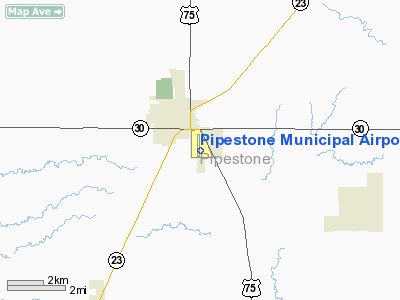
Pipestone Municipal Airport |
Location & QuickFacts
| FAA Information Effective: | 2008-09-25 |
| Airport Identifier: | PQN |
| Airport Status: | Operational |
| Longitude/Latitude: | 096-18-01.1190W/43-58-59.8920N
-96.300311/43.983303 (Estimated) |
| Elevation: | 1736 ft / 529.13 m (Surveyed) |
| Land: | 295 acres |
| From nearest city: | 1 nautical miles SE of Pipestone, MN |
| Location: | Pipestone County, MN |
| Magnetic Variation: | 06E (1990) |
Owner & Manager
| Ownership: | Publicly owned |
| Owner: | City Of Pipestone |
| Address: | 119 Sw 2nd Ave
Pipestone, MN 56164 |
| Phone number: | 507-825-3324 |
| Manager: | Robert Dykstra |
| Address: | 1302 13th St. Se
Pipestone, MN 56164 |
| Phone number: | 507-825-9956 |
Airport Operations and Facilities
| Airport Use: | Open to public |
| Wind indicator: | Yes |
| Segmented Circle: | No |
| Control Tower: | No |
| Lighting Schedule: | DUSK-DAWN
ACTVT MIRL RY 18/36; REIL RYS 18 & 36 & PAPI RYS 18 & 36 - CTAF. |
| Beacon Color: | Clear-Green (lighted land airport) |
| Landing fee charge: | No |
| Sectional chart: | Omaha |
| Region: | AGL - Great Lakes |
| Boundary ARTCC: | ZMP - Minneapolis |
| Tie-in FSS: | PNM - Princeton |
| FSS on Airport: | No |
| FSS Toll Free: | 1-800-WX-BRIEF |
| NOTAMs Facility: | PQN (NOTAM-d service avaliable) |
| Federal Agreements: | NGY |
Airport Communications
| CTAF: | 122.800 |
| Unicom: | 122.800 |
Airport Services
| Fuel available: | 100LLA MOGAS
FUEL AVBL 24 HOURS WITH CREDIT CARD. |
| Airframe Repair: | NONE |
| Power Plant Repair: | NONE |
| Bottled Oxygen: | NONE |
| Bulk Oxygen: | NONE |
Runway Information
Runway 09/27
| Dimension: | 2539 x 221 ft / 773.9 x 67.4 m |
| Surface: | TURF, Good Condition |
| |
Runway 09 |
Runway 27 |
| Longitude: | 096-18-20.6210W | 096-17-46.1190W |
| Latitude: | 43-59-04.3930N | 43-59-01.3920N |
| Elevation: | 1723.00 ft | 1736.00 ft |
| Alignment: | 97 | 127 |
| Traffic Pattern: | Left | Left |
| Markings: | None,
09/27 MKD WITH YELLOW CONES. | None, |
| Obstruction: | 25 ft trees, 150.0 ft from runway, 130 ft right of centerline, 6:1 slope to clear
ROAD +11 FT, 425 FT FM END, L/R, 38:1. | 26 ft pline, 775.0 ft from runway, 29:1 slope to clear |
|
Runway 18/36
| Dimension: | 4302 x 75 ft / 1311.2 x 22.9 m |
| Surface: | ASPH, Good Condition |
| Weight Limit: | Single wheel: 16000 lbs.
Dual wheel: 22000 lbs. |
| Edge Lights: | Medium |
| |
Runway 18 |
Runway 36 |
| Longitude: | 096-17-58.5000W | 096-18-02.2660W |
| Latitude: | 43-59-12.8460N | 43-58-30.4190N |
| Elevation: | 1734.00 ft | 1729.00 ft |
| Alignment: | 127 | 4 |
| Traffic Pattern: | Left | Left |
| Markings: | Non-precision instrument, Good Condition | Non-precision instrument, Good Condition |
| Crossing Height: | 23.00 ft | 28.00 ft |
| VASI: | 4-light PAPI on left side | 4-light PAPI on left side |
| Visual Glide Angle: | 3.00° | 3.00° |
| Runway End Identifier: | Yes | Yes |
|
Radio Navigation Aids
| ID |
Type |
Name |
Ch |
Freq |
Var |
Dist |
| MDS | NDB | Wentworth | | 400.00 | 05E | 34.1 nm |
| FS | NDB | Rokky | | 245.00 | 06E | 37.3 nm |
| ISB | NDB | Sibley | | 269.00 | 05E | 44.0 nm |
| PQN | NDB/DME | Pipestone | 028X | 284.00 | 06E | 0.2 nm |
| BKX | VOR/DME | Brookings | 025X | 108.80 | 06E | 29.4 nm |
| MML | VOR/DME | Marshall | 047X | 111.00 | 05E | 34.7 nm |
| OTG | VOR/DME | Worthington | 043X | 110.60 | 08E | 37.1 nm |
| FSD | VORTAC | Sioux Falls | 097X | 115.00 | 09E | 28.9 nm |
Remarks
- TURF RWY 09/27 NOT PLOWED WINTER MONTHS.
- GCO AVBL ON FREQ 121.725 THRU MINNEAPOLIS ARTCC & FLT SVCS.
Images and information placed above are from
http://www.airport-data.com/airport/PQN/
We thank them for the data!
| General Info
|
| Country |
United States
|
| State |
MINNESOTA
|
| FAA ID |
PQN
|
| Latitude |
43-58-59.892N
|
| Longitude |
096-18-01.119W
|
| Elevation |
1736 feet
|
| Near City |
PIPESTONE
|
We don't guarantee the information is fresh and accurate. The data may
be wrong or outdated.
For more up-to-date information please refer to other sources.
|
|


