 |
|
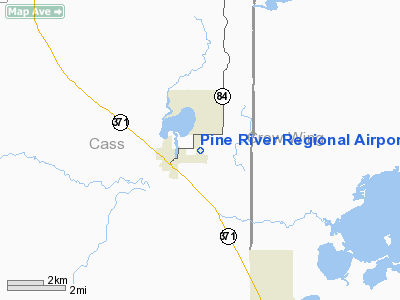
Pine River Regional Airport |
Location & QuickFacts
| FAA Information Effective: | 2008-09-25 |
| Airport Identifier: | PWC |
| Airport Status: | Operational |
| Longitude/Latitude: | 094-22-54.1200W/46-43-29.2350N
-94.381700/46.724787 (Estimated) |
| Elevation: | 1295 ft / 394.72 m (Estimated) |
| Land: | 147 acres |
| From nearest city: | 1 nautical miles E of Pine River, MN |
| Location: | Cass County, MN |
| Magnetic Variation: | 03E (2000) |
Owner & Manager
| Ownership: | Publicly owned |
| Owner: | City Of Pine River |
| Address: | Box 87
Pine River, MN 56474 |
| Phone number: | 218-587-2440 |
| Manager: | Wanda Mongan |
| Address: | Box 87
Pine River, MN 56474 |
| Phone number: | 218-587-2440 |
Airport Operations and Facilities
| Airport Use: | Open to public |
| Wind indicator: | Yes |
| Segmented Circle: | No |
| Control Tower: | No |
| Lighting Schedule: | RDO CTL
MIRL PRESET ON MED INT; INCREASE INT AND ACTVT VASI 16/34 AND REIL 16/34 - CTAF |
| Landing fee charge: | No |
| Sectional chart: | Twin Cities |
| Region: | AGL - Great Lakes |
| Boundary ARTCC: | ZMP - Minneapolis |
| Tie-in FSS: | PNM - Princeton |
| FSS on Airport: | No |
| FSS Toll Free: | 1-800-WX-BRIEF |
| NOTAMs Facility: | PWC (NOTAM-d service avaliable) |
| Federal Agreements: | N |
Airport Communications
Airport Services
| Fuel available: | 100LL
FUEL AVAIL 24 HRS W CREDIT CARD. |
| Airframe Repair: | MAJOR |
| Power Plant Repair: | MAJOR |
Runway Information
Runway 16/34
| Dimension: | 3000 x 75 ft / 914.4 x 22.9 m |
| Surface: | ASPH, Good Condition |
| Edge Lights: | Medium |
| |
Runway 16 |
Runway 34 |
| Longitude: | 094-23-00.4800W | 094-22-47.7600W |
| Latitude: | 46-43-43.3800N | 46-43-15.0900N |
| Elevation: | 1295.00 ft | 1294.00 ft |
| Alignment: | 127 | 127 |
| Traffic Pattern: | Left | Left |
| Markings: | Non-precision instrument, Fair Condition | Non-precision instrument, Fair Condition |
| Crossing Height: | 23.00 ft | 23.00 ft |
| VASI: | 2-box on left side | 2-box on left side |
| Visual Glide Angle: | 3.00° | 3.00° |
| Runway End Identifier: | Yes | Yes |
| Obstruction: | 80 ft trees, 2200.0 ft from runway, 25:1 slope to clear | 55 ft trees, 1650.0 ft from runway, 150 ft left of centerline, 26:1 slope to clear |
|
Radio Navigation Aids
| ID |
Type |
Name |
Ch |
Freq |
Var |
Dist |
| PWC | NDB | Pine River | | 330.00 | 03E | 0.2 nm |
| XVG | NDB | Longville | | 392.00 | 04E | 17.7 nm |
| PK | NDB | Spida | | 269.00 | 04E | 25.3 nm |
| SAZ | NDB | Staples | | 257.00 | 04E | 27.0 nm |
| AIT | NDB | Aitkin | | 397.00 | 03E | 31.0 nm |
| XCR | NDB | Ripley | | 404.00 | 03E | 38.9 nm |
| LXL | NDB | Little Falls | | 359.00 | 03E | 46.6 nm |
| RYM | TACAN | Camp Ripley | 048X | | 03E | 38.1 nm |
| PKD | VOR/DME | Park Rapids | 043X | 110.60 | 04E | 30.2 nm |
| GPZ | VOR/DME | Grand Rapids | 051X | 111.40 | 06E | 45.2 nm |
| BRD | VORTAC | Brainerd | 116X | 116.90 | 03E | 27.0 nm |
Remarks
- CFM SNOW REMOVAL & WINTER CONDS WITH AMGR CALL (218) 587-2440.
- ULTRALIGHTS ON & INVOF ARPT.
- DEER & WATERFOWL ON & INVOF ARPT.
Images and information placed above are from
http://www.airport-data.com/airport/PWC/
We thank them for the data!
| General Info
|
| Country |
United States
|
| State |
MINNESOTA
|
| FAA ID |
PWC
|
| Latitude |
46-43-29.235N
|
| Longitude |
094-22-54.120W
|
| Elevation |
1295 feet
|
| Near City |
PINE RIVER
|
We don't guarantee the information is fresh and accurate. The data may
be wrong or outdated.
For more up-to-date information please refer to other sources.
|
|


