 |
|
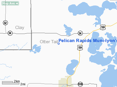
Pelican Rapids Muni - Lyon's Field Airport |
Location & QuickFacts
| FAA Information Effective: | 2008-09-25 |
| Airport Identifier: | 47Y |
| Airport Status: | Operational |
| Longitude/Latitude: | 096-06-16.2070W/46-38-29.8510N
-96.104502/46.641625 (Estimated) |
| Elevation: | 1389 ft / 423.37 m (Estimated) |
| Land: | 240 acres |
| From nearest city: | 4 nautical miles N of Pelican Rapids, MN |
| Location: | Otter Tail County, MN |
| Magnetic Variation: | 05E (1985) |
Owner & Manager
| Ownership: | Publicly owned |
| Owner: | City Of Pelican Rapids |
| Address: | Box 350
Pelican Rapids, MN 56572 |
| Phone number: | 218-863-6571 |
| Manager: | Don Solga |
| Address: | Box 350
Pelican Rapids, MN 56572 |
| Phone number: | 218-863-6571 |
Airport Operations and Facilities
| Airport Use: | Open to public |
| Wind indicator: | Yes |
| Segmented Circle: | No |
| Control Tower: | No |
| Lighting Schedule: | DUSK-DAWN |
| Beacon Color: | Clear-Green (lighted land airport) |
| Landing fee charge: | No |
| Sectional chart: | Twin Cities |
| Region: | AGL - Great Lakes |
| Boundary ARTCC: | ZMP - Minneapolis |
| Tie-in FSS: | PNM - Princeton |
| FSS Toll Free: | 1-800-WX-BRIEF |
| NOTAMs Facility: | PNM (NOTAM-d service avaliable) |
Airport Communications
Airport Services
| Fuel available: | 100LLMOGAS
FOR FUEL PHONE 218-863-6571. |
| Airframe Repair: | NONE |
| Power Plant Repair: | NONE |
| Bottled Oxygen: | NONE |
| Bulk Oxygen: | NONE |
Runway Information
Runway 15/33
| Dimension: | 3260 x 150 ft / 993.6 x 45.7 m |
| Surface: | TURF, Fair Condition |
| Edge Lights: | Non-standard lighting system
NSTD LIRL DUE TO SPACING. |
| |
Runway 15 |
Runway 33 |
| Longitude: | 096-06-23.1900W | 096-06-10.2200W |
| Latitude: | 46-38-44.8100N | 46-38-13.8900N |
| Elevation: | 1389.00 ft | 1379.00 ft |
| Traffic Pattern: | Left | Left |
| Runway End Identifier: | No | No |
| Centerline Lights: | No | No |
| Touchdown Lights: | No | No |
| Obstruction: | , 50:1 slope to clear | 3 ft hill, 100.0 ft from runway, 105 ft right of centerline, 33:1 slope to clear |
|
Radio Navigation Aids
| ID |
Type |
Name |
Ch |
Freq |
Var |
Dist |
| BWP | NDB | Breckenridge-wahpeton | | 233.00 | 05E | 31.6 nm |
| AA | NDB | Kenie | | 365.00 | 06E | 36.6 nm |
| PK | NDB | Spida | | 269.00 | 04E | 47.9 nm |
| DTL | VOR/DME | Detroit Lakes | 049X | 111.20 | 05E | 14.2 nm |
| FFM | VOR/DME | Fergus Falls | 041X | 110.40 | 05E | 21.3 nm |
| PKD | VOR/DME | Park Rapids | 043X | 110.60 | 04E | 45.3 nm |
| FAR | VORTAC | Fargo | 109X | 116.20 | 09E | 31.5 nm |
Remarks
Images and information placed above are from
http://www.airport-data.com/airport/47Y/
We thank them for the data!
| General Info
|
| Country |
United States
|
| State |
MINNESOTA
|
| FAA ID |
47Y
|
| Latitude |
46-38-29.851N
|
| Longitude |
096-06-16.207W
|
| Elevation |
1389 feet
|
| Near City |
PELICAN RAPIDS
|
We don't guarantee the information is fresh and accurate. The data may
be wrong or outdated.
For more up-to-date information please refer to other sources.
|
|


