 |
|
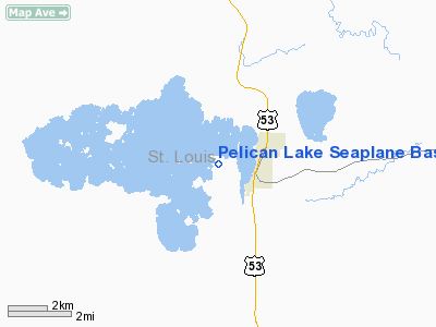
Pelican Lake Seaplane Base |
Location & QuickFacts
| FAA Information Effective: | 2008-09-25 |
| Airport Identifier: | 2MN5 |
| Airport Status: | Operational |
| Longitude/Latitude: | 092-51-21.6070W/48-03-28.6980N
-92.856002/48.057972 (Estimated) |
| Elevation: | 1288 ft / 392.58 m (Estimated) |
| Land: | 0 acres |
| From nearest city: | 2 nautical miles W of Orr, MN |
| Location: | St Louis County, MN |
| Magnetic Variation: | 02E (1985) |
Owner & Manager
| Ownership: | Privately owned |
| Owner: | Rodney K. Dunn |
| Address: |
Orr, MN 55771 |
| Phone number: | 218-757-3416 |
| Manager: | Rodney K. Dunn |
| Address: |
Orr, MN 55771 |
| Phone number: | 218-757-3416 |
Airport Operations and Facilities
| Airport Use: | Private |
| Wind indicator: | Yes |
| Segmented Circle: | No |
| Control Tower: | No |
| Landing fee charge: | No |
| Sectional chart: | Omaha |
| Region: | AGL - Great Lakes |
| Boundary ARTCC: | ZMP - Minneapolis |
| Tie-in FSS: | PNM - Princeton |
| FSS on Airport: | No |
| FSS Toll Free: | 1-800-WX-BRIEF |
Airport Services
Runway Information
Runway NW/SE
| Dimension: | 5000 x 3000 ft / 1524.0 x 914.4 m |
| Surface: | WATER, |
| |
Runway NW |
Runway SE |
| Traffic Pattern: | Left | Left |
|
Radio Navigation Aids
| ID |
Type |
Name |
Ch |
Freq |
Var |
Dist |
| ORB | NDB | Orr | | 341.00 | 02E | 2.4 nm |
| CQM | NDB | Cook | | 233.00 | 01E | 15.7 nm |
| SCG | NDB | Scott | | 385.00 | 02E | 19.5 nm |
| IN | NDB | Raize | | 353.00 | 06E | 30.5 nm |
| FOZ | NDB | Bigfork | | 345.00 | 02E | 36.1 nm |
| YAG | NDB | Fort Frances | | 376.00 | 02E | 46.7 nm |
| EVM | VOR/DME | Eveleth | 019X | 108.20 | 01E | 40.8 nm |
| ELO | VOR/DME | Ely | 033X | 109.60 | 00E | 43.7 nm |
| HIB | VOR/DME | Hibbing | 045X | 110.80 | 02E | 45.9 nm |
| INL | VORTAC | International Falls | 047X | 111.00 | 06E | 37.6 nm |
Remarks
- ALL TFC PTN OPERATIONS CONDUCTED N OF DESCRIBED SEALANE (ALL TURNS R TKOF/LNDG NE ALL TURNS R TKOF/LNDG SE).
Images and information placed above are from
http://www.airport-data.com/airport/2MN5/
We thank them for the data!
| General Info
|
| Country |
United States
|
| State |
MINNESOTA
|
| FAA ID |
2MN5
|
| Latitude |
48-03-28.698N
|
| Longitude |
092-51-21.607W
|
| Elevation |
1288 feet
|
| Near City |
ORR
|
We don't guarantee the information is fresh and accurate. The data may
be wrong or outdated.
For more up-to-date information please refer to other sources.
|
|


