 |
|
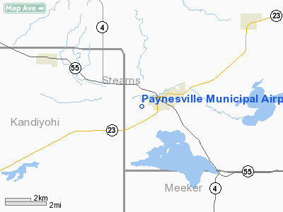
Paynesville Municipal Airport |
Location & QuickFacts
| FAA Information Effective: | 2008-09-25 |
| Airport Identifier: | PEX |
| Airport Status: | Operational |
| Longitude/Latitude: | 094-44-41.1000W/45-22-19.4000N
-94.744750/45.372056 (Estimated) |
| Elevation: | 1180 ft / 359.66 m (Estimated) |
| Land: | 85 acres |
| From nearest city: | 1 nautical miles SW of Paynesville, MN |
| Location: | Stearns County, MN |
| Magnetic Variation: | 04E (1985) |
Owner & Manager
| Ownership: | Publicly owned |
| Owner: | City Of Paynesville |
| Address: | 221 Washburne Ave.
Paynesville, MN 56362 |
| Phone number: | 320-243-3714 |
| Manager: | Ron Mergen |
| Address: | 221 Washburne Ave
Paynesville, MN 56362 |
| Phone number: | 320-243-3714 |
Airport Operations and Facilities
| Airport Use: | Open to public |
| Wind indicator: | Yes |
| Segmented Circle: | No |
| Control Tower: | No |
| Lighting Schedule: | RDO-CTL
MIRL RY 11/29 PRESET ON LOW INTST; TO INCR INTST AND ACTVT DALGT HRS - CTAF. |
| Landing fee charge: | No |
| Sectional chart: | Twin Cities |
| Region: | AGL - Great Lakes |
| Boundary ARTCC: | ZMP - Minneapolis |
| Tie-in FSS: | PNM - Princeton |
| FSS on Airport: | No |
| FSS Toll Free: | 1-800-WX-BRIEF |
| NOTAMs Facility: | PEX (NOTAM-d service avaliable) |
Airport Communications
Airport Services
| Fuel available: | 100LL
FUEL AVAIL 24 HRS WITH CREDIT CARD. |
Runway Information
Runway 11/29
| Dimension: | 3300 x 75 ft / 1005.8 x 22.9 m |
| Surface: | ASPH, Good Condition |
| Edge Lights: | Medium |
| |
Runway 11 |
Runway 29 |
| Longitude: | 094-45-03.3400W | 094-44-18.8700W |
| Latitude: | 45-22-23.8500N | 45-22-14.9200N |
| Traffic Pattern: | Left | Left |
| Markings: | Non-precision instrument, Good Condition | Non-precision instrument, Good Condition |
| Runway End Identifier: | No | No |
| Obstruction: | 75 ft pline, 3200.0 ft from runway, 40:1 slope to clear | 99 ft trees, 3200.0 ft from runway, 30:1 slope to clear |
|
Radio Navigation Aids
| ID |
Type |
Name |
Ch |
Freq |
Var |
Dist |
| GHW | NDB | Glenwood | | 346.00 | 03E | 29.2 nm |
| EE | NDB | Tamie | | 374.00 | 04E | 34.5 nm |
| HCD | NDB | Hutchinson | | 209.00 | 04E | 34.6 nm |
| BBB | NDB | Benson | | 239.00 | 05E | 38.3 nm |
| LXL | NDB | Little Falls | | 359.00 | 03E | 38.6 nm |
| XCR | NDB | Ripley | | 404.00 | 03E | 45.7 nm |
| GYL | NDB | Glencoe | | 407.00 | 03E | 46.2 nm |
| PNM | NDB | Princeton | | 368.00 | 03E | 49.3 nm |
| RYM | TACAN | Camp Ripley | 048X | | 03E | 46.2 nm |
| ILL | VOR/DME | Willmar | 084X | 113.70 | 04E | 21.2 nm |
| BDH | VOR/DME | Willmar | 84X | 113.70 | 04E | 22.3 nm |
| STC | VOR/DME | St Cloud | 058X | 112.10 | 03E | 30.8 nm |
| AXN | VOR/DME | Alexandria | 075X | 112.80 | 07E | 40.8 nm |
| MVE | VOR/DME | Montevideo | 053X | 111.60 | 05E | 47.5 nm |
| DWN | VORTAC | Darwin | 027X | 109.00 | 07E | 21.1 nm |
Remarks
- SEE AIRSPACE CASE 99-AGL-1410-NRA
Images and information placed above are from
http://www.airport-data.com/airport/PEX/
We thank them for the data!
| General Info
|
| Country |
United States
|
| State |
MINNESOTA
|
| FAA ID |
PEX
|
| Latitude |
45.372325
45° 22' 20.37" N
|
| Longitude |
-94.746592
094° 44' 47.73" W
|
| Elevation |
1180 feet
360 meters
|
| Magnetic Variation |
002° E (01/06)
|
| Operating Agency |
U.S.CIVIL AIRPORT WHEREIN PERMIT COVERS USE BY TRANSIT MILITARY AIRCRAFT
|
We don't guarantee the information is fresh and accurate. The data may
be wrong or outdated.
For more up-to-date information please refer to other sources.
|
|


