 |
|
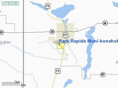
Park Rapids Muni - Konshok Field Airport |
Location & QuickFacts
| FAA Information Effective: | 2008-09-25 |
| Airport Identifier: | PKD |
| Airport Status: | Operational |
| Longitude/Latitude: | 095-04-23.2000W/46-54-02.5000N
-95.073111/46.900694 (Estimated) |
| Elevation: | 1445 ft / 440.44 m (Surveyed) |
| Land: | 638 acres |
| From nearest city: | 2 nautical miles S of Park Rapids, MN |
| Location: | Hubbard County, MN |
| Magnetic Variation: | 04E (1995) |
Owner & Manager
| Ownership: | Publicly owned |
| Owner: | City Of Park Rapids |
| Address: | City Hall 223 S. Main, 212 West 2nd Street
Park Rapids, MN 56470 |
| Phone number: | 218-732-3163 |
| Manager: | Scott Burlingame |
| Address: | 212 West 2nd Street
Park Rapids, MN 56470 |
| Phone number: | 218-237-2713 |
Airport Operations and Facilities
| Airport Use: | Open to public |
| Wind indicator: | Yes |
| Segmented Circle: | Yes |
| Control Tower: | No |
| Lighting Schedule: | DUSK-DAWN
ACTVT MIRL RY 13/31; REIL RY 13; MALSR 31 - CTAF. |
| Beacon Color: | Clear-Green (lighted land airport) |
| Landing fee charge: | No |
| Sectional chart: | Twin Cities |
| Region: | AGL - Great Lakes |
| Traffic Pattern Alt: | 957 ft |
| Boundary ARTCC: | ZMP - Minneapolis |
| Tie-in FSS: | PNM - Princeton |
| FSS on Airport: | No |
| FSS Toll Free: | 1-800-WX-BRIEF |
| NOTAMs Facility: | PKD (NOTAM-d service avaliable) |
| Federal Agreements: | NGY |
Airport Communications
| CTAF: | 123.000 |
| Unicom: | 123.000 |
Airport Services
| Fuel available: | 100LLA |
| Airframe Repair: | MAJOR |
| Power Plant Repair: | MAJOR |
| Bottled Oxygen: | NONE |
| Bulk Oxygen: | NONE |
Runway Information
Runway 13/31
| Dimension: | 5498 x 100 ft / 1675.8 x 30.5 m |
| Surface: | ASPH, Good Condition |
| Weight Limit: | Single wheel: 20000 lbs.
Dual wheel: 36000 lbs. |
| Edge Lights: | Medium
RY 13/31 NO AMBER RY LIGHTS IN LAST 2000 FT OF RY. |
| |
Runway 13 |
Runway 31 |
| Longitude: | 095-04-52.0045W | 095-03-56.0940W |
| Latitude: | 46-54-24.1922N | 46-53-45.7837N |
| Elevation: | 1444.00 ft | 1443.00 ft |
| Alignment: | 127 | 127 |
| ILS Type: | | ILS
|
| Traffic Pattern: | Left | Left |
| Markings: | Precision instrument, Good Condition | Precision instrument, Good Condition |
| Approach lights: | | MALSR |
| Runway End Identifier: | Yes | |
| Centerline Lights: | No | No |
| Touchdown Lights: | No | No |
|
Runway 17/35
| Dimension: | 3244 x 140 ft / 988.8 x 42.7 m |
| Surface: | TURF, Fair Condition |
| |
Runway 17 |
Runway 35 |
| Longitude: | 095-04-21.8323W | 095-04-21.8181W |
| Latitude: | 46-54-14.1947N | 46-53-42.1732N |
| Elevation: | 1438.00 ft | 1442.00 ft |
| Alignment: | 127 | 127 |
| Traffic Pattern: | Left | Left |
| Obstruction: | 38 ft trees, 1080.0 ft from runway, 28:1 slope to clear | , 50:1 slope to clear |
|
Radio Navigation Aids
| ID |
Type |
Name |
Ch |
Freq |
Var |
Dist |
| PK | NDB | Spida | | 269.00 | 04E | 5.7 nm |
| PWC | NDB | Pine River | | 330.00 | 03E | 30.2 nm |
| SAZ | NDB | Staples | | 257.00 | 04E | 33.1 nm |
| XVG | NDB | Longville | | 392.00 | 04E | 36.0 nm |
| PKD | VOR/DME | Park Rapids | 043X | 110.60 | 04E | 0.2 nm |
| DTL | VOR/DME | Detroit Lakes | 049X | 111.20 | 05E | 33.8 nm |
| BJI | VORTAC | Bemidji | 023X | 108.60 | 04E | 40.6 nm |
Remarks
- RY 17/35 CLSD WINTER MONTHS.
Images and information placed above are from
http://www.airport-data.com/airport/PKD/
We thank them for the data!
| General Info
|
| Country |
United States
|
| State |
MINNESOTA
|
| FAA ID |
PKD
|
| Latitude |
46-54-02.253N
|
| Longitude |
095-04-23.278W
|
| Elevation |
1443 feet
|
| Near City |
PARK RAPIDS
|
We don't guarantee the information is fresh and accurate. The data may
be wrong or outdated.
For more up-to-date information please refer to other sources.
|
|


