 |
|
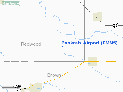
Location & QuickFacts
| FAA Information Effective: | 2008-09-25 |
| Airport Identifier: | 0MN5 |
| Airport Status: | Operational |
| Longitude/Latitude: | 094-55-00.9600W/44-18-25.8550N
-94.916933/44.307182 (Estimated) |
| Elevation: | 1033 ft / 314.86 m (Surveyed) |
| Land: | 0 acres |
| From nearest city: | 5 nautical miles NE of Springfield, MN |
| Location: | Redwood County, MN |
| Magnetic Variation: | 05E (1985) |
Owner & Manager
| Ownership: | Privately owned |
| Owner: | Roy Pankratz |
| Address: | 43442 180 St
Springfield, MN 56087 |
| Phone number: | 507-723-5868 |
| Manager: | Roy Pankratz |
| Address: | 43442 180 St.
Springfield, MN 56087 |
| Phone number: | 507-723-5868 |
Airport Operations and Facilities
| Airport Use: | Private
PERSONAL USE. |
| Wind indicator: | Yes |
| Segmented Circle: | No |
| Control Tower: | No |
| Landing fee charge: | No |
| Sectional chart: | Omaha |
| Region: | AGL - Great Lakes |
| Boundary ARTCC: | ZMP - Minneapolis |
| Tie-in FSS: | PNM - Princeton |
| FSS on Airport: | No |
| FSS Toll Free: | 1-800-WX-BRIEF |
Airport Services
| Airframe Repair: | NONE |
| Power Plant Repair: | NONE |
Runway Information
Runway N/S
| Dimension: | 2800 x 60 ft / 853.4 x 18.3 m |
| Surface: | TURF, |
| |
Runway N |
Runway S |
| Traffic Pattern: | Left | Left |
|
Radio Navigation Aids
| ID |
Type |
Name |
Ch |
Freq |
Var |
Dist |
| JYG | NDB | St James | | 260.00 | 04E | 24.9 nm |
| MWM | NDB | Windom | | 203.00 | 03E | 25.3 nm |
| MJQ | NDB | Jackson | | 353.00 | 04E | 39.8 nm |
| HCD | NDB | Hutchinson | | 209.00 | 04E | 40.2 nm |
| GYL | NDB | Glencoe | | 407.00 | 03E | 44.9 nm |
| ULM | NDB/DME | New Ulm | 050X | 272.00 | 04E | 18.0 nm |
| RWF | VOR/DME | Redwood Falls | 080X | 113.30 | 07E | 13.2 nm |
| MML | VOR/DME | Marshall | 047X | 111.00 | 05E | 39.9 nm |
| MKT | VOR/DME | Mankato | 045X | 110.80 | 07E | 43.6 nm |
| FRM | VOR/DME | Fairmont | 039X | 110.20 | 07E | 45.1 nm |
| OTG | VOR/DME | Worthington | 043X | 110.60 | 08E | 49.0 nm |
| ILL | VOR/DME | Willmar | 084X | 113.70 | 04E | 49.3 nm |
| BDH | VOR/DME | Willmar | 84X | 113.70 | 04E | 49.5 nm |
Remarks
Images and information placed above are from
http://www.airport-data.com/airport/0MN5/
We thank them for the data!
| General Info
|
| Country |
United States
|
| State |
MINNESOTA
|
| FAA ID |
0MN5
|
| Latitude |
44-18-25.855N
|
| Longitude |
094-55-00.960W
|
| Elevation |
1033 feet
|
| Near City |
SPRINGFIELD
|
We don't guarantee the information is fresh and accurate. The data may
be wrong or outdated.
For more up-to-date information please refer to other sources.
|
|


