|
|
Owatonna Degner Regional Airport |
|
 |
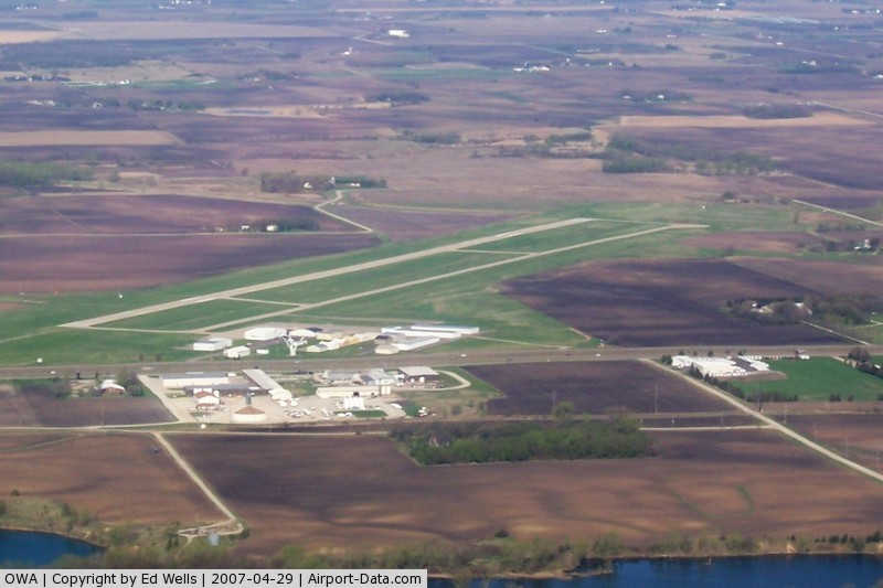
(Click on the photo to enlarge) |
|
 |
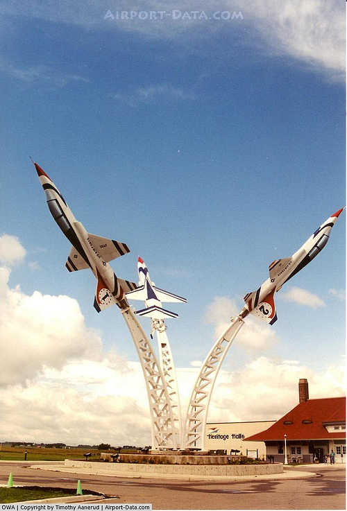
(Click on the photo to enlarge) |
|
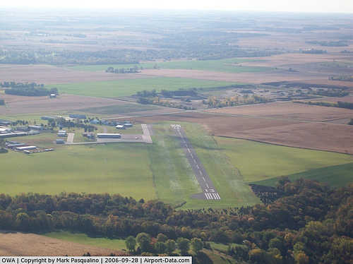 |
(Click on the photo to enlarge) |
Location & QuickFacts
| FAA Information Effective: | 2008-09-25 |
| Airport Identifier: | OWA |
| Airport Status: | Operational |
| Longitude/Latitude: | 093-15-38.2000W/44-07-24.2000N
-93.260611/44.123389 (Estimated) |
| Elevation: | 1146 ft / 349.30 m (Surveyed) |
| Land: | 260 acres |
| From nearest city: | 3 nautical miles NW of Owatonna, MN |
| Location: | Steele County, MN |
| Magnetic Variation: | 02E (2000) |
Owner & Manager
| Ownership: | Publicly owned |
| Owner: | City Of Owatonna |
| Address: | 540 West Hills Cir, City Hall
Owatonna, MN 55060 |
| Phone number: | 507-444-4300 |
| Manager: | Dave Beaver |
| Address: | 3400 West Frontage Road
Owatonna, MN 58060 |
| Phone number: | 507-444-2448 |
Airport Operations and Facilities
| Airport Use: | Open to public |
| Wind indicator: | Yes |
| Segmented Circle: | No |
| Control Tower: | No |
| Lighting Schedule: | DUSK-DAWN
ACTVT HIRL RY 12/30 & REIL RY 12 & MALSR RY 30 - CTAF. |
| Beacon Color: | Clear-Green (lighted land airport) |
| Landing fee charge: | No |
| Sectional chart: | Omaha |
| Region: | AGL - Great Lakes |
| Traffic Pattern Alt: | 852 ft |
| Boundary ARTCC: | ZMP - Minneapolis |
| Tie-in FSS: | PNM - Princeton |
| FSS on Airport: | No |
| FSS Toll Free: | 1-800-WX-BRIEF |
| NOTAMs Facility: | OWA (NOTAM-d service avaliable) |
| Federal Agreements: | N1 |
Airport Communications
| CTAF: | 122.700 |
| Unicom: | 122.700 |
Airport Services
| Fuel available: | 100LLA
FUEL AVAIL 24 HRS W CREDIT CARD. |
| Airframe Repair: | MAJOR |
| Power Plant Repair: | MAJOR |
| Bottled Oxygen: | NONE |
| Bulk Oxygen: | NONE |
Runway Information
Runway 12/30
| Dimension: | 5500 x 100 ft / 1676.4 x 30.5 m |
| Surface: | CONC, Good Condition |
| Weight Limit: | Single wheel: 30000 lbs.
Dual wheel: 60000 lbs. |
| Edge Lights: | High |
| |
Runway 12 |
Runway 30 |
| Longitude: | 093-16-09.4799W | 093-15-06.9648W |
| Latitude: | 44-07-39.4204N | 44-07-09.0579N |
| Elevation: | 1106.00 ft | 1145.00 ft |
| Alignment: | 124 | 127 |
| ILS Type: | | ILS
|
| Traffic Pattern: | Left | Left |
| Markings: | Precision instrument, Good Condition | Non-precision instrument, Good Condition |
| VASI: | 4-light PAPI on left side | 4-light PAPI on left side |
| Approach lights: | | MALSR |
| Runway End Identifier: | Yes | Yes |
| Centerline Lights: | No | No |
| Touchdown Lights: | No | No |
| Obstruction: | 35 ft trees, 1400.0 ft from runway, 250 ft left of centerline, 34:1 slope to clear
TREES +5, 175-200 FM RWY END, 400L. | , 50:1 slope to clear |
|
Radio Navigation Aids
| ID |
Type |
Name |
Ch |
Freq |
Var |
Dist |
| ACQ | NDB | Waseca | | 371.00 | 02E | 13.0 nm |
| MS | NDB | Narco | | 266.00 | 02E | 42.8 nm |
| PPI | NDB | Hopey | | 400.00 | 03E | 47.1 nm |
| SBU | NDB | Blue Earth | | 332.00 | 04E | 48.1 nm |
| FOW | VOR/DME | Halfway | 049X | 111.20 | 02E | 6.8 nm |
| AEL | VOR/DME | Albert Lea | 035X | 109.80 | 05E | 27.0 nm |
| MKT | VOR/DME | Mankato | 045X | 110.80 | 07E | 28.7 nm |
| RST | VOR/DME | Rochester | 057X | 112.00 | 05E | 35.3 nm |
| JAY | VOR/DME | Austin | 019X | 108.20 | 03E | 36.1 nm |
| FCM | VOR/DME | Flying Cloud | 055X | 111.80 | 06E | 43.0 nm |
| MSP | VOR/DME | Minneapolis | 100X | 115.30 | 02E | 46.5 nm |
| FGT | VORTAC | Farmington | 104X | 115.70 | 06E | 30.7 nm |
| MSP | VOT | Minneapolis St Paul | | 111.00 | | 45.8 nm |
| STP | VOT | St Paul | | 114.40 | | 49.9 nm |
Images and information placed above are from
http://www.airport-data.com/airport/OWA/
We thank them for the data!
| General Info
|
| Country |
United States
|
| State |
MINNESOTA
|
| FAA ID |
OWA
|
| Latitude |
44-07-24.200N
|
| Longitude |
093-15-38.200W
|
| Elevation |
1146 feet
|
| Near City |
OWATONNA
|
We don't guarantee the information is fresh and accurate. The data may
be wrong or outdated.
For more up-to-date information please refer to other sources.
|
|