 |
|
| Orr Regional Airport |
| IATA: none – ICAO: KORB – FAA LID: ORB |
| Summary |
| Airport type |
Public |
| Owner |
City of Orr |
| Serves |
Orr, Minnesota |
| Location |
Leiding Township, St. Louis County, Minnesota |
| Elevation AMSL |
1,311 ft / 400 m |
| Coordinates |
48°00′57″N 092°51′22″W / 48.01583°N 92.85611°W / 48.01583; -92.85611 |
| Website |
OrrAirport.com |
| Runways |
| Direction |
Length |
Surface |
| ft |
m |
| 13/31 |
4,001 |
1,220 |
Asphalt |
| Statistics (2007) |
| Aircraft operations |
2,500 |
| Based aircraft |
9 |
| Sources: Minnesota DOT, FAA |
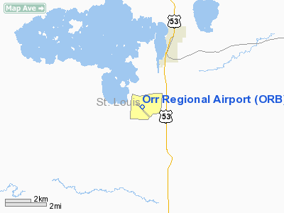
Orr Regional Airport (ICAO: KORB, FAA LID: ORB) is a city-owned public-use airport located three nautical miles (6 km) southwest of the central business district of Orr, a city in St. Louis County, Minnesota, United States.
Although most U.S. airports use the same three-letter location identifier for the FAA and IATA, this airport is assigned ORB by the FAA but has no designation from the IATA (which assigned ORB to Örebro Airport in Örebro, Sweden).
Facilities and aircraft
Orr Regional Airport covers an area of 332 acres (134 ha) at an elevation of 1,311 feet (400 m) above mean sea level. It has one runway designated 13/31 with an asphalt surface measuring 4,001 by 75 feet (1,220 x 23 m).
For the 12-month period ending April 30, 2007, the airport had 2,500 general aviationaircraft operations, an average of 208 per month. At that time there were 9 aircraft based at this airport, all single-engine.
The above content comes from Wikipedia and is published under free licenses – click here to read more.
Location & QuickFacts
| FAA Information Effective: | 2008-09-25 |
| Airport Identifier: | ORB |
| Airport Status: | Operational |
| Longitude/Latitude: | 092-51-21.7850W/48-00-57.3190N
-92.856051/48.015922 (Estimated) |
| Elevation: | 1311 ft / 399.59 m (Surveyed) |
| Land: | 332 acres |
| From nearest city: | 3 nautical miles SW of Orr, MN |
| Location: | St Louis County, MN |
| Magnetic Variation: | 02E (1995) |
Owner & Manager
| Ownership: | Publicly owned |
| Owner: | City Of Orr |
| Address: | 4540 Lake St., Po Box 237
Orr, MN 55771 |
| Phone number: | 218-757-3288 |
| Manager: | Rod Dunn |
| Address: | 11014 Nett Lake Rd
Orr, MN 55771 |
| Phone number: | 218-757-9994 |
Airport Operations and Facilities
| Airport Use: | Open to public |
| Wind indicator: | Yes |
| Segmented Circle: | No |
| Control Tower: | No |
| Lighting Schedule: | DUSK-DAWN
ACTVT MIRL RY 13/31, PAPI & REIL RYS 13 & 31 - CTAF. |
| Beacon Color: | Clear-Green (lighted land airport) |
| Landing fee charge: | No |
| Sectional chart: | Green Bay |
| Region: | AGL - Great Lakes |
| Boundary ARTCC: | ZMP - Minneapolis |
| Tie-in FSS: | PNM - Princeton |
| FSS on Airport: | No |
| FSS Toll Free: | 1-800-WX-BRIEF |
| NOTAMs Facility: | ORB (NOTAM-d service avaliable) |
| Federal Agreements: | NGY |
Airport Communications
| CTAF: | 122.800 |
| Unicom: | 122.800 |
Airport Services
| Fuel available: | 100LLA
FUEL AVAIL 24 HRS WITH CREDIT CARD. |
Runway Information
Runway 13/31
| Dimension: | 4001 x 75 ft / 1219.5 x 22.9 m |
| Surface: | ASPH, Good Condition |
| Edge Lights: | Medium |
| |
Runway 13 |
Runway 31 |
| Longitude: | 092-51-41.4000W | 092-51-02.1400W |
| Latitude: | 48-01-12.0100N | 48-00-42.6100N |
| Elevation: | 1309.00 ft | 1308.00 ft |
| Alignment: | 127 | 127 |
| Traffic Pattern: | Left | Left |
| Markings: | Non-precision instrument, Good Condition | Non-precision instrument, Good Condition |
| Runway End Identifier: | Yes | Yes |
| Obstruction: | 46 ft trees, 1400.0 ft from runway, 26:1 slope to clear | 121 ft trees, 3169.0 ft from runway, 330 ft right of centerline, 24:1 slope to clear |
|
Radio Navigation Aids
| ID |
Type |
Name |
Ch |
Freq |
Var |
Dist |
| ORB | NDB | Orr | | 341.00 | 02E | 0.3 nm |
| CQM | NDB | Cook | | 233.00 | 01E | 13.5 nm |
| SCG | NDB | Scott | | 385.00 | 02E | 21.2 nm |
| IN | NDB | Raize | | 353.00 | 06E | 32.7 nm |
| FOZ | NDB | Bigfork | | 345.00 | 02E | 35.1 nm |
| YAG | NDB | Fort Frances | | 376.00 | 02E | 48.8 nm |
| EVM | VOR/DME | Eveleth | 019X | 108.20 | 01E | 38.5 nm |
| ELO | VOR/DME | Ely | 033X | 109.60 | 00E | 42.9 nm |
| HIB | VOR/DME | Hibbing | 045X | 110.80 | 02E | 43.4 nm |
| INL | VORTAC | International Falls | 047X | 111.00 | 06E | 39.7 nm |
Remarks
- ULTRALIGHT ACTIVITY ON & INVOF ARPT.
- GCO AVBL ON FREQ 121.725 THRU MINNEAPOLIS ARTCC & FLT SVCS.
- BIRDS & WILDLIFE ON & INVOF ARPT.
Images and information placed above are from
http://www.airport-data.com/airport/ORB/
We thank them for the data!
| General Info
|
| Country |
United States
|
| State |
MINNESOTA
|
| FAA ID |
ORB
|
| Latitude |
48-00-57.319N
|
| Longitude |
092-51-21.785W
|
| Elevation |
1311 feet
|
| Near City |
ORR
|
We don't guarantee the information is fresh and accurate. The data may
be wrong or outdated.
For more up-to-date information please refer to other sources.
|
|


