 |
|
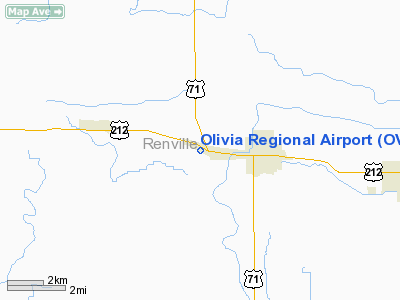
Location & QuickFacts
| FAA Information Effective: | 2008-09-25 |
| Airport Identifier: | OVL |
| Airport Status: | Operational |
| Longitude/Latitude: | 095-01-58.0020W/44-46-42.8590N
-95.032778/44.778572 (Estimated) |
| Elevation: | 1076 ft / 327.96 m (Surveyed) |
| Land: | 83 acres |
| From nearest city: | 2 nautical miles W of Olivia, MN |
| Location: | Renville County, MN |
| Magnetic Variation: | 06E (1980) |
Owner & Manager
| Ownership: | Publicly owned |
| Owner: | City Of Olivia |
| Address: | 1009 W Lincoln
Olivia, MN 56277 |
| Phone number: | 320-523-2361 |
| Manager: | Dale W. Hardy |
| Address: | Box 169
Olivia, MN 56277 |
| Phone number: | 320-523-2186 |
Airport Operations and Facilities
| Airport Use: | Open to public |
| Wind indicator: | Yes
WINDSOCK UNRELIABLE. TREES OBSTRUCT SE WIND. |
| Segmented Circle: | No |
| Control Tower: | No |
| Lighting Schedule: | DUSK-DAWN |
| Beacon Color: | Clear-Green (lighted land airport) |
| Landing fee charge: | No |
| Sectional chart: | Twin Cities |
| Region: | AGL - Great Lakes |
| Boundary ARTCC: | ZMP - Minneapolis |
| Tie-in FSS: | PNM - Princeton |
| FSS on Airport: | No |
| FSS Toll Free: | 1-800-WX-BRIEF |
| NOTAMs Facility: | OVL (NOTAM-d service avaliable) |
Airport Communications
| CTAF: | 122.800 |
| Unicom: | 122.800 |
Airport Services
| Fuel available: | 100LL
FOR SERVICE AFTER HOURS CALL: 320-523-5842 OR 320-235-3397. |
| Airframe Repair: | MAJOR |
| Power Plant Repair: | MINOR |
| Bottled Oxygen: | NONE |
| Bulk Oxygen: | NONE |
Runway Information
Runway 11/29
| Dimension: | 3498 x 75 ft / 1066.2 x 22.9 m |
| Surface: | ASPH, Good Condition |
| Edge Lights: | Low |
| |
Runway 11 |
Runway 29 |
| Longitude: | 095-02-19.3810W | 095-01-36.5920W |
| Latitude: | 44-46-51.0150N | 44-46-34.7530N |
| Elevation: | 1071.00 ft | 1076.00 ft |
| Alignment: | 118 | 127 |
| Traffic Pattern: | Left | Left |
| Markings: | Non-precision instrument, Good Condition | Non-precision instrument, Good Condition |
| Runway End Identifier: | No | No |
| Centerline Lights: | No | No |
| Touchdown Lights: | No | No |
| Obstruction: | 129 ft tree, 4600.0 ft from runway, 100 ft left of centerline, 34:1 slope to clear | 30 ft tree, 400.0 ft from runway, 250 ft left of centerline, 6:1 slope to clear
RWY 29: FENCE +3 FT, 190-200 FT FM RY END, 180-250 FT R. |
|
Radio Navigation Aids
| ID |
Type |
Name |
Ch |
Freq |
Var |
Dist |
| HCD | NDB | Hutchinson | | 209.00 | 04E | 28.1 nm |
| GYL | NDB | Glencoe | | 407.00 | 03E | 40.4 nm |
| BBB | NDB | Benson | | 239.00 | 05E | 42.1 nm |
| AQP | NDB | Appleton | | 356.00 | 05E | 49.5 nm |
| ULM | NDB/DME | New Ulm | 050X | 272.00 | 04E | 35.9 nm |
| RWF | VOR/DME | Redwood Falls | 080X | 113.30 | 07E | 19.2 nm |
| ILL | VOR/DME | Willmar | 084X | 113.70 | 04E | 20.5 nm |
| BDH | VOR/DME | Willmar | 84X | 113.70 | 04E | 20.8 nm |
| MVE | VOR/DME | Montevideo | 053X | 111.60 | 05E | 31.2 nm |
| MML | VOR/DME | Marshall | 047X | 111.00 | 05E | 39.3 nm |
| DWN | VORTAC | Darwin | 027X | 109.00 | 07E | 30.8 nm |
Images and information placed above are from
http://www.airport-data.com/airport/OVL/
We thank them for the data!
| General Info
|
| Country |
United States
|
| State |
MINNESOTA
|
| FAA ID |
OVL
|
| Latitude |
44-46-42.859N
|
| Longitude |
095-01-58.002W
|
| Elevation |
1076 feet
|
| Near City |
OLIVIA
|
We don't guarantee the information is fresh and accurate. The data may
be wrong or outdated.
For more up-to-date information please refer to other sources.
|
|


