 |
|
Location & QuickFacts
| FAA Information Effective: | 2008-09-25 |
| Airport Identifier: | 58MN |
| Airport Status: | Operational |
| Longitude/Latitude: | 095-04-15.8570W/49-21-04.9850N
-95.071071/49.351385 (Estimated) |
| Elevation: | 1071 ft / 326.44 m (Estimated) |
| Land: | 18 acres |
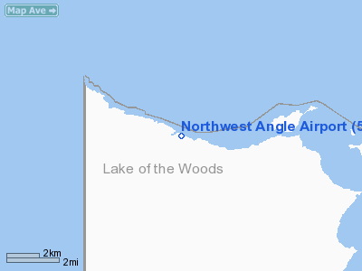
| From nearest city: | 28 nautical miles NE of Warroad, MN |
| Location: | Lake Of The Woods County, MN |
| Magnetic Variation: | 03E (1985) |
Owner & Manager
| Ownership: | Privately owned |
| Owner: | Lehr & Davis Properties |
| Address: |
Waden, MN 56482 |
| Phone number: | 218-631-5018 |
| Manager: | Lehr & Davis Properties |
| Address: |
Waden, MN 56482 |
| Phone number: | 218-613-5018 |
Airport Operations and Facilities
| Airport Use: | Private |
| Wind indicator: | Yes |
| Segmented Circle: | No |
| Control Tower: | No |
| Landing fee charge: | Yes |
| Sectional chart: | Twin Cities |
| Region: | AGL - Great Lakes |
| Boundary ARTCC: | ZMP - Minneapolis |
| Tie-in FSS: | PNM - Princeton |
| FSS on Airport: | No |
| FSS Toll Free: | 1-800-WX-BRIEF |
Airport Communications
Airport Services
| Airframe Repair: | NONE |
| Power Plant Repair: | NONE |
| Bottled Oxygen: | NONE |
| Bulk Oxygen: | NONE |
Runway Information
Runway 08/26
| Dimension: | 2380 x 105 ft / 725.4 x 32.0 m |
| Surface: | TURF, |
| |
Runway 08 |
Runway 26 |
| Traffic Pattern: | Left | Left |
| Runway End Identifier: | No | No |
| Centerline Lights: | No | No |
| Touchdown Lights: | No | No |
|
Radio Navigation Aids
| ID |
Type |
Name |
Ch |
Freq |
Var |
Dist |
| YQK | NDB | Kenora | | 326.00 | 05E | 36.6 nm |
| PFT | NDB | Piney Pinecreek | | 342.00 | 05E | 41.7 nm |
| ROX | VOR/DME | Roseau | 025X | 108.80 | 05E | 38.7 nm |
| BDE | VOR/DME | Baudette | 053X | 111.60 | 04E | 42.0 nm |
| VBI | VORTAC | Sioux Narrows | 099X | 115.20 | 04E | 40.8 nm |
Remarks
- (E62-08) LNDG LENGTH BASED ON 20:1 APCH RATIO.
- (E62-26) LNDG LENGTH BASED ON 20:1 APCH RATIO.
Images and information placed above are from
http://www.airport-data.com/airport/58MN/
We thank them for the data!
| General Info
|
| Country |
United States
|
| State |
MINNESOTA
|
| FAA ID |
58MN
|
| Latitude |
49-21-04.985N
|
| Longitude |
095-04-15.857W
|
| Elevation |
1071 feet
|
| Near City |
WARROAD
|
We don't guarantee the information is fresh and accurate. The data may
be wrong or outdated.
For more up-to-date information please refer to other sources.
|
|


