 |
|
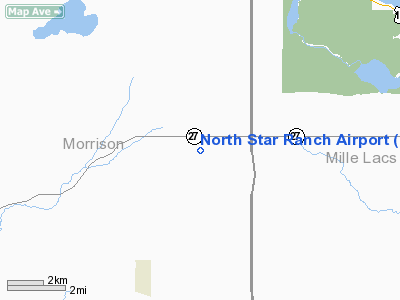
Location & QuickFacts
| FAA Information Effective: | 2008-09-25 |
| Airport Identifier: | MY66 |
| Airport Status: | Operational |
| Longitude/Latitude: | 093-50-49.9160W/46-04-13.8630N
-93.847199/46.070518 (Estimated) |
| Elevation: | 1330 ft / 405.38 m (Estimated) |
| Land: | 0 acres |
| From nearest city: | 8 nautical miles W of Onamia, MN |
| Location: | Morrison County, MN |
| Magnetic Variation: | 03E (1985) |
Owner & Manager
| Ownership: | Privately owned |
| Owner: | Willmus Companies |
| Address: | 2819 Hamline Ave North Nr 111
Roseville, MN 55113 |
| Phone number: | 612-633-5701 |
| Manager: | Thomas M. Willmus |
| Address: | Rt 1
Hillman, MN 56338 |
| Phone number: | 612-277-3242 |
Airport Operations and Facilities
| Airport Use: | Private |
| Segmented Circle: | No |
| Control Tower: | No |
| Sectional chart: | Twin Cities |
| Region: | AGL - Great Lakes |
| Boundary ARTCC: | ZMP - Minneapolis |
| Tie-in FSS: | PNM - Princeton |
| FSS on Airport: | No |
| FSS Toll Free: | 1-800-WX-BRIEF |
Runway Information
Runway 18/36
| Dimension: | 3500 x 100 ft / 1066.8 x 30.5 m |
| Surface: | TURF, |
| |
Runway 18 |
Runway 36 |
| Traffic Pattern: | Left | Left |
| Obstruction: | 40 ft trees, 200.0 ft from runway | |
|
Radio Navigation Aids
| ID |
Type |
Name |
Ch |
Freq |
Var |
Dist |
| XCR | NDB | Ripley | | 404.00 | 03E | 20.7 nm |
| LXL | NDB | Little Falls | | 359.00 | 03E | 21.9 nm |
| JMR | NDB | Mora | | 327.00 | 03E | 26.5 nm |
| AIT | NDB | Aitkin | | 397.00 | 03E | 29.5 nm |
| PNM | NDB | Princeton | | 368.00 | 03E | 32.0 nm |
| CBG | NDB | Cambridge | | 350.00 | 03E | 39.4 nm |
| ROS | NDB | Rush City | | 282.00 | 02E | 43.5 nm |
| SAZ | NDB | Staples | | 257.00 | 04E | 44.0 nm |
| PWC | NDB | Pine River | | 330.00 | 03E | 45.3 nm |
| MZH | NDB | Moose Lake | | 362.00 | 02E | 48.1 nm |
| RYM | TACAN | Camp Ripley | 048X | | 03E | 21.2 nm |
| STC | VOR/DME | St Cloud | 058X | 112.10 | 03E | 32.6 nm |
| BRD | VORTAC | Brainerd | 116X | 116.90 | 03E | 18.3 nm |
Remarks
- FILED FOR RECORD PURPOSES ONLY.
Images and information placed above are from
http://www.airport-data.com/airport/MY66/
We thank them for the data!
| General Info
|
| Country |
United States
|
| State |
MINNESOTA
|
| FAA ID |
MY66
|
| Latitude |
46-04-13.863N
|
| Longitude |
093-50-49.916W
|
| Elevation |
1330 feet
|
| Near City |
ONAMIA
|
We don't guarantee the information is fresh and accurate. The data may
be wrong or outdated.
For more up-to-date information please refer to other sources.
|
|


