 |
|
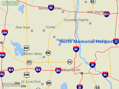
Location & QuickFacts
| FAA Information Effective: | 2008-09-25 |
| Airport Identifier: | MY77 |
| Airport Status: | Operational |
| Longitude/Latitude: | 093-19-21.0000W/45-00-50.0000N
-93.322500/45.013889 (Estimated) |
| Elevation: | 930 ft / 283.46 m (Estimated) |
| Land: | 0 acres |
| From nearest city: | 1 nautical miles SE of Robbinsdale, MN |
| Location: | Hennepin County, MN |
| Magnetic Variation: | 04E (1980) |
Owner & Manager
| Ownership: | Privately owned |
| Owner: | North Memorial Medical Center |
| Address: | 3300 Oakdale N.
Robbinsdale, MN 55422 |
| Phone number: | 612-520-5357 |
| Manager: | Pat Coyne |
| Address: | 3300 Oakdale N
Robbinsdale, MN 55422 |
| Phone number: | 612-520-5357 |
Airport Operations and Facilities
| Airport Use: | Private
MEDICAL USE. |
| Wind indicator: | Yes |
| Segmented Circle: | No |
| Control Tower: | No |
| Lighting Schedule: | RDO-CTL
ACTVT FLOOD LGTS H1 AND ARPT BCN - 122.975. |
| Beacon Color: | Clear (unlighted land airport) |
| Sectional chart: | Twin Cities |
| Region: | AGL - Great Lakes |
| Boundary ARTCC: | ZMP - Minneapolis |
| Tie-in FSS: | PNM - Princeton |
| FSS Toll Free: | 1-800-WX-BRIEF |
Airport Services
Runway Information
Helipad H1
| Dimension: | 120 x 100 ft / 36.6 x 30.5 m |
| Surface: | CONC,
LCTD ON ROOFTOP. |
| |
Runway H1 |
Runway |
| Traffic Pattern: | Left | Left |
|
Radio Navigation Aids
| ID |
Type |
Name |
Ch |
Freq |
Var |
Dist |
| MS | NDB | Narco | | 266.00 | 02E | 15.0 nm |
| PPI | NDB | Hopey | | 400.00 | 03E | 18.3 nm |
| OEO | NDB | Osceola | | 233.00 | 01E | 32.3 nm |
| CBG | NDB | Cambridge | | 350.00 | 03E | 32.8 nm |
| RNH | NDB | New Richmond | | 257.00 | 02E | 34.4 nm |
| PNM | NDB | Princeton | | 368.00 | 03E | 35.2 nm |
| GYL | NDB | Glencoe | | 407.00 | 03E | 35.9 nm |
| AHH | NDB | Ameron | | 278.00 | 01E | 43.4 nm |
| ROS | NDB | Rush City | | 282.00 | 02E | 43.9 nm |
| HCD | NDB | Hutchinson | | 209.00 | 04E | 46.1 nm |
| MSP | VOR/DME | Minneapolis | 100X | 115.30 | 02E | 7.9 nm |
| FCM | VOR/DME | Flying Cloud | 055X | 111.80 | 06E | 12.7 nm |
| STC | VOR/DME | St Cloud | 058X | 112.10 | 03E | 44.8 nm |
| FOW | VOR/DME | Halfway | 049X | 111.20 | 02E | 48.7 nm |
| GEP | VORTAC | Gopher | 120X | 117.30 | 06E | 8.2 nm |
| FGT | VORTAC | Farmington | 104X | 115.70 | 06E | 23.8 nm |
| DWN | VORTAC | Darwin | 027X | 109.00 | 07E | 48.2 nm |
| MSP | VOT | Minneapolis St Paul | | 111.00 | | 9.0 nm |
| STP | VOT | St Paul | | 114.40 | | 12.0 nm |
Remarks
- PRVDD APCH/DEPT RTES SHALL FOLLOW HWY 81 BTN 225 DEG TO 110 DEG; AREA MKD; WIND INDICATOR MNTD.
Images and information placed above are from
http://www.airport-data.com/airport/MY77/
We thank them for the data!
| General Info
|
| Country |
United States
|
| State |
MINNESOTA
|
| FAA ID |
MY77
|
| Latitude |
45-00-50.000N
|
| Longitude |
093-19-21.000W
|
| Elevation |
930 feet
|
| Near City |
ROBBINSDALE
|
We don't guarantee the information is fresh and accurate. The data may
be wrong or outdated.
For more up-to-date information please refer to other sources.
|
|


