 |
|
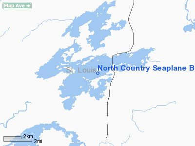
North Country Seaplane Base |
Location & QuickFacts
| FAA Information Effective: | 2008-09-25 |
| Airport Identifier: | 9M0 |
| Airport Status: | Operational |
| Longitude/Latitude: | 092-10-05.6700W/47-00-53.7700N
-92.168242/47.014936 (Estimated) |
| Elevation: | 1370 ft / 417.58 m (Estimated) |
| Land: | 2 acres |
| From nearest city: | 16 nautical miles N of Duluth, MN |
| Location: | St Louis County, MN |
| Magnetic Variation: | 02E (1985) |
Owner & Manager
| Ownership: | Privately owned |
| Owner: | Neil Mathison |
| Address: | 4565 Island Lake Dr
Duluth, MN 55803 |
| Phone number: | 218-721-4448 |
| Manager: | Neil Mathison |
| Address: | 4535 Airport Approach Rd
Duluth, MN 55811 |
| Phone number: | 218-727-2911 |
Airport Operations and Facilities
| Airport Use: | Open to public |
| Wind indicator: | Yes |
| Segmented Circle: | No |
| Control Tower: | No |
| Sectional chart: | Green Bay |
| Region: | AGL - Great Lakes |
| Boundary ARTCC: | ZMP - Minneapolis |
| Tie-in FSS: | PNM - Princeton |
| FSS on Airport: | No |
| FSS Toll Free: | 1-800-WX-BRIEF |
| NOTAMs Facility: | PNM (NOTAM-d service avaliable) |
Airport Communications
| CTAF: | 122.700 |
| Unicom: | 122.800 |
Airport Services
| Fuel available: | 100LL
100LL FUEL AVBL FOR EMERGENCY PURPOSES ONLY. |
Runway Information
Runway 03/21
| Dimension: | 5000 x 300 ft / 1524.0 x 91.4 m |
| Surface: | WATER, |
| |
Runway 03 |
Runway 21 |
| Traffic Pattern: | Left | Left |
|
Runway 09/27
| Dimension: | 5000 x 300 ft / 1524.0 x 91.4 m |
| Surface: | WATER, |
| |
Runway 09 |
Runway 27 |
| Traffic Pattern: | Left | Left |
|
Runway 13/31
| Dimension: | 5000 x 300 ft / 1524.0 x 91.4 m |
| Surface: | WATER, |
| |
Runway 13 |
Runway 31 |
| Traffic Pattern: | Left | Left |
|
Radio Navigation Aids
| ID |
Type |
Name |
Ch |
Freq |
Var |
Dist |
| DL | NDB | Pykla | | 379.00 | 02E | 12.7 nm |
| TWM | NDB | Two Harbors | | 243.00 | 01E | 17.5 nm |
| SUW | NDB | Bong | | 260.00 | 01E | 19.6 nm |
| COQ | NDB | Cloquet | | 335.00 | 03E | 23.5 nm |
| BFW | NDB | Silver Bay | | 350.00 | 00E | 33.9 nm |
| OLG | NDB | Solon Springs | | 388.00 | 01E | 44.4 nm |
| MZH | NDB | Moose Lake | | 362.00 | 02E | 44.5 nm |
| LKI | TACAN | Lakeside | 011X | | 05E | 10.2 nm |
| HIB | VOR/DME | Hibbing | 045X | 110.80 | 02E | 27.9 nm |
| EVM | VOR/DME | Eveleth | 019X | 108.20 | 01E | 28.0 nm |
| DLH | VORTAC | Duluth | 073X | 112.60 | 05E | 12.9 nm |
Images and information placed above are from
http://www.airport-data.com/airport/9M0/
We thank them for the data!
| General Info
|
| Country |
United States
|
| State |
MINNESOTA
|
| FAA ID |
9M0
|
| Latitude |
47-00-53.770N
|
| Longitude |
092-10-05.670W
|
| Elevation |
1370 feet
|
| Near City |
DULUTH
|
We don't guarantee the information is fresh and accurate. The data may
be wrong or outdated.
For more up-to-date information please refer to other sources.
|
|


