 |
|
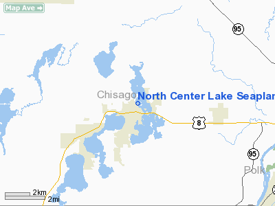
North Center Lake Seaplane Base |
Location & QuickFacts
| FAA Information Effective: | 2008-09-25 |
| Airport Identifier: | 6MN4 |
| Airport Status: | Operational |
| Longitude/Latitude: | 092-49-53.7700W/45-23-49.8680N
-92.831603/45.397186 (Estimated) |
| Elevation: | 900 ft / 274.32 m (Estimated) |
| Land: | 0 acres |
| From nearest city: | 0 nautical miles N of Lindstrom, MN |
| Location: | Chisago County, MN |
| Magnetic Variation: | 03E (1985) |
Owner & Manager
| Ownership: | Privately owned |
| Owner: | L. A. Mattson |
| Address: |
Lindstrom, MN 55045 |
| Phone number: | 612-257-1307 |
| Manager: | L. A. Mattson |
| Address: |
Lindstrom, MN 55045 |
| Phone number: | 612-257-1307 |
Airport Operations and Facilities
| Airport Use: | Private
PERSONAL USE. |
| Wind indicator: | No |
| Segmented Circle: | No |
| Control Tower: | No |
| Landing fee charge: | No |
| Sectional chart: | Green Bay |
| Region: | AGL - Great Lakes |
| Boundary ARTCC: | ZMP - Minneapolis |
| Tie-in FSS: | PNM - Princeton |
| FSS on Airport: | No |
| FSS Toll Free: | 1-800-WX-BRIEF |
Runway Information
Runway 02/20
| Dimension: | 4000 x 300 ft / 1219.2 x 91.4 m |
| Surface: | WATER, |
| |
Runway 02 |
Runway 20 |
| Traffic Pattern: | Left | Left |
|
Runway 14/32
| Dimension: | 6000 x 300 ft / 1828.8 x 91.4 m |
| Surface: | WATER, |
| |
Runway 14 |
Runway 32 |
| Traffic Pattern: | Left | Left |
|
Radio Navigation Aids
| ID |
Type |
Name |
Ch |
Freq |
Var |
Dist |
| OEO | NDB | Osceola | | 233.00 | 01E | 8.0 nm |
| ROS | NDB | Rush City | | 282.00 | 02E | 18.8 nm |
| RNH | NDB | New Richmond | | 257.00 | 02E | 19.6 nm |
| CBG | NDB | Cambridge | | 350.00 | 03E | 20.5 nm |
| AHH | NDB | Ameron | | 278.00 | 01E | 20.7 nm |
| PPI | NDB | Hopey | | 400.00 | 03E | 31.8 nm |
| BXR | NDB | Big Doctor | | 203.00 | 02E | 32.1 nm |
| PNM | NDB | Princeton | | 368.00 | 03E | 34.2 nm |
| JMR | NDB | Mora | | 327.00 | 03E | 34.9 nm |
| MS | NDB | Narco | | 266.00 | 02E | 36.1 nm |
| UBE | NDB | Cumberland | | 375.00 | 01E | 36.7 nm |
| SSQ | NDB | Shell Lake | | 212.00 | 01E | 43.2 nm |
| RZN | VOR/DME | Siren | 031X | 109.40 | 02E | 31.9 nm |
| MSP | VOR/DME | Minneapolis | 100X | 115.30 | 02E | 34.6 nm |
| FCM | VOR/DME | Flying Cloud | 055X | 111.80 | 06E | 43.4 nm |
| RPD | VOR/DME | Rice Lake | 037X | 110.00 | 01E | 44.5 nm |
| GEP | VORTAC | Gopher | 120X | 117.30 | 06E | 27.4 nm |
| FGT | VORTAC | Farmington | 104X | 115.70 | 06E | 48.4 nm |
| STP | VOT | St Paul | | 114.40 | | 29.1 nm |
| MSP | VOT | Minneapolis St Paul | | 111.00 | | 34.9 nm |
Remarks
- SAFE OPN CANNOT BE CONDUCTED DUE TO HEAVY WATER USE BY BOATS IN SUMMER MONTHS; BLIND SPOTS CREATED BY POINTS OF LAND & ISLANDS NEAR PPSD SEALANES.
Images and information placed above are from
http://www.airport-data.com/airport/6MN4/
We thank them for the data!
| General Info
|
| Country |
United States
|
| State |
MINNESOTA
|
| FAA ID |
6MN4
|
| Latitude |
45-23-49.868N
|
| Longitude |
092-49-53.770W
|
| Elevation |
900 feet
|
| Near City |
LINDSTROM
|
We don't guarantee the information is fresh and accurate. The data may
be wrong or outdated.
For more up-to-date information please refer to other sources.
|
|


