 |
|
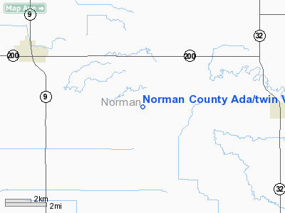
Norman County Ada / Twin Valley Airport |
Location & QuickFacts
| FAA Information Effective: | 2008-09-25 |
| Airport Identifier: | D00 |
| Airport Status: | Operational |
| Longitude/Latitude: | 096-24-00.9500W/47-15-37.6830N
-96.400264/47.260467 (Estimated) |
| Elevation: | 954 ft / 290.78 m (Estimated) |
| Land: | 335 acres |
| From nearest city: | 5 nautical miles SE of Ada/twin Valley, MN |
| Location: | Norman County, MN |
| Magnetic Variation: | 05E (2000) |
Owner & Manager
| Ownership: | Publicly owned |
| Owner: | Cnty Norman & Ada-twin Valley |
| Address: | Po Box 9
Ada, MN 56510 |
| Phone number: | 218-784-2211 |
| Manager: | Bruce Visser |
| Address: | P.o. Box 9
Ada, MN 56510 |
| Phone number: | 218-784-2962
ARPT MGR WORK PHONE 218-766-3515. |
Airport Operations and Facilities
| Airport Use: | Open to public |
| Wind indicator: | Yes |
| Segmented Circle: | No |
| Control Tower: | No |
| Lighting Schedule: | DUSK-DAWN |
| Beacon Color: | Clear-Green (lighted land airport) |
| Sectional chart: | Twin Cities |
| Region: | AGL - Great Lakes |
| Traffic Pattern Alt: | 800 ft |
| Boundary ARTCC: | ZMP - Minneapolis |
| Tie-in FSS: | PNM - Princeton |
| FSS on Airport: | No |
| FSS Toll Free: | 1-800-WX-BRIEF |
| NOTAMs Facility: | PNM (NOTAM-d service avaliable) |
Airport Communications
Airport Services
| Fuel available: | 100LL
FOR FUEL CALL 218-784-4381/2962. |
Runway Information
Runway 15/33
| Dimension: | 3103 x 60 ft / 945.8 x 18.3 m |
| Surface: | ASPH, Good Condition
CRACKING AND SURFACE EROSION. |
| Edge Lights: | Low
SEVERAL LIGHTS OUT OTHERS LEANING. |
| |
Runway 15 |
Runway 33 |
| Longitude: | 096-24-10.7760W | 096-23-51.1240W |
| Latitude: | 47-15-51.4570N | 47-15-23.9080N |
| Elevation: | 938.00 ft | 954.00 ft |
| Alignment: | 127 | 127 |
| Traffic Pattern: | Left | Left |
| Markings: | Non-precision instrument, Good Condition | Non-precision instrument, Good Condition |
| Obstruction: | 52 ft tree, 2300.0 ft from runway, 40:1 slope to clear | 8 ft tree, 250.0 ft from runway, 230 ft left of centerline, 6:1 slope to clear
TREES +72 FT, 1800 FT FM RWY END, 150 FT L, 22:1. |
|
Radio Navigation Aids
| ID |
Type |
Name |
Ch |
Freq |
Var |
Dist |
| AA | NDB | Kenie | | 365.00 | 06E | 22.7 nm |
| FSE | NDB | Fosston | | 224.00 | 05E | 32.4 nm |
| CKN | NDB | Crookston | | 400.00 | 07E | 35.9 nm |
| DTL | VOR/DME | Detroit Lakes | 049X | 111.20 | 05E | 33.5 nm |
| TVF | VOR/DME | Thief River Falls | 021X | 108.40 | 08E | 49.4 nm |
| FAR | VORTAC | Fargo | 109X | 116.20 | 09E | 35.6 nm |
Remarks
- ULTRALIGHTS ON & INVOF ARPT.
- NON COMPLIANCE FAR 157.
Images and information placed above are from
http://www.airport-data.com/airport/D00/
We thank them for the data!
| General Info
|
| Country |
United States
|
| State |
MINNESOTA
|
| FAA ID |
D00
|
| Latitude |
47-15-37.683N
|
| Longitude |
096-24-00.950W
|
| Elevation |
954 feet
|
| Near City |
ADA/TWIN VALLEY
|
We don't guarantee the information is fresh and accurate. The data may
be wrong or outdated.
For more up-to-date information please refer to other sources.
|
|


