 |
|
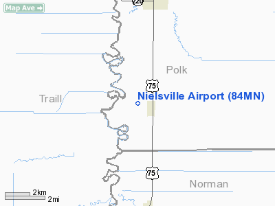
Location & QuickFacts
| FAA Information Effective: | 2008-09-25 |
| Airport Identifier: | 84MN |
| Airport Status: | Operational |
| Longitude/Latitude: | 096-49-51.2850W/47-31-59.9050N
-96.830912/47.533307 (Estimated) |
| Elevation: | 869 ft / 264.87 m (Estimated) |
| Land: | 5 acres |
| From nearest city: | 1 nautical miles W of Nielsville, MN |
| Location: | Polk County, MN |
| Magnetic Variation: | 06E (1985) |
Owner & Manager
| Ownership: | Privately owned |
| Owner: | Ron Deck |
| Address: | 16285 5th St. N.e.
Hillsboro, ND 58045 |
| Phone number: | 701-436-5880 |
| Manager: | Ron Deck |
| Address: | 16285 5th St. N,e,
Hillsboro, ND 58045 |
| Phone number: | 701-436-5880 |
Airport Operations and Facilities
| Airport Use: | Private |
| Wind indicator: | Yes |
| Segmented Circle: | No |
| Control Tower: | No |
| Landing fee charge: | No |
| Sectional chart: | Twin Cities |
| Region: | AGL - Great Lakes |
| Boundary ARTCC: | ZMP - Minneapolis |
| Tie-in FSS: | GFK - Grand Forks |
| FSS on Airport: | No |
| FSS Toll Free: | 1-800-WX-BRIEF |
Airport Services
| Fuel available: | 100
FOR FUEL CALL 701-436-5880. GRADE 130 FUEL ALSO AVBL. |
Runway Information
Runway 17/35
| Dimension: | 2950 x 50 ft / 899.2 x 15.2 m |
| Surface: | CONC-TURF,
SOUTH 600 FT X 15 FT CONC. |
| |
Runway 17 |
Runway 35 |
| Traffic Pattern: | Left | Left |
|
Radio Navigation Aids
| ID |
Type |
Name |
Ch |
Freq |
Var |
Dist |
| CKN | NDB | Crookston | | 400.00 | 07E | 20.4 nm |
| AA | NDB | Kenie | | 365.00 | 06E | 31.5 nm |
| FSE | NDB | Fosston | | 224.00 | 05E | 43.2 nm |
| RDR | TACAN | Red River | 111X | | 06E | 34.5 nm |
| GFK | VOR/DME | Grand Forks | 090X | 114.30 | 09E | 29.1 nm |
| TVF | VOR/DME | Thief River Falls | 021X | 108.40 | 08E | 41.4 nm |
| FAR | VORTAC | Fargo | 109X | 116.20 | 09E | 46.9 nm |
Remarks
- E111: CONFLICT OF AIRSPACE RQRD FOR SIMULTANEOUS ARPT TFC PTN OPNS FOR BOTH NIELSVILLE & CHANDLER FIELD ARPTS.
Images and information placed above are from
http://www.airport-data.com/airport/84MN/
We thank them for the data!
| General Info
|
| Country |
United States
|
| State |
MINNESOTA
|
| FAA ID |
84MN
|
| Latitude |
47-31-59.905N
|
| Longitude |
096-49-51.285W
|
| Elevation |
869 feet
|
| Near City |
NIELSVILLE
|
We don't guarantee the information is fresh and accurate. The data may
be wrong or outdated.
For more up-to-date information please refer to other sources.
|
|


