 |
|
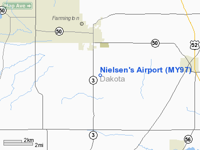
Location & QuickFacts
| FAA Information Effective: | 2008-09-25 |
| Airport Identifier: | MY97 |
| Airport Status: | Operational |
| Longitude/Latitude: | 093-07-36.7700W/44-35-52.8700N
-93.126881/44.598019 (Estimated) |
| Elevation: | 990 ft / 301.75 m (Estimated) |
| Land: | 4 acres |
| From nearest city: | 3 nautical miles S of Farmington, MN |
| Location: | Dakota County, MN |
| Magnetic Variation: | 03E (1990) |
Owner & Manager
| Ownership: | Privately owned |
| Owner: | James I. Nielsen |
| Address: | 3196- 240th Street West
Farmington, MN 55024 |
| Phone number: | 651-460-6963 |
| Manager: | James I. Nielsen |
| Address: | 3196- 240th Street West
Farmington, MN 55024 |
| Phone number: | 651-460-6963 |
Airport Operations and Facilities
| Airport Use: | Private |
| Wind indicator: | Yes |
| Segmented Circle: | No |
| Control Tower: | No |
| Sectional chart: | Twin Cities |
| Region: | AGL - Great Lakes |
| Boundary ARTCC: | ZMP - Minneapolis |
| Tie-in FSS: | PNM - Princeton |
| FSS on Airport: | No |
| FSS Toll Free: | 1-800-WX-BRIEF |
Runway Information
Runway 18/36
| Dimension: | 2000 x 60 ft / 609.6 x 18.3 m |
| Surface: | TURF, |
| |
Runway 18 |
Runway 36 |
| Traffic Pattern: | Left | Left |
| Displaced threshold: | 160.00 ft | 0.00 ft |
|
Radio Navigation Aids
| ID |
Type |
Name |
Ch |
Freq |
Var |
Dist |
| MS | NDB | Narco | | 266.00 | 02E | 13.8 nm |
| PPI | NDB | Hopey | | 400.00 | 03E | 18.3 nm |
| ACQ | NDB | Waseca | | 371.00 | 02E | 36.6 nm |
| RNH | NDB | New Richmond | | 257.00 | 02E | 41.6 nm |
| GYL | NDB | Glencoe | | 407.00 | 03E | 42.1 nm |
| OEO | NDB | Osceola | | 233.00 | 01E | 46.7 nm |
| MSP | VOR/DME | Minneapolis | 100X | 115.30 | 02E | 18.5 nm |
| FCM | VOR/DME | Flying Cloud | 055X | 111.80 | 06E | 19.6 nm |
| FOW | VOR/DME | Halfway | 049X | 111.20 | 02E | 25.9 nm |
| MKT | VOR/DME | Mankato | 045X | 110.80 | 07E | 40.7 nm |
| FGT | VORTAC | Farmington | 104X | 115.70 | 06E | 3.1 nm |
| GEP | VORTAC | Gopher | 120X | 117.30 | 06E | 34.6 nm |
| MSP | VOT | Minneapolis St Paul | | 111.00 | | 17.6 nm |
| STP | VOT | St Paul | | 114.40 | | 20.8 nm |
Remarks
- PRVDD ANY OBSTNS IN RY APCH SLOPE SFC BE LOWERED OR REMOVED AND THE AREA 125 FT EITHER SIDE OF RY CNTRLN AND 240 FT FROM EITHER END OF RY BE CLEAR OF ANY OBSTNS.
Images and information placed above are from
http://www.airport-data.com/airport/MY97/
We thank them for the data!
| General Info
|
| Country |
United States
|
| State |
MINNESOTA
|
| FAA ID |
MY97
|
| Latitude |
44-35-52.870N
|
| Longitude |
093-07-36.770W
|
| Elevation |
990 feet
|
| Near City |
FARMINGTON
|
We don't guarantee the information is fresh and accurate. The data may
be wrong or outdated.
For more up-to-date information please refer to other sources.
|
|


