 |
|
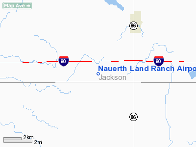
Nauerth Land Ranch Airport |
Location & QuickFacts
| FAA Information Effective: | 2008-09-25 |
| Airport Identifier: | 03MN |
| Airport Status: | Operational |
| Longitude/Latitude: | 095-13-29.0000W/43-37-30.8580N
-95.224722/43.625238 (Estimated) |
| Elevation: | 1435 ft / 437.39 m (Estimated) |
| Land: | 0 acres |
| From nearest city: | 3 nautical miles SW of Lakefield, MN |
| Location: | Jackson County, MN |
| Magnetic Variation: | 04E (1995) |
Owner & Manager
| Ownership: | Privately owned |
| Owner: | John Nauerth Iii |
| Address: | Rr 2 Box 21
Lakefield, MN 56150 |
| Phone number: | 507-662-5473 |
| Manager: | John Nauerth Iii |
| Address: | Rr 2 Box 21
Lakefield, MN 56150 |
| Phone number: | 507-662-5473 |
Airport Operations and Facilities
| Airport Use: | Private |
| Segmented Circle: | No |
| Control Tower: | No |
| Sectional chart: | Omaha |
| Region: | AGL - Great Lakes |
| Boundary ARTCC: | ZMP - Minneapolis |
| Tie-in FSS: | PNM - Princeton |
| FSS on Airport: | No |
| FSS Toll Free: | 1-800-WX-BRIEF |
Runway Information
Runway 17/35
| Dimension: | 1940 x 75 ft / 591.3 x 22.9 m |
| Surface: | TURF, |
| |
Runway 17 |
Runway 35 |
| Traffic Pattern: | Left | Left |
| Obstruction: | | 150 ft pline, 2890.0 ft from runway |
|
Radio Navigation Aids
| ID |
Type |
Name |
Ch |
Freq |
Var |
Dist |
| MJQ | NDB | Jackson | | 353.00 | 04E | 10.5 nm |
| MWM | NDB | Windom | | 203.00 | 03E | 17.8 nm |
| PUF | NDB | Puff | | 345.00 | 04E | 26.9 nm |
| ISB | NDB | Sibley | | 269.00 | 05E | 27.7 nm |
| LTU | NDB | Little Sioux | | 326.00 | 05E | 30.2 nm |
| SHL | NDB | Sheldon | | 338.00 | 05E | 36.3 nm |
| JYG | NDB | St James | | 260.00 | 04E | 36.3 nm |
| EGQ | NDB | Emmetsburg | | 410.00 | 04E | 38.8 nm |
| SBU | NDB | Blue Earth | | 332.00 | 04E | 49.1 nm |
| EST | VOR | Estherville | | 110.40 | 07E | 24.6 nm |
| OTG | VOR/DME | Worthington | 043X | 110.60 | 08E | 15.6 nm |
| SPW | VOR/DME | Spencer | 037X | 110.00 | 05E | 27.9 nm |
| FRM | VOR/DME | Fairmont | 039X | 110.20 | 07E | 34.9 nm |
| DDL | VOR/DME | Sheldon | 023X | 108.60 | 05E | 36.4 nm |
Remarks
- 20:1 APCH CLNC OVR OBSTNS; 25 FT EA SIDE OF RY & 200 FT OFF EOR CLEARED; 60 FT EA SIDE OF RY & 240 FT OFF EOR GRADED & CLEARED.
Images and information placed above are from
http://www.airport-data.com/airport/03MN/
We thank them for the data!
| General Info
|
| Country |
United States
|
| State |
MINNESOTA
|
| FAA ID |
03MN
|
| Latitude |
43-37-30.858N
|
| Longitude |
095-13-27.986W
|
| Elevation |
1430 feet
|
| Near City |
LAKEFIELD
|
We don't guarantee the information is fresh and accurate. The data may
be wrong or outdated.
For more up-to-date information please refer to other sources.
|
|


