 |
|
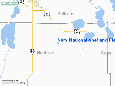
Nary National - Shefland Field Airport |
Location & QuickFacts
| FAA Information Effective: | 2008-09-25 |
| Airport Identifier: | 5C3 |
| Airport Status: | Operational |
| Longitude/Latitude: | 094-47-55.5000W/47-22-31.4000N
-94.798750/47.375389 (Estimated) |
| Elevation: | 1389 ft / 423.37 m (Estimated) |
| Land: | 160 acres |
| From nearest city: | 3 nautical miles NE of Nary, MN |
| Location: | Hubbard County, MN |
| Magnetic Variation: | 05E (1985) |
Owner & Manager
| Ownership: | Privately owned |
| Owner: | Raymond C. Shefland |
| Address: | 27040 County Road 9
Bemidji, MN 56601 |
| Phone number: | 218-759-0457 |
| Manager: | Raymond C. Shefland |
| Address: | 27040 County Road 9
Bemidji, MN 56601 |
| Phone number: | 218-759-0457 |
Airport Operations and Facilities
| Airport Use: | Open to public |
| Wind indicator: | No |
| Segmented Circle: | Yes |
| Control Tower: | No |
| Lighting Schedule: | DUSK-DAWN
ACTVT LIRL RY 17/35 - 122.9. |
| Beacon Color: | Clear-Green (lighted land airport) |
| Sectional chart: | Twin Cities |
| Region: | AGL - Great Lakes |
| Boundary ARTCC: | ZMP - Minneapolis |
| Tie-in FSS: | PNM - Princeton |
| FSS Toll Free: | 1-800-WX-BRIEF |
| NOTAMs Facility: | PNM |
Airport Communications
| CTAF: | 122.800 |
| Unicom: | 122.800 |
Airport Services
Runway Information
Runway 17/35
| Dimension: | 3850 x 60 ft / 1173.5 x 18.3 m |
| Surface: | ASPH, Good Condition |
| Edge Lights: | Non-standard lighting system
NSTD LIRL, LGTS 3 FT ABV GRADE & 10 FT FM RY EDGE. |
| |
Runway 17 |
Runway 35 |
| Longitude: | 094-47-57.1300W | 094-47-53.9000W |
| Latitude: | 47-22-50.4100N | 47-22-12.4700N |
| Traffic Pattern: | Left | Left |
| Markings: | Basic, Fair Condition | Basic, Fair Condition |
| VASI: | 2-box on right side | 2-box on left side |
| Obstruction: | 30 ft trees, 1100.0 ft from runway, 150 ft right of centerline, 30:1 slope to clear
TREE +10, 150 FM END, 120R. | 102 ft trees, 1510.0 ft from runway, 160 ft left of centerline, 12:1 slope to clear |
|
Radio Navigation Aids
| ID |
Type |
Name |
Ch |
Freq |
Var |
Dist |
| XVG | NDB | Longville | | 392.00 | 04E | 33.3 nm |
| PK | NDB | Spida | | 269.00 | 04E | 33.3 nm |
| FSE | NDB | Fosston | | 224.00 | 05E | 41.5 nm |
| PWC | NDB | Pine River | | 330.00 | 03E | 42.5 nm |
| PKD | VOR/DME | Park Rapids | 043X | 110.60 | 04E | 30.8 nm |
| BJI | VORTAC | Bemidji | 023X | 108.60 | 04E | 15.1 nm |
Remarks
Images and information placed above are from
http://www.airport-data.com/airport/5C3/
We thank them for the data!
| General Info
|
| Country |
United States
|
| State |
MINNESOTA
|
| FAA ID |
5C3
|
| Latitude |
47-22-33.832N
|
| Longitude |
094-47-52.991W
|
| Elevation |
1389 feet
|
| Near City |
NARY
|
We don't guarantee the information is fresh and accurate. The data may
be wrong or outdated.
For more up-to-date information please refer to other sources.
|
|


