 |
|
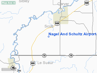
Nagel And Schultz Airport |
Location & QuickFacts
| FAA Information Effective: | 2008-09-25 |
| Airport Identifier: | 37MN |
| Airport Status: | Operational |
| Longitude/Latitude: | 093-48-05.8650W/44-34-55.8680N
-93.801629/44.582186 (Estimated) |
| Elevation: | 970 ft / 295.66 m (Estimated) |
| Land: | 5 acres |
| From nearest city: | 2 nautical miles SW of Belle Plaine, MN |
| Location: | Scott County, MN |
| Magnetic Variation: | 04E (1985) |
Owner & Manager
| Ownership: | Privately owned |
| Owner: | Gerald Nagel And Glen Schultz |
| Address: | 25426 German Road
Belle Plaine, MN 56011 |
| Phone number: | 612-873-6128 |
| Manager: | Gerald Nagel And Glen Schultz |
| Address: | 25426 German Road
Belle Plaine, MN 56011 |
| Phone number: | 612-873-6128 |
Airport Operations and Facilities
| Airport Use: | Private
PERSONAL USE. |
| Wind indicator: | Yes |
| Segmented Circle: | No |
| Control Tower: | No |
| Landing fee charge: | No |
| Sectional chart: | Twin Cities |
| Region: | AGL - Great Lakes |
| Boundary ARTCC: | ZMP - Minneapolis |
| Tie-in FSS: | PNM - Princeton |
| FSS on Airport: | No |
| FSS Toll Free: | 1-800-WX-BRIEF |
Runway Information
Runway 08/26
| Dimension: | 2000 x 50 ft / 609.6 x 15.2 m |
| Surface: | TURF, |
| |
Runway 08 |
Runway 26 |
| Traffic Pattern: | Left | Left |
| Displaced threshold: | 0.00 ft | 700.00 ft |
| Obstruction: | | 35 ft pline, 600.0 ft from runway |
|
Runway 17/35
| Dimension: | 1450 x 50 ft / 442.0 x 15.2 m |
| Surface: | TURF, |
| |
Runway 17 |
Runway 35 |
| Traffic Pattern: | Left | Left |
|
Radio Navigation Aids
| ID |
Type |
Name |
Ch |
Freq |
Var |
Dist |
| GYL | NDB | Glencoe | | 407.00 | 03E | 16.2 nm |
| HCD | NDB | Hutchinson | | 209.00 | 04E | 29.8 nm |
| ACQ | NDB | Waseca | | 371.00 | 02E | 32.6 nm |
| MS | NDB | Narco | | 266.00 | 02E | 33.7 nm |
| PPI | NDB | Hopey | | 400.00 | 03E | 40.7 nm |
| JYG | NDB | St James | | 260.00 | 04E | 48.3 nm |
| ULM | NDB/DME | New Ulm | 050X | 272.00 | 04E | 33.8 nm |
| FCM | VOR/DME | Flying Cloud | 055X | 111.80 | 06E | 20.8 nm |
| MKT | VOR/DME | Mankato | 045X | 110.80 | 07E | 22.3 nm |
| FOW | VOR/DME | Halfway | 049X | 111.20 | 02E | 29.3 nm |
| MSP | VOR/DME | Minneapolis | 100X | 115.30 | 02E | 30.6 nm |
| FGT | VORTAC | Farmington | 104X | 115.70 | 06E | 26.7 nm |
| GEP | VORTAC | Gopher | 120X | 117.30 | 06E | 38.5 nm |
| DWN | VORTAC | Darwin | 027X | 109.00 | 07E | 41.2 nm |
| MSP | VOT | Minneapolis St Paul | | 111.00 | | 30.9 nm |
| STP | VOT | St Paul | | 114.40 | | 38.3 nm |
Remarks
- (E111-2) AND DEPARTURES BY THE TYPE AIRCRAFT USING THE RWYS.
- PROVIDED THAT IF THERE ARE OBSTNS IN THE RWY APCH SLOPE SURFACES THAT CANNOT BE LOWERED OR REMOVED; THE RWY THR ARE DSPLCD AND CLEARLY MARKED;. SO AS TO PROVIDE A MIN 20:1 APCH CLEARANCE OVER ALL OBSTNS AND SUFFICIENT REMAINING USABLE RWY LENGTH IS AVAILABLE TO PERMIT SAFE LANDINGS;.
Images and information placed above are from
http://www.airport-data.com/airport/37MN/
We thank them for the data!
| General Info
|
| Country |
United States
|
| State |
MINNESOTA
|
| FAA ID |
37MN
|
| Latitude |
44-34-55.868N
|
| Longitude |
093-48-05.865W
|
| Elevation |
970 feet
|
| Near City |
BELLE PLAINE
|
We don't guarantee the information is fresh and accurate. The data may
be wrong or outdated.
For more up-to-date information please refer to other sources.
|
|


