 |
|
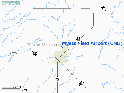
Myers Field Airport (CNB) |
Location & QuickFacts
| FAA Information Effective: | 2008-09-25 |
| Airport Identifier: | CNB |
| Airport Status: | Operational |
| Longitude/Latitude: | 096-15-57.7000W/44-43-46.2000N
-96.266028/44.729500 (Estimated) |
| Elevation: | 1194 ft / 363.93 m (Surveyed) |
| Land: | 160 acres |
| From nearest city: | 1 nautical miles N of Canby, MN |
| Location: | Yellow Medicine County, MN |
| Magnetic Variation: | 03E (1985) |
Owner & Manager
| Ownership: | Publicly owned |
| Owner: | City Of Canby |
| Address: | 110 Oscar Avenue N
Canby, MN 56220 |
| Phone number: | 507-829-9608 |
| Manager: | Matt Wagner |
| Address: | Po Box 14
Canby, MN 56220 |
| Phone number: | 507-829-9608 |
Airport Operations and Facilities
| Airport Use: | Open to public |
| Wind indicator: | Yes |
| Segmented Circle: | No |
| Control Tower: | No |
| Lighting Schedule: | DUSK-DAWN
MIRL RYS 12/30 PRESET ON LOW INTST. TO INCR INTST AND ACTVT REIL RYS 12 & 30 AND PAPI RYS 12 & 30 - CTAF. |
| Beacon Color: | Clear-Green (lighted land airport) |
| Landing fee charge: | No |
| Sectional chart: | Twin Cities |
| Region: | AGL - Great Lakes |
| Boundary ARTCC: | ZMP - Minneapolis |
| Tie-in FSS: | PNM - Princeton |
| FSS on Airport: | No |
| FSS Toll Free: | 1-800-WX-BRIEF |
| NOTAMs Facility: | CNB (NOTAM-d service avaliable) |
| Federal Agreements: | N |
Airport Communications
Airport Services
| Fuel available: | 100LL
SELF SERVE FUEL AVBL 24 HRS WITH CREDIT CARD. |
Runway Information
Runway 12/30
| Dimension: | 4648 x 75 ft / 1416.7 x 22.9 m |
| Surface: | ASPH, Fair Condition |
| Edge Lights: | Medium |
| |
Runway 12 |
Runway 30 |
| Longitude: | 096-16-25.1953W | 096-15-30.1859W |
| Latitude: | 44-43-58.1249N | 44-43-34.2736N |
| Elevation: | 1194.00 ft | 1185.00 ft |
| Alignment: | 121 | 127 |
| Traffic Pattern: | Left | Left |
| Markings: | Basic, Good Condition | Basic, Good Condition |
| Crossing Height: | 25.00 ft | 29.00 ft |
| Displaced threshold: | 0.00 ft | 239.00 ft |
| VASI: | 4-light PAPI on left side | 4-light PAPI on left side |
| Visual Glide Angle: | 3.00° | 3.00° |
| Runway End Identifier: | Yes | Yes |
| Centerline Lights: | No | No |
| Touchdown Lights: | No | No |
| Obstruction: | , 50:1 slope to clear | 19 ft road, 224.0 ft from runway, 125 ft left of centerline, 1:1 slope to clear |
|
Radio Navigation Aids
| ID |
Type |
Name |
Ch |
Freq |
Var |
Dist |
| DXX | NDB | Dawson/madison | | 341.00 | 06E | 15.7 nm |
| AQP | NDB | Appleton | | 356.00 | 05E | 31.9 nm |
| VVV | NDB | Ortonville | | 332.00 | 05E | 35.0 nm |
| BBB | NDB | Benson | | 239.00 | 05E | 44.4 nm |
| PQN | NDB/DME | Pipestone | 028X | 284.00 | 06E | 44.7 nm |
| MML | VOR/DME | Marshall | 047X | 111.00 | 05E | 25.3 nm |
| MVE | VOR/DME | Montevideo | 053X | 111.60 | 05E | 27.8 nm |
| BKX | VOR/DME | Brookings | 025X | 108.80 | 06E | 34.8 nm |
| ATY | VORTAC | Watertown | 113X | 116.60 | 09E | 40.2 nm |
Remarks
- GCO AVBL ON FREQ 121.725 THRU FLT SVCS.
- GCO OTS INDEFLY.
- BIRDS ON AND INVOF ARPT.
- FILED FOR RECORD PURPOSES.
Images and information placed above are from
http://www.airport-data.com/airport/CNB/
We thank them for the data!
| General Info
|
| Country |
United States
|
| State |
MINNESOTA
|
| FAA ID |
CNB
|
| Latitude |
44.729489
44° 43' 46.16" N
|
| Longitude |
-96.266003
096° 15' 57.61" W
|
| Elevation |
1193 feet
364 meters
|
| Magnetic Variation |
004° E (01/06)
|
| Beacon |
Yes
|
| Operating Agency |
U.S.CIVIL AIRPORT WHEREIN PERMIT COVERS USE BY TRANSIT MILITARY AIRCRAFT
|
| Alternate Name |
CANBY MUNI
|
We don't guarantee the information is fresh and accurate. The data may
be wrong or outdated.
For more up-to-date information please refer to other sources.
|
|


