 |
|
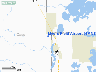
Myers Field Airport (4MN8) |
Location & QuickFacts
| FAA Information Effective: | 2008-09-25 |
| Airport Identifier: | 4MN8 |
| Airport Status: | Operational |
| Longitude/Latitude: | 094-20-21.9850W/46-37-38.8680N
-94.339440/46.627463 (Estimated) |
| Elevation: | 1300 ft / 396.24 m (Estimated) |
| Land: | 0 acres |
| From nearest city: | 3 nautical miles NW of Pequot Lakes, MN |
| Location: | Cass County, MN |
| Magnetic Variation: | 04E (1985) |
Owner & Manager
| Ownership: | Privately owned |
| Owner: | Raymond E. Myers |
| Address: | 4981-9-ave Sw
Pequot Lakes, MN 56472 |
| Phone number: | 218-568-5210 |
| Manager: | Raymond E. Myers |
| Address: | 4981-9-ave Sw
Pequot Lakes, MN 56472 |
| Phone number: | 218-568-5210 |
Airport Operations and Facilities
| Airport Use: | Private
PERSONAL USE. |
| Wind indicator: | Yes |
| Segmented Circle: | No |
| Control Tower: | No |
| Landing fee charge: | No |
| Sectional chart: | Twin Cities |
| Region: | AGL - Great Lakes |
| Boundary ARTCC: | ZMP - Minneapolis |
| Tie-in FSS: | PNM - Princeton |
| FSS on Airport: | No |
| FSS Toll Free: | 1-800-WX-BRIEF |
Runway Information
Runway 09/27
| Dimension: | 3960 x 200 ft / 1207.0 x 61.0 m |
| Surface: | TURF, |
| |
Runway 09 |
Runway 27 |
| Traffic Pattern: | Left | Left |
|
Radio Navigation Aids
| ID |
Type |
Name |
Ch |
Freq |
Var |
Dist |
| PWC | NDB | Pine River | | 330.00 | 03E | 6.3 nm |
| XVG | NDB | Longville | | 392.00 | 04E | 22.7 nm |
| SAZ | NDB | Staples | | 257.00 | 04E | 24.3 nm |
| AIT | NDB | Aitkin | | 397.00 | 03E | 27.9 nm |
| PK | NDB | Spida | | 269.00 | 04E | 29.0 nm |
| XCR | NDB | Ripley | | 404.00 | 03E | 33.0 nm |
| LXL | NDB | Little Falls | | 359.00 | 03E | 40.7 nm |
| RYM | TACAN | Camp Ripley | 048X | | 03E | 32.3 nm |
| PKD | VOR/DME | Park Rapids | 043X | 110.60 | 04E | 34.2 nm |
| GPZ | VOR/DME | Grand Rapids | 051X | 111.40 | 06E | 47.5 nm |
| BRD | VORTAC | Brainerd | 116X | 116.90 | 03E | 21.2 nm |
Remarks
- OWNER DESIRES ARPT TO BE CHARTED.
Images and information placed above are from
http://www.airport-data.com/airport/4MN8/
We thank them for the data!
| General Info
|
| Country |
United States
|
| State |
MINNESOTA
|
| FAA ID |
4MN8
|
| Latitude |
46-37-38.868N
|
| Longitude |
094-20-21.985W
|
| Elevation |
1300 feet
|
| Near City |
PEQUOT LAKES
|
We don't guarantee the information is fresh and accurate. The data may
be wrong or outdated.
For more up-to-date information please refer to other sources.
|
|


