 |
|
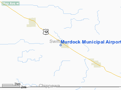
Murdock Municipal Airport |
Location & QuickFacts
| FAA Information Effective: | 2008-09-25 |
| Airport Identifier: | 23Y |
| Airport Status: | Operational |
| Longitude/Latitude: | 095-24-04.0890W/45-13-19.8570N
-95.401136/45.222182 (Estimated) |
| Elevation: | 1082 ft / 329.79 m (Estimated) |
| Land: | 61 acres |
| From nearest city: | 0 nautical miles S of Murdock, MN |
| Location: | Swift County, MN |
| Magnetic Variation: | 05E (1985) |
Owner & Manager
| Ownership: | Publicly owned |
| Owner: | City Of Murdock |
| Address: | 300 Frederick St., P.o. Box 130
Murdock, MN 56271 |
| Phone number: | 320-875-2112 |
| Manager: | Harlyn Saulsbury |
| Address: | 300 Frederick St, P.o. Box 130
Murdock, MN 56271 |
| Phone number: | 320-875-4841 |
Airport Operations and Facilities
| Airport Use: | Open to public |
| Wind indicator: | Yes |
| Segmented Circle: | No |
| Control Tower: | No |
| Landing fee charge: | No |
| Sectional chart: | Twin Cities |
| Region: | AGL - Great Lakes |
| Boundary ARTCC: | ZMP - Minneapolis |
| Tie-in FSS: | PNM - Princeton |
| FSS on Airport: | No |
| FSS Toll Free: | 1-800-WX-BRIEF |
| NOTAMs Facility: | PNM (NOTAM-d service avaliable) |
Airport Communications
Airport Services
| Airframe Repair: | NONE |
| Power Plant Repair: | NONE |
| Bottled Oxygen: | NONE |
| Bulk Oxygen: | NONE |
Runway Information
Runway 12/30
| Dimension: | 3415 x 150 ft / 1040.9 x 45.7 m |
| Surface: | TURF, Good Condition |
| |
Runway 12 |
Runway 30 |
| Longitude: | 095-24-24.9800W | 095-23-42.1900W |
| Latitude: | 45-13-27.8200N | 45-13-12.8900N |
| Elevation: | 1080.00 ft | 1080.00 ft |
| Traffic Pattern: | Left | Left |
| Obstruction: | 15 ft road, 350.0 ft from runway, 125 ft left of centerline, 23:1 slope to clear | 15 ft road, 500.0 ft from runway, 125 ft left of centerline, 33:1 slope to clear |
|
Radio Navigation Aids
| ID |
Type |
Name |
Ch |
Freq |
Var |
Dist |
| BBB | NDB | Benson | | 239.00 | 05E | 12.3 nm |
| GHW | NDB | Glenwood | | 346.00 | 03E | 25.6 nm |
| AQP | NDB | Appleton | | 356.00 | 05E | 25.8 nm |
| EE | NDB | Tamie | | 374.00 | 04E | 34.5 nm |
| DXX | NDB | Dawson/madison | | 341.00 | 06E | 36.0 nm |
| VVV | NDB | Ortonville | | 332.00 | 05E | 43.4 nm |
| HCD | NDB | Hutchinson | | 209.00 | 04E | 48.5 nm |
| BDH | VOR/DME | Willmar | 84X | 113.70 | 04E | 13.2 nm |
| ILL | VOR/DME | Willmar | 084X | 113.70 | 04E | 14.6 nm |
| MVE | VOR/DME | Montevideo | 053X | 111.60 | 05E | 20.0 nm |
| MOX | VOR/DME | Morris | 033X | 109.60 | 05E | 31.6 nm |
| AXN | VOR/DME | Alexandria | 075X | 112.80 | 07E | 44.8 nm |
| RWF | VOR/DME | Redwood Falls | 080X | 113.30 | 07E | 46.8 nm |
| MML | VOR/DME | Marshall | 047X | 111.00 | 05E | 49.9 nm |
| DWN | VORTAC | Darwin | 027X | 109.00 | 07E | 41.0 nm |
Remarks
Images and information placed above are from
http://www.airport-data.com/airport/23Y/
We thank them for the data!
| General Info
|
| Country |
United States
|
| State |
MINNESOTA
|
| FAA ID |
23Y
|
| Latitude |
45-13-19.857N
|
| Longitude |
095-24-04.089W
|
| Elevation |
1082 feet
|
| Near City |
MURDOCK
|
We don't guarantee the information is fresh and accurate. The data may
be wrong or outdated.
For more up-to-date information please refer to other sources.
|
|


