 |
|
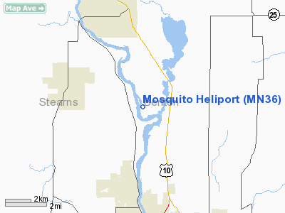
Location & QuickFacts
| FAA Information Effective: | 2008-09-25 |
| Airport Identifier: | MN36 |
| Airport Status: | Operational |
| Longitude/Latitude: | 094-11-59.9700W/45-41-10.2700N
-94.199992/45.686186 (Estimated) |
| Elevation: | 1000 ft / 304.80 m (Estimated) |
| Land: | 2000 acres |
| From nearest city: | 5 nautical miles N of Rice, MN |
| Location: | Benton County, MN |
| Magnetic Variation: | 03E () |
Owner & Manager
| Ownership: | Privately owned |
| Owner: | Wayne A. Brutger |
| Address: | 7975 Ne River Dr
Rice, MN 56367 |
| Phone number: | 320-393-4293 |
| Manager: | Wayne A. Brutger |
| Address: | 7975 Ne River Dr
Rice, MN 56367 |
| Phone number: | 320-393-4293 |
Airport Operations and Facilities
| Airport Use: | Private |
| Wind indicator: | Yes |
| Segmented Circle: | No |
| Control Tower: | No |
| Sectional chart: | Twin Cities |
| Region: | AGL - Great Lakes |
| Boundary ARTCC: | ZMP - Minneapolis |
| Tie-in FSS: | PNM - Princeton |
| FSS Toll Free: | 1-800-WX-BRIEF |
Runway Information
Helipad H1
| Dimension: | 400 x 1000 ft / 121.9 x 304.8 m |
| Surface: | TURF, |
| |
Runway H1 |
Runway |
| Traffic Pattern: | Left | Left |
|
Radio Navigation Aids
| ID |
Type |
Name |
Ch |
Freq |
Var |
Dist |
| LXL | NDB | Little Falls | | 359.00 | 03E | 16.9 nm |
| XCR | NDB | Ripley | | 404.00 | 03E | 24.3 nm |
| PNM | NDB | Princeton | | 368.00 | 03E | 26.0 nm |
| CBG | NDB | Cambridge | | 350.00 | 03E | 40.2 nm |
| JMR | NDB | Mora | | 327.00 | 03E | 40.9 nm |
| EE | NDB | Tamie | | 374.00 | 04E | 46.8 nm |
| GHW | NDB | Glenwood | | 346.00 | 03E | 47.1 nm |
| SAZ | NDB | Staples | | 257.00 | 04E | 48.9 nm |
| RYM | TACAN | Camp Ripley | 048X | | 03E | 25.2 nm |
| STC | VOR/DME | St Cloud | 058X | 112.10 | 03E | 10.2 nm |
| AXN | VOR/DME | Alexandria | 075X | 112.80 | 07E | 46.2 nm |
| DWN | VORTAC | Darwin | 027X | 109.00 | 07E | 37.5 nm |
| BRD | VORTAC | Brainerd | 116X | 116.90 | 03E | 40.5 nm |
| GEP | VORTAC | Gopher | 120X | 117.30 | 06E | 47.7 nm |
Remarks
- POWERLINES & TREES ALL QUADRANTS.
- PRVDD ALL APCH DEP ROUTES ARE FM 076-230, AREA IS MKD, WIND INDICATOR IS MAINTAINED AND COMPLY WITH FAR PART 91.126(B)(2).
Images and information placed above are from
http://www.airport-data.com/airport/MN36/
We thank them for the data!
| General Info
|
| Country |
United States
|
| State |
MINNESOTA
|
| FAA ID |
MN36
|
| Latitude |
45-41-10.270N
|
| Longitude |
094-11-59.970W
|
| Elevation |
1000 feet
|
| Near City |
RICE
|
We don't guarantee the information is fresh and accurate. The data may
be wrong or outdated.
For more up-to-date information please refer to other sources.
|
|


