 |
|
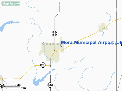
Location & QuickFacts
| FAA Information Effective: | 2008-09-25 |
| Airport Identifier: | JMR |
| Airport Status: | Operational |
| Longitude/Latitude: | 093-16-18.5000W/45-53-09.8000N
-93.271806/45.886056 (Estimated) |
| Elevation: | 1012 ft / 308.46 m (Surveyed) |
| Land: | 308 acres |
| From nearest city: | 1 nautical miles NE of Mora, MN |
| Location: | Kanabec County, MN |
| Magnetic Variation: | 03E (1985) |
Owner & Manager
| Ownership: | Publicly owned |
| Owner: | City Of Mora |
| Address: | 101 Lake Street South
Mora, MN 55051 |
| Phone number: | 320-679-1511 |
| Manager: | Joel Dhein |
| Address: | 101 Lake Street South
Mora, MN 55051 |
| Phone number: | 320-679-1511 |
Airport Operations and Facilities
| Airport Use: | Open to public |
| Wind indicator: | Yes |
| Segmented Circle: | No |
| Control Tower: | No |
| Lighting Schedule: | DUSK-DAWN
ACTVT MIRL RY 17/35, REIL RYS 17 & 35, & PAPI RYS 17 & 35 - CTAF. |
| Beacon Color: | Clear-Green (lighted land airport) |
| Landing fee charge: | No |
| Sectional chart: | Twin Cities |
| Region: | AGL - Great Lakes |
| Boundary ARTCC: | ZMP - Minneapolis |
| Tie-in FSS: | PNM - Princeton |
| FSS on Airport: | No |
| FSS Toll Free: | 1-800-WX-BRIEF |
| NOTAMs Facility: | JMR (NOTAM-d service avaliable) |
| Federal Agreements: | NGY |
Airport Communications
Airport Services
| Fuel available: | 100LLA
FUEL AVBL 24 HRS WITH CREDIT CARD. |
Runway Information
Runway 11/29
| Dimension: | 2506 x 200 ft / 763.8 x 61.0 m |
| Surface: | TURF, Good Condition |
| |
Runway 11 |
Runway 29 |
| Longitude: | 093-16-38.8543W | 093-16-07.9087W |
| Latitude: | 45-53-03.9915N | 45-52-51.9551N |
| Elevation: | 1010.00 ft | 1007.00 ft |
| Alignment: | 119 | 127 |
| Traffic Pattern: | Left | Left |
| Obstruction: | 41 ft trees, 600.0 ft from runway, 50 ft right of centerline, 14:1 slope to clear | 40 ft trees, 660.0 ft from runway, 100 ft left of centerline, 16:1 slope to clear |
|
Runway 17/35
| Dimension: | 3998 x 75 ft / 1218.6 x 22.9 m |
| Surface: | ASPH, Good Condition |
| Edge Lights: | Medium |
| |
Runway 17 |
Runway 35 |
| Longitude: | 093-16-19.5041W | 093-16-11.3653W |
| Latitude: | 45-53-36.7650N | 45-52-57.7125N |
| Elevation: | 1000.00 ft | 1009.00 ft |
| Alignment: | 127 | 127 |
| Traffic Pattern: | Left | Left |
| Markings: | Non-precision instrument, Good Condition | Non-precision instrument, Good Condition |
| Crossing Height: | 41.00 ft | 40.00 ft |
| VASI: | 4-light PAPI on left side | 4-light PAPI on left side |
| Visual Glide Angle: | 3.00° | 3.00° |
| Runway End Identifier: | Yes | Yes |
| Obstruction: | 80 ft trees, 1350.0 ft from runway, 250 ft right of centerline, 14:1 slope to clear | , 31:1 slope to clear |
|
Radio Navigation Aids
| ID |
Type |
Name |
Ch |
Freq |
Var |
Dist |
| JMR | NDB | Mora | | 327.00 | 03E | 0.3 nm |
| ROS | NDB | Rush City | | 282.00 | 02E | 17.5 nm |
| CBG | NDB | Cambridge | | 350.00 | 03E | 19.8 nm |
| PNM | NDB | Princeton | | 368.00 | 03E | 23.9 nm |
| MZH | NDB | Moose Lake | | 362.00 | 02E | 37.3 nm |
| BXR | NDB | Big Doctor | | 203.00 | 02E | 38.1 nm |
| OEO | NDB | Osceola | | 233.00 | 01E | 42.4 nm |
| AIT | NDB | Aitkin | | 397.00 | 03E | 43.2 nm |
| LXL | NDB | Little Falls | | 359.00 | 03E | 44.9 nm |
| XCR | NDB | Ripley | | 404.00 | 03E | 46.2 nm |
| RYM | TACAN | Camp Ripley | 048X | | 03E | 46.9 nm |
| RZN | VOR/DME | Siren | 031X | 109.40 | 02E | 37.8 nm |
| STC | VOR/DME | St Cloud | 058X | 112.10 | 03E | 38.7 nm |
| BRD | VORTAC | Brainerd | 116X | 116.90 | 03E | 41.9 nm |
| GEP | VORTAC | Gopher | 120X | 117.30 | 06E | 44.7 nm |
Remarks
- WATERFOWL INVOF ARPT.
- ULTRALIGHTS ON & INVOF ARPT.
Images and information placed above are from
http://www.airport-data.com/airport/JMR/
We thank them for the data!
| General Info
|
| Country |
United States
|
| State |
MINNESOTA
|
| FAA ID |
JMR
|
| Latitude |
45-53-09.950N
|
| Longitude |
093-16-18.402W
|
| Elevation |
1012 feet
|
| Near City |
MORA
|
We don't guarantee the information is fresh and accurate. The data may
be wrong or outdated.
For more up-to-date information please refer to other sources.
|
|


