 |
|
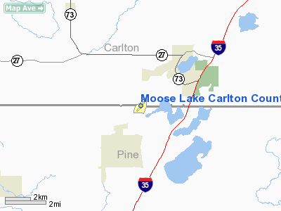
Moose Lake Carlton County Airport |
Location & QuickFacts
| FAA Information Effective: | 2008-09-25 |
| Airport Identifier: | MZH |
| Airport Status: | Operational |
| Longitude/Latitude: | 092-48-17.2000W/46-25-07.0000N
-92.804778/46.418611 (Estimated) |
| Elevation: | 1076 ft / 327.96 m (Surveyed) |
| Land: | 264 acres |
| From nearest city: | 3 nautical miles SW of Moose Lake, MN |
| Location: | Carlton County, MN |
| Magnetic Variation: | 02E (1995) |
Owner & Manager
| Ownership: | Publicly owned |
| Owner: | Carlton County |
| Address: | 1215 Ave C
Cloquet, MN 55720 |
| Phone number: | 218-879-4583 |
| Manager: | Darwin Chester |
| Address: | 4026 County Rd 138
Barnum, MN 55707 |
| Phone number: | 218-389-6005 |
Airport Operations and Facilities
| Airport Use: | Open to public |
| Wind indicator: | Yes |
| Segmented Circle: | No |
| Control Tower: | No |
| Lighting Schedule: | DUSK-DAWN
MIRL RY 04/22 PRESET TO LOW INTST, INCR INTST & ACTVT REIL RYS 04 & 22 - CTAF. |
| Beacon Color: | Clear-Green (lighted land airport) |
| Landing fee charge: | No |
| Sectional chart: | Green Bay |
| Region: | AGL - Great Lakes |
| Boundary ARTCC: | ZMP - Minneapolis |
| Tie-in FSS: | PNM - Princeton |
| FSS on Airport: | No |
| FSS Toll Free: | 1-800-WX-BRIEF |
| NOTAMs Facility: | MZH (NOTAM-d service avaliable) |
| Federal Agreements: | 1 |
Airport Communications
Airport Services
| Fuel available: | 100LL
SELF SERVICE FUEL AVBL 24 HRS; WITH CREDIT CARD. |
Runway Information
Runway 04/22
| Dimension: | 3200 x 75 ft / 975.4 x 22.9 m |
| Surface: | ASPH, Good Condition |
| Edge Lights: | Medium |
| |
Runway 04 |
Runway 22 |
| Longitude: | 092-48-32.0067W | 092-48-02.4145W |
| Latitude: | 46-24-54.9259N | 46-25-18.9847N |
| Elevation: | 1074.00 ft | 1071.00 ft |
| Alignment: | 40 | 127 |
| Traffic Pattern: | Left | Left |
| Markings: | Non-precision instrument, Good Condition | Non-precision instrument, Good Condition |
| Runway End Identifier: | Yes | Yes |
| Obstruction: | 29 ft trees, 525.0 ft from runway, 225 ft right of centerline, 11:1 slope to clear | 46 ft tree, 960.0 ft from runway, 120 ft left of centerline, 16:1 slope to clear |
|
Radio Navigation Aids
| ID |
Type |
Name |
Ch |
Freq |
Var |
Dist |
| MZH | NDB | Moose Lake | | 362.00 | 02E | 0.1 nm |
| COQ | NDB | Cloquet | | 335.00 | 03E | 20.9 nm |
| DL | NDB | Pykla | | 379.00 | 02E | 31.7 nm |
| SUW | NDB | Bong | | 260.00 | 01E | 33.3 nm |
| AIT | NDB | Aitkin | | 397.00 | 03E | 36.9 nm |
| JMR | NDB | Mora | | 327.00 | 03E | 37.2 nm |
| BXR | NDB | Big Doctor | | 203.00 | 02E | 40.3 nm |
| OLG | NDB | Solon Springs | | 388.00 | 01E | 41.5 nm |
| ROS | NDB | Rush City | | 282.00 | 02E | 43.8 nm |
| LKI | TACAN | Lakeside | 011X | | 05E | 36.2 nm |
| RZN | VOR/DME | Siren | 031X | 109.40 | 02E | 40.2 nm |
| DLH | VORTAC | Duluth | 073X | 112.60 | 05E | 33.9 nm |
Remarks
- ULTRALIGHTS ON & INVOF ARPT.
- PARALLEL GRASS TAXIWAY IN POOR CONDITION.
- PRVD THRS ARE LCTD TO PRV A MIN 20:1 CLNC OVER OBSTNS.
Images and information placed above are from
http://www.airport-data.com/airport/MZH/
We thank them for the data!
| General Info
|
| Country |
United States
|
| State |
MINNESOTA
|
| FAA ID |
MZH
|
| Latitude |
46-25-07.500N
|
| Longitude |
092-48-16.800W
|
| Elevation |
1076 feet
|
| Near City |
MOOSE LAKE
|
We don't guarantee the information is fresh and accurate. The data may
be wrong or outdated.
For more up-to-date information please refer to other sources.
|
|


