|
|
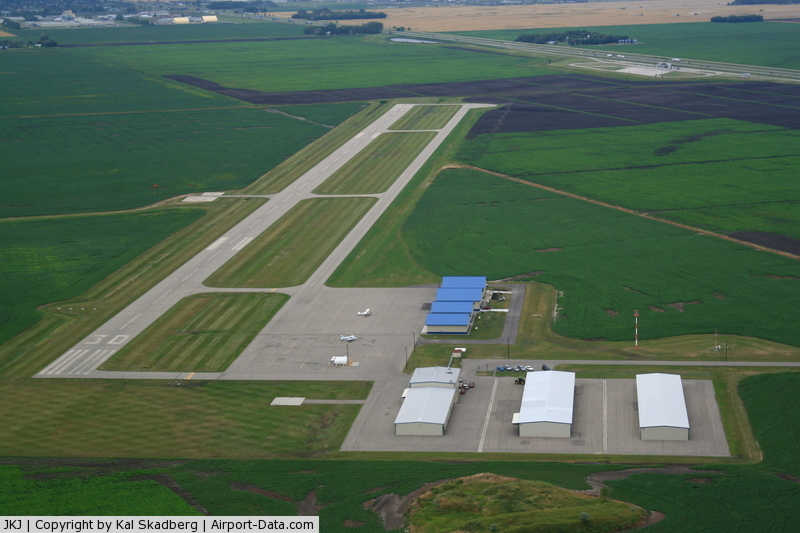
Moorhead Municipal Airport |
|
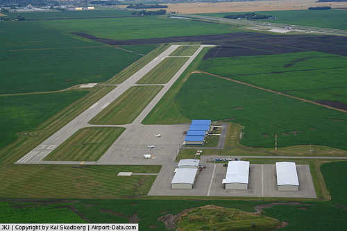 |
(Click on the photo to enlarge) |
Location & QuickFacts
| FAA Information Effective: | 2008-09-25 |
| Airport Identifier: | JKJ |
| Airport Status: | Operational |
| Longitude/Latitude: | 096-39-49.4800W/46-50-21.3760N
-96.663744/46.839271 (Estimated) |
| Elevation: | 917 ft / 279.50 m (Surveyed) |
| Land: | 180 acres |
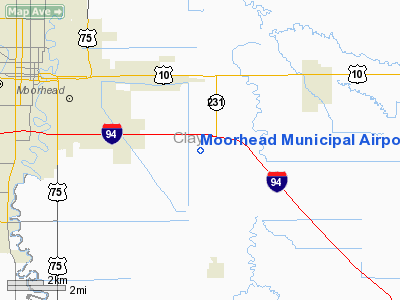
| From nearest city: | 4 nautical miles SE of Moorhead, MN |
| Location: | Clay County, MN |
| Magnetic Variation: | 05E (2000) |
Owner & Manager
| Ownership: | Publicly owned |
| Owner: | City Of Moorhead |
| Address: | 500 Center Ave Box 779
Moorhead, MN 56561-0779 |
| Phone number: | 218-299-5441 |
| Manager: | Kal Skadberg |
| Address: | Moorhead Municipal Arpt, 3309 70th Street South
Glyndon, MN 56547 |
| Phone number: | 218-287-1400 |
Airport Operations and Facilities
| Airport Use: | Open to public |
| Wind indicator: | Yes |
| Segmented Circle: | No |
| Control Tower: | No |
| Lighting Schedule: | DUSK-DAWN
ACTVT MIRL RY 12/30, REIL RY 12 & 30, PAPI RY 12 & 30 - CTAF. |
| Beacon Color: | Clear-Green (lighted land airport) |
| Sectional chart: | Twin Cities |
| Region: | AGL - Great Lakes |
| Traffic Pattern Alt: | 800 ft |
| Boundary ARTCC: | ZMP - Minneapolis |
| Tie-in FSS: | PNM - Princeton |
| FSS Toll Free: | 1-800-WX-BRIEF |
| NOTAMs Facility: | JKJ (NOTAM-d service avaliable) |
| Federal Agreements: | N |
Airport Communications
| CTAF: | 123.000 |
| Unicom: | 123.000 |
Airport Services
| Fuel available: | 100LLA
SELF SERVICE FUEL AVBL 24 HRS WITH CREDIT CARD. |
| Airframe Repair: | MAJOR |
| Power Plant Repair: | MAJOR |
Runway Information
Runway 12/30
| Dimension: | 4300 x 75 ft / 1310.6 x 22.9 m |
| Surface: | ASPH, Good Condition |
| Edge Lights: | Medium
RY 30 LAST 2000 FT RY LIGHTS WHITE NOT AMBER. |
| |
Runway 12 |
Runway 30 |
| Longitude: | 096-40-17.1810W | 096-39-21.7800W |
| Latitude: | 46-50-30.8120N | 46-50-11.9400N |
| Elevation: | 914.00 ft | 917.00 ft |
| Alignment: | 116 | 127 |
| Traffic Pattern: | Left | Left |
| Markings: | Non-precision instrument, Good Condition | Non-precision instrument, Good Condition |
| VASI: | 4-light PAPI on left side | 4-light PAPI on left side |
| Runway End Identifier: | Yes | Yes |
| Obstruction: | , 50:1 slope to clear
TREES +6, 140 FM END, 100R. | 19 ft road, 994.0 ft from runway, 369 ft right of centerline, 41:1 slope to clear |
|
Radio Navigation Aids
| ID |
Type |
Name |
Ch |
Freq |
Var |
Dist |
| AA | NDB | Kenie | | 365.00 | 06E | 12.0 nm |
| BWP | NDB | Breckenridge-wahpeton | | 233.00 | 05E | 35.8 nm |
| DTL | VOR/DME | Detroit Lakes | 049X | 111.20 | 05E | 31.9 nm |
| FFM | VOR/DME | Fergus Falls | 041X | 110.40 | 05E | 39.1 nm |
| FAR | VORTAC | Fargo | 109X | 116.20 | 09E | 9.3 nm |
Remarks
- ARPT UNDERLIES FARGO TRSA; HECTOR INTL CLASS D AIRSPACE 3 MILES NW OF ARPT.
- NOISE ABATEMENT PROCEDURES IN EFFECT; CTC AMGR (218) 287-1400.
- FOUR PRIVATE ARPTS WILL CLOSE; OWNER WILL COORDINATE WITH FARGO ATCT; FUTURE ALP REVISIONS WILL BE COORDINATED WITH FARGO ATM; ALL TFC PATTERNS WILL NOT CONFLICT WITH HECTOR INTL ARPT.
Images and information placed above are from
http://www.airport-data.com/airport/JKJ/
We thank them for the data!
| General Info
|
| Country |
United States
|
| State |
MINNESOTA
|
| FAA ID |
JKJ
|
| Latitude |
46-50-21.091N
|
| Longitude |
096-39-47.269W
|
| Elevation |
917 feet
|
| Near City |
MOORHEAD
|
We don't guarantee the information is fresh and accurate. The data may
be wrong or outdated.
For more up-to-date information please refer to other sources.
|
|