 |
|
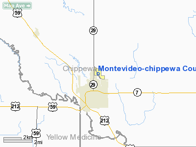
Montevideo - Chippewa County Airport |
Location & QuickFacts
| FAA Information Effective: | 2008-09-25 |
| Airport Identifier: | MVE |
| Airport Status: | Operational |
| Longitude/Latitude: | 095-42-36.9000W/44-58-08.6000N
-95.710250/44.969056 (Estimated) |
| Elevation: | 1034 ft / 315.16 m (Surveyed) |
| Land: | 374 acres |
| From nearest city: | 2 nautical miles N of Montevideo, MN |
| Location: | Chippewa County, MN |
| Magnetic Variation: | 05E (1995) |
Owner & Manager
| Ownership: | Publicly owned |
| Owner: | City Of Montevideo
AND CHIPPEWA COUNTY. |
| Address: | 103 Canton Ave; Po Box 676
Montevideo, MN 56265 |
| Phone number: | 320-269-6575 |
| Manager: | Hdon Ruether |
| Address: | 611 South 10th St.
Montevideo, MN 56265 |
| Phone number: | 320-269-4829 |
Airport Operations and Facilities
| Airport Use: | Open to public |
| Wind indicator: | Yes |
| Segmented Circle: | No |
| Control Tower: | No |
| Lighting Schedule: | DUSK-DAWN
ACTVT MIRL RY 14/32; REIL & VASI RY 14; REIL & VASI RY 32 - CTAF. |
| Beacon Color: | Clear-Green (lighted land airport) |
| Landing fee charge: | No |
| Sectional chart: | Twin Cities |
| Region: | AGL - Great Lakes |
| Boundary ARTCC: | ZMP - Minneapolis |
| Tie-in FSS: | PNM - Princeton |
| FSS on Airport: | No |
| FSS Toll Free: | 1-800-WX-BRIEF |
| NOTAMs Facility: | MVE (NOTAM-d service avaliable) |
| Federal Agreements: | NY1 |
Airport Communications
| CTAF: | 122.800 |
| Unicom: | 122.800 |
Airport Services
| Fuel available: | 100LL |
| Airframe Repair: | NONE |
| Power Plant Repair: | NONE |
| Bottled Oxygen: | NONE |
| Bulk Oxygen: | NONE |
Runway Information
Runway 03/21
| Dimension: | 2330 x 165 ft / 710.2 x 50.3 m |
| Surface: | TURF, Fair Condition
BADGER & GOPHER HOLES. |
| |
Runway 03 |
Runway 21 |
| Longitude: | 095-42-50.4700W | 095-42-29.0930W |
| Latitude: | 44-58-04.1500N | 44-58-22.3450N |
| Elevation: | 1031.00 ft | 1020.00 ft |
| Alignment: | 40 | 127 |
| Traffic Pattern: | Left | Left |
| Obstruction: | 32 ft tree, 400.0 ft from runway, 155 ft right of centerline, 12:1 slope to clear
RY 3: ADDL TREES +90, 1380 FM RY END, 120R, 15:1. | 19 ft gnd, 750.0 ft from runway, 39:1 slope to clear |
|
Runway 14/32
| Dimension: | 4000 x 75 ft / 1219.2 x 22.9 m |
| Surface: | ASPH, Good Condition
BADGER & GOPHER HOLES. |
| Weight Limit: | Single wheel: 14000 lbs.
Dual wheel: 18000 lbs. |
| Edge Lights: | Medium |
| |
Runway 14 |
Runway 32 |
| Longitude: | 095-42-51.9480W | 095-42-18.2790W |
| Latitude: | 44-58-21.5160N | 44-57-50.1030N |
| Elevation: | 1034.00 ft | 1019.00 ft |
| Alignment: | 127 | 127 |
| Traffic Pattern: | Left | Left |
| Markings: | Non-precision instrument, Good Condition | Non-precision instrument, Good Condition |
| VASI: | 4-light PAPI on left side | 4-light PAPI on left side |
| Runway End Identifier: | Yes
NON FRANGIBLE CAGES AROUND REILS. | Yes
NON FRANGIBLE CAGES AROUND REILS. |
| Obstruction: | 11 ft road, 440.0 ft from runway, 280 ft right of centerline, 21:1 slope to clear | 5 ft tree, 201.0 ft from runway, 180 ft right of centerline
CROPS +5, 0-200 FORM RY END, 180R. |
|
Radio Navigation Aids
| ID |
Type |
Name |
Ch |
Freq |
Var |
Dist |
| DXX | NDB | Dawson/madison | | 341.00 | 06E | 20.0 nm |
| AQP | NDB | Appleton | | 356.00 | 05E | 20.1 nm |
| BBB | NDB | Benson | | 239.00 | 05E | 21.7 nm |
| VVV | NDB | Ortonville | | 332.00 | 05E | 36.2 nm |
| GHW | NDB | Glenwood | | 346.00 | 03E | 43.8 nm |
| MVE | VOR/DME | Montevideo | 053X | 111.60 | 05E | 0.2 nm |
| BDH | VOR/DME | Willmar | 84X | 113.70 | 04E | 26.3 nm |
| ILL | VOR/DME | Willmar | 084X | 113.70 | 04E | 27.8 nm |
| MML | VOR/DME | Marshall | 047X | 111.00 | 05E | 31.7 nm |
| MOX | VOR/DME | Morris | 033X | 109.60 | 05E | 37.5 nm |
| RWF | VOR/DME | Redwood Falls | 080X | 113.30 | 07E | 39.1 nm |
Remarks
- RWY 03/21 NOT PLOWED WINTER MONTHS.
- ULTRALIGHTS ON AND INVOF ARPT.
- PENDING.
Images and information placed above are from
http://www.airport-data.com/airport/MVE/
We thank them for the data!
| General Info
|
| Country |
United States
|
| State |
MINNESOTA
|
| FAA ID |
MVE
|
| Latitude |
44-58-08.600N
|
| Longitude |
095-42-36.900W
|
| Elevation |
1034 feet
|
| Near City |
MONTEVIDEO
|
We don't guarantee the information is fresh and accurate. The data may
be wrong or outdated.
For more up-to-date information please refer to other sources.
|
|


