|
|
Minneapolis - st Paul Intl / Wold-chamberlain Airport |
| Minneapolis-Saint Paul International Airport |
 |
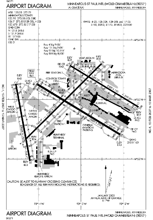 |
| FAA Airport Diagram |
| IATA: MSP – ICAO: KMSP – FAA LID: MSP
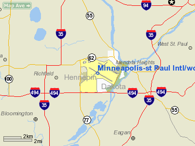
Location of the Minneapolis-Saint Paul International Airport
|
| Summary |
| Airport type |
Public |
| Owner |
MAC |
| Serves |
Minneapolis and St. Paul, Minnesota (Twin Cities) |
| Location |
Hennepin County, Minnesota, USA |
| Hub for |
- Bemidji Airlines
- Delta Air Lines
- Sun Country Airlines
|
| Elevation AMSL |
841 ft / 256 m |
| Coordinates |
44°52′55″N 093°13′18″W / 44.88194°N 93.22167°W / 44.88194; -93.22167 |
| Website |
www.mspairport.com |
| Runways |
| Direction |
Length |
Surface |
| ft |
m |
| 4/22 |
11,006 |
3,355 |
Concrete |
| 12R/30L |
10,000 |
3,048 |
Asphalt/Concrete |
| 12L/30R |
8,200 |
2,499 |
Concrete |
| 17/35 |
8,000 |
2,438 |
Concrete |
| Statistics (2008) |
| Passengers |
34,056,443 |
| Traffic Movements |
450,044 |
| Source: Passenger & traffic statistics from MSP airport.; Runways from FAA |
Minneapolis-Saint Paul International Airport (IATA: MSP, ICAO: KMSP, FAA LID: MSP) is the largest and busiest airport in the five-state upper Midwest region of Minnesota, Iowa, South Dakota, North Dakota, and Wisconsin.
In terms of passengers, Minneapolis-Saint Paul International Airport is the sixteenth busiest airport in the United States (2008), and thirtieth busiest airport in the world in 2008. A joint civil-military airport, MSP is also home to the Minneapolis-Saint Paul Joint Air Reserve Station, supporting both Air Force Reserve Command and Air National Guard flight operations. Airlines out of Minneapolis/St. Paul International airport serve 134 nonstop markets from MSP, including 120 domestic and 14 international markets. Compared to other metropolitan areas in the United States, only Denver serves more non-stop markets per capita.
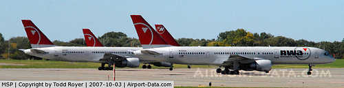
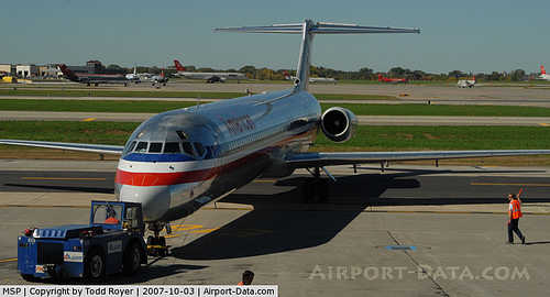
The airport, including both passenger terminal buildings, is mostly located in the Census-designated place of Fort Snelling in an unincorporated part of Hennepin County. Small sections of the airport are within the city limits of Minneapolis. The airport is across the Mississippi River from St. Paul. The terminal exits of the airport are minutes away from the Mall of America; careful flight pattern planning ensures that aircraft never fly over the mall at low altitude. It is the third largest hub airport for Delta Air Lines and Delta Connection partners Compass Airlines, Mesaba Airlines, and Pinnacle Airlines (with Compass and Mesaba having headquarters nearby). It also serves as the hub for Sun Country Airlines. Delta Air Lines accounts for more than 80% of the airport's passenger traffic. It is operated by the Metropolitan Airports Commission, which also handles operation of six smaller airports in the region.
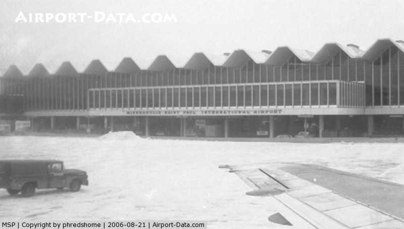
The airport first came into being when several local groups came together to take control of the former bankrupt Twin City Speedway race track, giving the airport its original name, Speedway Field. Soon after, in 1921, the airport was renamed Wold-Chamberlain Field for the World War I pilots Ernest Groves Wold and Cyrus Foss Chamberlain. In 1944, the site was renamed to Minneapolis-St. Paul Metropolitan Airport/Wold-Chamberlain Field, with "International" replacing "Metropolitan" four years later. The main Charles Lindbergh terminal building was built in 1962, and the current Hubert H. Humphrey Terminal was built in 2001. Today, it is very rare to see the Wold-Chamberlain portion of the name used anywhere. In 1938 Howard Hughes briefly stopped at Wold-Chamberlain Field on his round the world flight. DescriptionMinneapolis/Saint Paul International Airport has two terminals, both of which were named for famous Minnesotans: the Lindbergh Terminal (named after the aviator Charles Lindbergh) and the much smaller Humphrey Terminal (named for former US Vice President Hubert Humphrey). Lindbergh Terminal officially has seven concourses, lettered A-G, with the Humphrey terminal labeled as Concourse H. The Lindbergh Terminal is designated as Terminal 1-Lindbergh and the Humphrey Terminal is designated as Terminal 2-Humphrey. The old Humphrey Terminal, built in the late 70's, was rebuilt in 2001 to expand capacity and give passengers a more seamless experience.
Like many other airports, MSP interconnects with several other forms of transportation. Several large parking ramps are available for cars. Most other connections are made at the Hub Building and adjacent Transit Center, which has city and shuttle bus, taxi, light-rail, and rental car service. Two trams (people movers) are at the airport. One carries passengers from the main section of Lindbergh Terminal to the Hub Building, and another runs along the long Concourse C in that terminal.
The airport is near Fort Snelling, the site of one of the earliest European settlements in the area. Both the Mississippi and Minnesota rivers flow nearby. Minnesota State Highway 5 provides the closest entrance to the Lindbergh Terminal, just a short distance from Interstate 494. The Humphrey Terminal is accessed via the 34th Avenue exit from I-494, which runs past Fort Snelling National Cemetery. Delta Air Lines has hangars arranged along I-494 and 34th Avenue, so it's possible to see airliners undergoing maintenance while driving past.
The Hiawatha Line light-rail has stops at both the Hub Building (Lindbergh Station) and Humphrey Terminal (Humphrey Station). It connects the airport with downtown Minneapolis as well as with the Mall of America in nearby Bloomington, and operates as a shuttle service between the two airport terminals. Travelers can use the rail line to go between the two sites at all times; it is the only part of the line that operates continuously through the night (the rest shuts down for about four hours early in the morning). Passengers going between the two terminals may ride free of charge, but those riding beyond the airport grounds must pay a standard fare. Two parallel tunnels for the line run roughly 70 feet (20 meters) below the airport, and at 1.7 miles (2.7 km) in length are the longest tunnels on the route. The Lindbergh Terminal station is the only one underground on the line, as the rails return to the surface near Humphrey Terminal. Due to current concerns about terrorism, a great deal of effort went into ensuring that the tunnels are highly blast-resistant. The underground portion was the costliest section of the entire rail project.
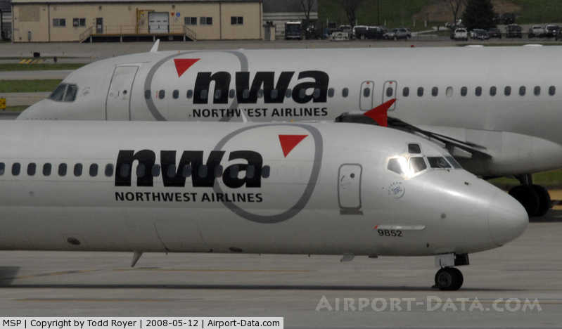
MSP had been the headquarters for two major airlines, Republic Airlines (formerly North Central Airlines) and Northwest Orient Airlines. In 1986, the two airlines merged under the Northwest Airlines name. Before it was acquired by Delta Air Lines in 2008 (with the merger completed at the end of 2009), Northwest Airlines had always had a large operation at the airport over the years. In the past, Northwest and others had proposed moving out of MSP airport and building a new airport on the fringes of the Twin Cities metro area to handle large jets and international traffic. Minneapolis and other neighboring cities were concerned that such a move would have a negative economic impact, so an arrangement was made where the Metropolitan Airports Commission would outfit many homes in the vicinity of the airport with sound insulation and air conditioning so that indoor noise could be reduced. A citizen group named ROAR (Residents Opposed to Airport Racket) was created in 1998 and helped push the MAC to make these concessions. Later, in 2004, the MAC voted to reduce funding for the soundproofing projects, stating in part that the economic climate had turned in the wake of the September 11, 2001 attacks. Minneapolis Mayor R.T. Rybak, who had been a founding member of ROAR, promised that the city would challenge the funding changes.
The 1970 disaster film Airport was partially filmed at MSP, filling in for a fictional Chicago airport. It was followed by several sequels and was a prototype for many disaster films that followed. The airport used colors as the method for naming different concourses for many years, a convention that was duplicated in the movie. Starting in 2000, MSP switched to lettered concourses, which has become standard practice at airports around the world. The color names still survive as the names for the Lindbergh Terminal parking ramp wings.
The Humphrey Terminal used to handle all international arrivals but is now used mostly for charter airlines and low cost carriers, including Sun Country, AirTran, and Southwest. Icelandair started service to Minneapolis/St. Paul from Reykjavik in 1998. Northwest operated flights from Minneapolis/St. Paul to Hong Kong and Osaka in 1998 using 747-400 aircraft, but were dropped in the same year. Northwest also operated Minneapolis/St. Paul to Oslo and Frankfurt service using DC-10 aircraft, but they too were dropped. In the late 1990s and early 2000s, KLM operated 747 and MD-11 service from Amsterdam to Minneapolis/St. Paul. In part because of the Northwest/KLM joint venture, KLM hasn't served Minneapolis/St. Paul with its own aircraft since 2003.
The airport has three airline lounges, all located in the Main Terminal: two Delta Air Lines Sky Clubs and one United Airlines Red Carpet Club.
MSP 2020 VisionIn 2004, Northwest Airlines proposed expanding the Lindbergh Terminal to accommodate growing flight operations in a plan known as the MSP 2020 Vision. The proposed expansion included moving all airlines other than Northwest and its SkyTeam alliance partners to the Humphrey Terminal. This caused increased concern about Northwest Airlines' control of the Minneapolis-St. Paul commercial air service market with some claiming that Northwest was using its market position to inflate airfares. While AirTran Airways voiced opposition to the plan, American Airlines and United Airlines remained neutral on the move since both had exclusive terminals at their own main hubs. Despite the merger between Northwest and Delta Air Lines, Delta still plans to carry out the expansions. In May 2005, the MAC approved the plan with the following conditions:
- The Humphrey Terminal will be expanded to 22 gates, over double its current size
- Another parking ramp will be constructed at the Humphrey Terminal
- Delta and other SkyTeam airlines will have exclusive rights to the entire Lindbergh Terminal
- Non-SkyTeam airlines will use the Humphrey Terminal
- Concourse C will be converted into a regional jet terminal
- A new Concourse H will be built on the site of the former NWA Building B
Due to the bankruptcies of both Northwest and Mesaba Airlines and various other reasons, much of the plan has yet to be implemented including the expansion of both terminals and the move of some of the non-SkyTeam airlines. However, AirTran and Icelandair have moved from the Lindbergh Terminal and the new parking structure at the Humphrey Terminal has been completed. Also, part of Concourse C has now been converted to handle mostly regional jets.
Airlines and destinations
Concourses A-G are located at the Lindbergh Terminal (Terminal 1), whilst Concourse H is the Humphrey Terminal (Terminal 2).
| Airlines |
Destinations |
Concourse |
| Air Canada Jazz |
Toronto-Pearson |
E |
| AirTran Airways |
Atlanta, Milwaukee
Seasonal: Orlando |
H |
| Alaska Airlines |
Seattle/Tacoma |
F |
| American Airlines |
Chicago-O'Hare, Dallas/Fort Worth, Miami |
E |
| American Eagle |
Chicago-O'Hare, New York-LaGuardia |
E |
| Continental Airlines |
Houston-Intercontinental |
E |
| Continental Express operated by Chautauqua Airlines |
Cleveland |
E |
| Continental Express operated by ExpressJet Airlines |
Cleveland, Houston-Intercontinental, Newark |
E |
| Delta Air Lines |
Albuquerque, Amsterdam, Anchorage, Atlanta, Austin, Baltimore, Bismarck, Boston, Calgary, Charlotte, Chicago-O'Hare, Dallas/Fort Worth, Denver, Detroit, Fargo, Fort Lauderdale, Fort Myers, Grand Rapids, Hartford, Honolulu, Indianapolis, Kansas City, Las Vegas, London-Heathrow, Los Angeles, Madison, Memphis, Miami, Milwaukee, New York-JFK, New York-LaGuardia, Newark, Omaha, Orange County, Orlando, Paris-Charles de Gaulle, Philadelphia, Phoenix, Portland (OR), Rapid City, Sacramento, St. Louis, Salt Lake City, San Antonio, San Diego, San Francisco, San Jose (CA), Seattle/Tacoma, Sioux Falls, Spokane, Tampa, Tokyo-Narita, Tucson, Vancouver, Washington-Reagan
Seasonal: Billings, Boise, Bozeman, Cancun, Cozumel, Fairbanks, Grand Cayman, Green Bay, Ixtapa/Zihuatanejo, Kalispell, Mazatlan, Montego Bay, Palm Springs, Puerto Vallarta, Punta Cana, Raleigh/Durham, San Jose del Cabo, San Juan, Traverse City
Future Routes: Mexico City [December 18] |
C, D, F, G |
| Delta Connection operated by Comair |
Bentonville (AR), Chicago-Midway, Chicago-O'Hare, Cincinnati/Northern Kentucky, Cleveland, Columbus (OH), Dallas/Fort Worth, Dayton, Des Moines, Jacksonville (FL), Louisville, Montreal-Trudeau, New York-JFK, Oklahoma City, Omaha, Pittsburgh, Sioux Falls, St. Louis, Toronto-Pearson, Winnipeg |
A, B, C |
| Delta Connection operated by Compass Airlines |
Baltimore, Billings, Charlotte, Chicago-Midway, Dallas/Fort Worth, Duluth, Grand Rapids, Great Falls, Jacksonville, Kalispell, Louisville, Madison, Minot, Missoula, New Orleans, New York-JFK, Newark, Norfolk, Pittsburgh, Raleigh/Durham, Richmond, St. Louis, San Antonio, Sioux Falls, Washington-Dulles, Washington-Reagan
Seasonal: Bozeman |
C, D, F, G |
| Delta Connection operated by Mesaba Airlines |
Aberdeen (SD), Albany, Appleton, Austin, Bemidji, Birmingham (AL), Bismarck, Boise, Brainerd, Buffalo, Cedar Rapids/Iowa City, Charlotte, Chicago-O'Hare, Chisholm-Hibbing, Cleveland, Colorado Springs, Columbus (OH), Dallas/Fort Worth, Des Moines, Detroit, Devil's Lake, Edmonton, Fort Dodge, Grand Forks, Grand Rapids, Hartford/Springfield, Helena, Houston-Intercontinental, International Falls, Iron Mountain, Jamestown, Kansas City, Knoxville, Lincoln, Louisville, Madison, Marquette, Mason City, Memphis, Moline/Quad Cities, Montréal-Trudeau, Nashville, Oklahoma City, Omaha, Pasco (WA), Peoria, Pierre, Pittsburgh, Providence, Raleigh/Durham, Rapid City, Regina, Rhinelander, Rochester (MN), Rochester (NY), St. Louis, Salt Lake City, Sioux City, Sioux Falls, Thief River Falls, Thunder Bay [ends October 10], Waterloo, Watertown (SD), Wausau
Seasonal: Springfield (MO) |
A, B, C |
| Delta Connection operated by Pinnacle Airlines |
Appleton, Bismarck, Bloomington/Normal, Cedar Rapids/Iowa City, Cleveland, Dayton, Des Moines, Duluth, Fayetteville (AR), Flint, Fort Wayne, Grand Forks, Grand Rapids, Green Bay, Indianapolis, Kalamazoo, La Crosse, Lansing, Lexington, Lincoln, Louisville, Madison, Oklahoma City, Omaha, Rhinelander, Saginaw, Sioux Falls, South Bend, Toronto-Pearson, Traverse City, Tulsa, Waterloo, Wichita, Winnipeg
Future Routes: Toledo [November 1] |
A, B, C |
| Delta Connection operated by Shuttle America |
Chicago O'Hare, Norfolk |
A, B, C |
| Delta Connection operated by SkyWest Airlines |
Bemidji, Bismarck, Calgary, Cedar Rapids, Cincinnati, Cleveland, Chicago O'Hare, Colorado Springs, Columbus (OH), Des Moines, Duluth, Edmonton, Fargo, Grand Rapids (MI), Green Bay, La Crosse, Minot, Nashville, Oklahoma City, Omaha, Pittsburgh, Rapid City, Regina, Rochester (MN), Saskatoon, Sioux Falls, Toronto-Pearson, Winnipeg, Vancouver, Wichita
Future Routes: Lexington [November 1] |
A, B, C |
| Frontier Airlines |
Denver |
E |
| Frontier Airlines operated by Chautauqua Airlines |
Milwaukee |
E |
| Frontier Airlines operated by Republic Airlines |
Milwaukee |
E |
| Icelandair |
Seasonal: Reykjavík-Keflavik |
H-6 |
| Southwest Airlines |
Chicago-Midway, Denver, Phoenix, St. Louis |
H |
| Sun Country Airlines |
Cancún, Dallas/Fort Worth, Las Vegas, Orlando, San Diego
Seasonal: Anchorage, Boston, Cozumel, Fort Myers, Harlingen, Ixtapa/Zihuantanejo, Laughlin/Bullhead City, London-Stansted, Los Angeles, Mazatlán, Miami, Montego Bay, New York-JFK, Palm Springs, Phoenix, Puerto Vallarta, Punta Cana, St. Maarten, St. Thomas, San Francisco, San José del Cabo, San Juan, Seattle/Tacoma, Tampa, Tucson, Washington-Dulles |
H |
| United Airlines |
Chicago-O'Hare, Denver, San Francisco |
E |
| United Express operated by Shuttle America |
Chicago-O'Hare, Denver |
E |
| US Airways |
Charlotte, Philadelphia, Phoenix |
C, E |
| US Airways Express operated by Republic Airlines |
Charlotte, Philadelphia |
E |
Cargo operations
| Airlines |
Destinations |
| ABX Air |
Chicago-O'Hare, Wilmington (OH), San Francisco |
| Ameriflight |
Winnipeg |
| Bemidji Airlines |
Alexandria (MN), Bemidji, Brainerd, Duluth, Eveleth, Fergus Falls, Grand Rapids, La Crosse, Marshall, Rice Lake, Thief River Falls, Winona |
| Capital Cargo International Airlines |
Calgary, Toledo |
| FedEx Express |
Chicago-O'Hare, Columbus-Rickenbacker, Duluth, Fort Worth, Grand Forks, Indianapolis, Memphis, Milwaukee, Oakland, Sioux Falls |
| UPS Airlines |
Louisville, Peoria, Philadelphia, Rockford, Winnipeg |
Military facilities
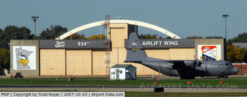
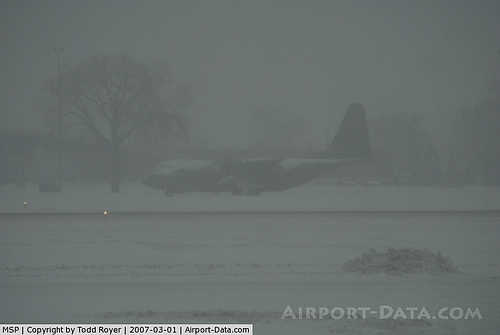
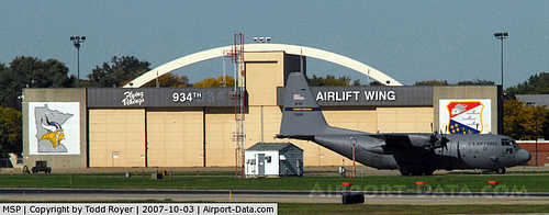
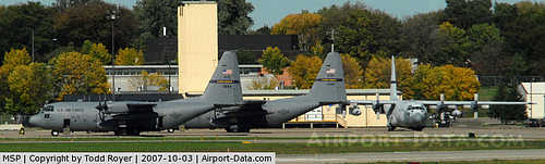
The Minneapolis-Saint Paul Air Reserve Station at MSP is home to the 934th Airlift Wing (934 AW), an Air Force Reserve Command (AFRC) unit, and the 133d Airlift Wing (133 AW) of the Minnesota Air National Guard. Both units fly the C-130 Hercules and are operationally-gained by the Air Mobility Command (AMC). The 934th consists of over 1,300 military personnel, of which approximately 250 are full-time Active Guard and Reserve (AGR) and Air Reserve Technician (ART) personnel. The 133rd is similarly manned, making for a total military presence of over 2,600 full-time and part-time personnel.
The 934 AW serves as the "host" wing for the installation, which also includes lodging/billeting, officers club, Base Exchange (BX) and other morale, welfare and recreation (MWR) facilities for active, reserve/national guard and retired military personnel and their families.
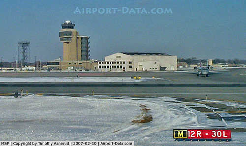
Runways
Minneapolis-Saint Paul International Airport has four runways:
- Runway 4/22: 11,006 x 150 ft. (3,354 x 46 m), Surface: Concrete
- Runway 12R/30L: 10,000 x 200 ft. (3,048 x 61 m), Surface: Asphalt/Concrete
- Runway 12L/30R: 8,200 x 150 ft. (2,499 x 46 m), Surface: Asphalt/Concrete
- Runway 17/35: 8,000 x 150 ft. (2,438 x 46 m), Surface: Concrete
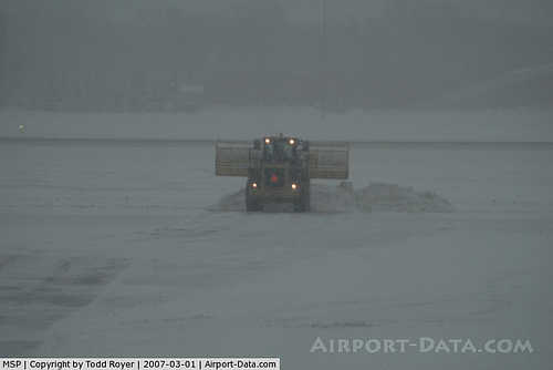
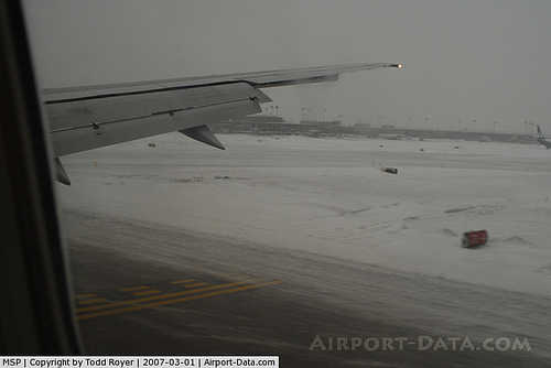
Runway 17/35 opened in October 2005. Prior to that time, a number of buildings (including several hangars and the City of Richfield's Rich Acres Golf Course) were demolished to make way for the runway protection zone of the new runway. Similarly, plans for expansion at Mall of America have been delayed by its construction. Aircraft approaching Runway 35 fly slightly east of the Mall of America, overfly Interstate 494, and land seconds later. Due to noise concerns from South Minneapolis, between 13 August 2007 and 18 October 2007, Runway 17/35 was used regularly during construction on Runway 12R/30L.
2007 bathroom incident
One bathroom at the airport has received notoriety following a June 11, 2007 sting operation in which Senator Larry Craig was caught soliciting sex. The incident eventually forced the Senator to retire.
The above content comes from Wikipedia and is published under free licenses – click here to read more.
|
 |
(Click on the photo to enlarge) |
|
 |
(Click on the photo to enlarge) |
|
 |
(Click on the photo to enlarge) |
|
 |
(Click on the photo to enlarge) |
|
 |
(Click on the photo to enlarge) |
|
 |
(Click on the photo to enlarge) |
|
 |
(Click on the photo to enlarge) |
|
 |
(Click on the photo to enlarge) |
|
 |
(Click on the photo to enlarge) |
|
 |
(Click on the photo to enlarge) |
|
 |
(Click on the photo to enlarge) |
|
 |
(Click on the photo to enlarge) |
|
 |
(Click on the photo to enlarge) |
|
 |
(Click on the photo to enlarge) |
|
 |
(Click on the photo to enlarge) |
|
 |
(Click on the photo to enlarge) |
Location & QuickFacts
| FAA Information Effective: | 2008-09-25 |
| Airport Identifier: | MSP |
| Airport Status: | Operational |
| Longitude/Latitude: | 093-13-18.3560W/44-52-55.0440N
-93.221766/44.881957 (Estimated) |
| Elevation: | 841 ft / 256.34 m (Surveyed) |
| Land: | 2930 acres |
| From nearest city: | 6 nautical miles SW of Minneapolis, MN |
| Location: | Hennepin County, MN |
| Magnetic Variation: | 02E (1995) |
Owner & Manager
| Ownership: | Publicly owned |
| Owner: | Metro Arpt Cmsn |
| Address: | 6040 28 Th Av So
Minneapolis, MN 55450 |
| Phone number: | 612-726-8100 |
| Manager: | Steve Wareham |
| Address: | 4300 Glumack Suite 3000
St Paul, MN 55111 |
| Phone number: | 612-725-6464 |
Airport Operations and Facilities
| Airport Use: | Open to public |
| Wind indicator: | Yes |
| Segmented Circle: | No |
| Control Tower: | Yes |
| Lighting Schedule: | DUSK-DAWN |
| Beacon Color: | Clear-Green (lighted land airport) |
| Landing fee charge: | Yes |
| Sectional chart: | Twin Cities |
| Region: | AGL - Great Lakes |
| Boundary ARTCC: | ZMP - Minneapolis |
| Tie-in FSS: | PNM - Princeton |
| FSS on Airport: | No |
| FSS Toll Free: | 1-800-WX-BRIEF |
| NOTAMs Facility: | MSP (NOTAM-d service avaliable) |
| Certification type/date: | I E S 05/1973 |
| Federal Agreements: | NGPRSY |
Airport Communications
Airport Services
| Fuel available: | 100LLA |
| Airframe Repair: | MAJOR |
| Power Plant Repair: | MAJOR |
| Bottled Oxygen: | HIGH |
| Bulk Oxygen: | HIGH |
Runway Information
Runway 04/22
| Dimension: | 11006 x 150 ft / 3354.6 x 45.7 m |
| Surface: | CONC, Good Condition |
| Surface Treatment: | Saw-cut or plastic Grooved |
| Weight Limit: | Single wheel: 100000 lbs.
Dual wheel: 200000 lbs.
Dual tandem wheel: 400000 lbs.
Dual dual tandem wheel: 850000 lbs. |
| Edge Lights: | High |
| |
Runway 04 |
Runway 22 |
| Longitude: | 093-14-17.9180W | 093-12-29.8260W |
| Latitude: | 44-52-20.1510N | 44-53-36.9810N |
| Elevation: | 833.00 ft | 830.00 ft |
| Alignment: | 45 | 127 |
| ILS Type: | ILS
| LOCALIZER
|
| Traffic Pattern: | Left | Left |
| Markings: | Precision instrument, Good Condition | Precision instrument, Good Condition |
| Crossing Height: | 75.00 ft | 42.00 ft |
| Displaced threshold: | 1550.00 ft | 988.00 ft |
| VASI: | 4-light PAPI on left side | 4-light PAPI on left side |
| Visual Glide Angle: | 3.00° | 3.00° |
| RVR Equipment: | touchdown, rollout | touchdown, rollout |
| Approach lights: | MALSR | MALSR |
| Runway End Identifier: | No | No |
| Centerline Lights: | No | No |
| Touchdown Lights: | No | No |
| Obstruction: | 101 ft tree, 2906.0 ft from runway, 834 ft left of centerline, 26:1 slope to clear
APCH RATIO 43:1 FM DSPLCD THLD, 102 FT TREE, 4456 FT FM DSPLCD THLD, 834 FT L OF CNTRLN. | 66 ft tree, 1350.0 ft from runway, 636 ft right of centerline, 17:1 slope to clear
APCH RATIO 34:1 FROM DSPLCD THR; 68 FT TREE 2337 FT FROM DSPLCD THLD.
4' FENCE 500'R OF CNTRLN. |
|
Runway 12L/30R
| Dimension: | 8200 x 150 ft / 2499.4 x 45.7 m |
| Surface: | ASPH-CONC, Fair Condition |
| Surface Treatment: | Saw-cut or plastic Grooved |
| Weight Limit: | Single wheel: 100000 lbs.
Dual wheel: 200000 lbs.
Dual tandem wheel: 400000 lbs.
Dual dual tandem wheel: 850000 lbs. |
| Edge Lights: | High |
| |
Runway 12L |
Runway 30R |
| Longitude: | 093-13-15.5450W | 093-11-38.2720W |
| Latitude: | 44-53-34.6210N | 44-52-52.5070N |
| Elevation: | 838.00 ft | 819.00 ft |
| Alignment: | 121 | 127 |
| ILS Type: | ILS/DME
| ILS/DME
|
| Traffic Pattern: | Left | Left |
| Markings: | Precision instrument, Good Condition | Precision instrument, Good Condition |
| Crossing Height: | 75.00 ft | 73.00 ft |
| Displaced threshold: | 0.00 ft | 200.00 ft |
| VASI: | 4-light PAPI on left side | 4-light PAPI on left side |
| Visual Glide Angle: | 3.00° | 3.00° |
| RVR Equipment: | touchdown, midfield, rollout | touchdown, midfield, rollout |
| Approach lights: | ALSF2 | |
| Runway End Identifier: | No | Yes |
| Centerline Lights: | Yes | Yes |
| Touchdown Lights: | Yes | No |
| Obstruction: | 61 ft tree, 3011.0 ft from runway, 667 ft right of centerline, 46:1 slope to clear | 13 ft tree, 808.0 ft from runway, 272 ft right of centerline, 46:1 slope to clear |
| Decleard distances: | Take off run available 8200.00 ft
Take off distance available 8200.00 ft
Actual stop distance available 7620.00 ft
Landing distance available 7620.00 ft
| Take off run available 8200.00 ft
Take off distance available 8200.00 ft
Actual stop distance available 8200.00 ft
Landing distance available 8000.00 ft
|
|
Runway 12R/30L
| Dimension: | 10000 x 200 ft / 3048.0 x 61.0 m |
| Surface: | CONC, |
| Surface Treatment: | Saw-cut or plastic Grooved |
| Weight Limit: | Single wheel: 100000 lbs.
Dual wheel: 200000 lbs.
Dual tandem wheel: 400000 lbs.
Dual dual tandem wheel: 850000 lbs. |
| Edge Lights: | High |
| |
Runway 12R |
Runway 30L |
| Longitude: | 093-14-02.8570W | 093-12-04.2480W |
| Latitude: | 44-53-16.0360N | 44-52-24.6730N |
| Elevation: | 841.00 ft | 813.00 ft |
| Alignment: | 121 | 127 |
| ILS Type: | ILS/DME
| ILS/DME
|
| Traffic Pattern: | Left | Left |
| Markings: | Precision instrument, Good Condition | Precision instrument, Good Condition |
| Crossing Height: | 65.00 ft | 73.00 ft |
| VASI: | 4-light PAPI on left side | 4-light PAPI on left side |
| Visual Glide Angle: | 3.00° | 3.00° |
| RVR Equipment: | touchdown, midfield, rollout | touchdown, midfield, rollout |
| Approach lights: | ALSF2 | ALSF2 |
| Runway End Identifier: | No | No |
| Centerline Lights: | Yes | Yes |
| Touchdown Lights: | Yes | Yes |
| Obstruction: | 36 ft tree, 1230.0 ft from runway, 634 ft left of centerline, 28:1 slope to clear | 36 ft tree, 1477.0 ft from runway, 562 ft right of centerline, 35:1 slope to clear |
|
Runway 17/35
| Dimension: | 8000 x 150 ft / 2438.4 x 45.7 m |
| Surface: | CONC, |
| Surface Treatment: | Saw-cut or plastic Grooved |
| Weight Limit: | Single wheel: 100000 lbs.
Dual wheel: 200000 lbs.
Dual tandem wheel: 400000 lbs.
Dual dual tandem wheel: 850000 lbs. |
| Edge Lights: | High |
| |
Runway 17 |
Runway 35 |
| Longitude: | 093-14-32.1033W | 093-14-11.9177W |
| Latitude: | 44-53-15.9140N | 44-51-58.2408N |
| Elevation: | 840.00 ft | 833.00 ft |
| Alignment: | 127 | 127 |
| ILS Type: | LOC/DME
| ILS/DME
|
| Traffic Pattern: | Left | Left |
| Markings: | Non-precision instrument, Good Condition | Precision instrument, Good Condition |
| Crossing Height: | 60.00 ft | 71.00 ft |
| VASI: | 4-light PAPI on right side | 4-light PAPI on left side |
| Visual Glide Angle: | 3.00° | 3.00° |
| RVR Equipment: | touchdown, midfield, rollout | touchdown, midfield, rollout |
| Approach lights: | | ALSF2 |
| Runway End Identifier: | Yes | No |
| Centerline Lights: | Yes | Yes |
| Touchdown Lights: | No | Yes |
| Obstruction: | 52 ft tree, 1990.0 ft from runway, 732 ft right of centerline, 34:1 slope to clear | , 50:1 slope to clear |
|
Radio Navigation Aids
| ID |
Type |
Name |
Ch |
Freq |
Var |
Dist |
| MS | NDB | Narco | | 266.00 | 02E | 6.5 nm |
| PPI | NDB | Hopey | | 400.00 | 03E | 11.9 nm |
| RNH | NDB | New Richmond | | 257.00 | 02E | 33.3 nm |
| OEO | NDB | Osceola | | 233.00 | 01E | 34.3 nm |
| GYL | NDB | Glencoe | | 407.00 | 03E | 37.5 nm |
| CBG | NDB | Cambridge | | 350.00 | 03E | 40.6 nm |
| AHH | NDB | Ameron | | 278.00 | 01E | 43.4 nm |
| PNM | NDB | Princeton | | 368.00 | 03E | 44.2 nm |
| HCD | NDB | Hutchinson | | 209.00 | 04E | 49.5 nm |
| MSP | VOR/DME | Minneapolis | 100X | 115.30 | 02E | 1.1 nm |
| FCM | VOR/DME | Flying Cloud | 055X | 111.80 | 06E | 10.6 nm |
| FOW | VOR/DME | Halfway | 049X | 111.20 | 02E | 41.2 nm |
| MKT | VOR/DME | Mankato | 045X | 110.80 | 07E | 49.6 nm |
| FGT | VORTAC | Farmington | 104X | 115.70 | 06E | 15.2 nm |
| GEP | VORTAC | Gopher | 120X | 117.30 | 06E | 17.1 nm |
| MSP | VOT | Minneapolis St Paul | | 111.00 | | 0.3 nm |
| STP | VOT | St Paul | | 114.40 | | 7.8 nm |
Remarks
- TRNG FLTS PROHIBITED. GA FLTS MUST TRMT AT THE FBO OR US CUSTOMS UNLESS APVD BY AMGR.
- VEHICLES PARKED ALONG SOUTH END OF TWY 'S'.
- TWY 'P6' CLSD INDEFLY.
- TWY 'Q', 'H' & 'P10' RESTRICTED TO B757A & BLO.
- FOR NOISE ABATEMENT PROCEDURES CALL (612) 726-9411; NO STAGE 1 CATEGORY CIVIL ACFT; NIGHTTIME HRS ARE 2230-0600.
- BIRDS ON & INVOF ARPT.
- SIGNATURE FLIGHT SUPPORT 128.95
- AFRC 934 AW: CTC PTD (VIKING OPS) 30 MIN PRIOR LDG FOR AFRC RAMP.
- MILITARY REMARKS: ARFC 934 AW: OPR 1300--400Z++ MON-THU, 1300-2230Z++ FRI, CLSD WKEND AND HOL, CTC BASE OPS FOR OPR HRS DURING UNIT TRAINING ASSEMBLY WKEND. TRANS ACFT MUST OPR 1300-2145Z++ MON-FRI, EXC HOL UNLESS DIRECTLY SUPPORTING 934 AW OR OTHER SPECISL CIRCUMSTANCES.
- MILITARY RSTD: NO HAZ CL/DIV1.1 OR 1.2 EXPLOSIVES PERMITTED. LOADING OR UNLOADING OF HAZ CL/DIV 1.3, 1.4, 1.5 0R 1.6 MUST BE APV BY ARPT DRCT PRIOR TO FLT.
- COMPLEX GEOMETRY AT RY 04 APPROACH END. RY 04 DEPARTURES CHECK COMPASS TO VERIFY CORRECT RY HEADING.
- TWY 'P4' RESTRICTED TO RY EXIT ONLY.
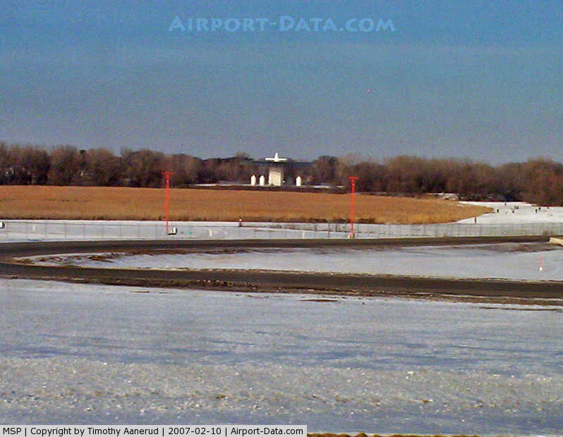
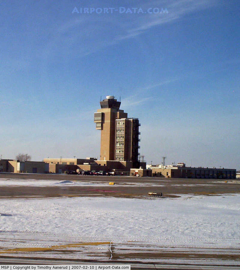
Images and information placed above are from
http://www.airport-data.com/airport/MSP/
We thank them for the data!
| General Info
| State |
MINNESOTA
|
| FAA ID |
MSP
|
| Latitude |
44-52-49.969N
|
| Longitude |
093-13-00.921W
|
| Elevation |
841 feet
|
| Near City |
MINNEAPOLIS
|
We don't guarantee the information is fresh and accurate. The data may
be wrong or outdated.
For more up-to-date information please refer to other sources.
|
|