 |
|
Location & QuickFacts
| FAA Information Effective: | 2008-09-25 |
| Airport Identifier: | MN94 |
| Airport Status: | Operational |
| Longitude/Latitude: | 093-39-44.8820W/46-04-22.8530N
-93.662467/46.073015 (Estimated) |
| Elevation: | 1100 ft / 335.28 m (Estimated) |
| Land: | 0 acres |
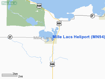
| From nearest city: | 0 nautical miles W of Onamia, MN |
| Location: | Mille Lacs County, MN |
| Magnetic Variation: | 04E (1985) |
Owner & Manager
| Ownership: | Privately owned |
| Owner: | Mille Lacs Hospital & Facility |
| Address: | 200 N Elm St
Onamia, MN 56359 |
| Phone number: | 320-532-2680 |
| Manager: | Mille Lacs Hospital &facility |
| Address: | 200 N Elm St
Onamia, MN 56359 |
| Phone number: | 320-532-2680 |
Airport Operations and Facilities
| Airport Use: | Private |
| Wind indicator: | Yes |
| Segmented Circle: | No |
| Control Tower: | No |
| Sectional chart: | Twin Cities |
| Region: | AGL - Great Lakes |
| Boundary ARTCC: | ZMP - Minneapolis |
| Tie-in FSS: | PNM - Princeton |
| FSS on Airport: | No |
| FSS Toll Free: | 1-800-WX-BRIEF |
Runway Information
Helipad H1
| Dimension: | 50 x 50 ft / 15.2 x 15.2 m |
| Surface: | CONC, |
| |
Runway H1 |
Runway |
| Traffic Pattern: | Left | Left |
|
Radio Navigation Aids
| ID |
Type |
Name |
Ch |
Freq |
Var |
Dist |
| JMR | NDB | Mora | | 327.00 | 03E | 19.8 nm |
| XCR | NDB | Ripley | | 404.00 | 03E | 28.4 nm |
| AIT | NDB | Aitkin | | 397.00 | 03E | 28.5 nm |
| LXL | NDB | Little Falls | | 359.00 | 03E | 29.3 nm |
| PNM | NDB | Princeton | | 368.00 | 03E | 30.6 nm |
| CBG | NDB | Cambridge | | 350.00 | 03E | 35.2 nm |
| ROS | NDB | Rush City | | 282.00 | 02E | 37.2 nm |
| MZH | NDB | Moose Lake | | 362.00 | 02E | 41.2 nm |
| PWC | NDB | Pine River | | 330.00 | 03E | 49.4 nm |
| RYM | TACAN | Camp Ripley | 048X | | 03E | 28.9 nm |
| STC | VOR/DME | St Cloud | 058X | 112.10 | 03E | 35.6 nm |
| BRD | VORTAC | Brainerd | 116X | 116.90 | 03E | 22.4 nm |
Remarks
- PRVDD ALL APCH/DEP OPNS 090-240 DEGS; TAKEOFF/LNDG AREA APPROPRIATELY MKD; NON-OBSTRUCTING WND INDICATOR MAINTAINED.
Images and information placed above are from
http://www.airport-data.com/airport/MN94/
We thank them for the data!
| General Info
|
| Country |
United States
|
| State |
MINNESOTA
|
| FAA ID |
MN94
|
| Latitude |
46-04-22.853N
|
| Longitude |
093-39-44.882W
|
| Elevation |
1100 feet
|
| Near City |
ONAMIA
|
We don't guarantee the information is fresh and accurate. The data may
be wrong or outdated.
For more up-to-date information please refer to other sources.
|
|


