 |
|
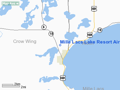
Mille Lacs Lake Resort Airport |
Location & QuickFacts
| FAA Information Effective: | 2008-09-25 |
| Airport Identifier: | 7MN4 |
| Airport Status: | Operational |
| Longitude/Latitude: | 093-49-50.9180W/46-19-09.8540N
-93.830811/46.319404 (Estimated) |
| Elevation: | 1261 ft / 384.35 m (Surveyed) |
| Land: | 120 acres |
| From nearest city: | 2 nautical miles NW of Garrison, MN |
| Location: | Crow Wing County, MN |
| Magnetic Variation: | 03E (1985) |
Owner & Manager
| Ownership: | Privately owned |
| Owner: | Nav Com Contractor Inc |
| Address: | P.o. 76
Garrison, MN 56450 |
| Phone number: | 612-692-4864 |
| Manager: | R.d. Rietzke |
| Address: | At Arpt
Garrison, MN 56450 |
| Phone number: | 612-692-4170 |
Airport Operations and Facilities
| Airport Use: | Private |
| Wind indicator: | Yes |
| Segmented Circle: | No |
| Control Tower: | No |
| Landing fee charge: | No |
| Sectional chart: | Twin Cities |
| Region: | AGL - Great Lakes |
| Boundary ARTCC: | ZMP - Minneapolis |
| Tie-in FSS: | PNM - Princeton |
| FSS on Airport: | No |
| FSS Toll Free: | 1-800-WX-BRIEF |
Airport Services
| Airframe Repair: | NONE |
| Power Plant Repair: | NONE |
Runway Information
Runway 03/21
| Dimension: | 2500 x 50 ft / 762.0 x 15.2 m |
| Surface: | TURF, |
| |
Runway 03 |
Runway 21 |
| Traffic Pattern: | Left | Left |
|
Runway 09/27
| Dimension: | 1250 x 50 ft / 381.0 x 15.2 m |
| Surface: | TURF, |
| |
Runway 09 |
Runway 27 |
| Traffic Pattern: | Left | Left |
|
Radio Navigation Aids
| ID |
Type |
Name |
Ch |
Freq |
Var |
Dist |
| AIT | NDB | Aitkin | | 397.00 | 03E | 15.1 nm |
| XCR | NDB | Ripley | | 404.00 | 03E | 25.8 nm |
| LXL | NDB | Little Falls | | 359.00 | 03E | 30.8 nm |
| PWC | NDB | Pine River | | 330.00 | 03E | 33.5 nm |
| JMR | NDB | Mora | | 327.00 | 03E | 34.9 nm |
| SAZ | NDB | Staples | | 257.00 | 04E | 40.6 nm |
| MZH | NDB | Moose Lake | | 362.00 | 02E | 43.0 nm |
| XVG | NDB | Longville | | 392.00 | 04E | 43.4 nm |
| PNM | NDB | Princeton | | 368.00 | 03E | 46.3 nm |
| RYM | TACAN | Camp Ripley | 048X | | 03E | 25.8 nm |
| STC | VOR/DME | St Cloud | 058X | 112.10 | 03E | 47.3 nm |
| BRD | VORTAC | Brainerd | 116X | 116.90 | 03E | 8.3 nm |
Remarks
Images and information placed above are from
http://www.airport-data.com/airport/7MN4/
We thank them for the data!
| General Info
|
| Country |
United States
|
| State |
MINNESOTA
|
| FAA ID |
7MN4
|
| Latitude |
46-19-09.854N
|
| Longitude |
093-49-50.918W
|
| Elevation |
1261 feet
|
| Near City |
GARRISON
|
We don't guarantee the information is fresh and accurate. The data may
be wrong or outdated.
For more up-to-date information please refer to other sources.
|
|


