 |
|
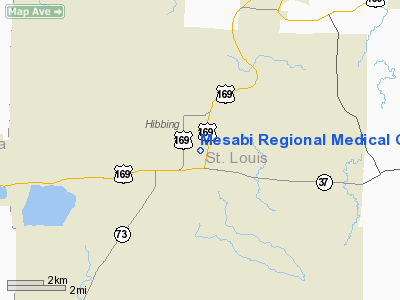
Mesabi Regional Medical Center Heliport |
Location & QuickFacts
| FAA Information Effective: | 2008-09-25 |
| Airport Identifier: | 5MN3 |
| Airport Status: | Operational |
| Longitude/Latitude: | 092-55-43.6800W/47-24-35.7570N
-92.928800/47.409933 (Estimated) |
| Elevation: | 1359 ft / 414.22 m (Estimated) |
| Land: | 0 acres |
| From nearest city: | 5 nautical miles SE of Hibbing, MN |
| Location: | St Louis County, MN |
| Magnetic Variation: | 03E (1985) |
Owner & Manager
| Ownership: | Privately owned |
| Owner: | Range Regional Health Services |
| Address: | University Medical Center Mesabi, 750 East 34th St
Hibbing, MN 55746 |
| Phone number: | 218-262-4881 |
| Manager: | Jeff Cimermancic |
| Address: | 750 East 34th St
Hibbing, MN 55746 |
| Phone number: | 218-262-4881 |
Airport Operations and Facilities
| Airport Use: | Private
MEDICAL USE. |
| Wind indicator: | Yes |
| Segmented Circle: | No |
| Control Tower: | No |
| Sectional chart: | Green Bay |
| Region: | AGL - Great Lakes |
| Boundary ARTCC: | ZMP - Minneapolis |
| Tie-in FSS: | PNM - Princeton |
| FSS on Airport: | No |
| FSS Toll Free: | 1-800-WX-BRIEF |
Runway Information
Helipad H1
| Dimension: | 50 x 50 ft / 15.2 x 15.2 m |
| Surface: | CONC, |
| |
Runway H1 |
Runway |
| Traffic Pattern: | Left | Left |
|
Radio Navigation Aids
| ID |
Type |
Name |
Ch |
Freq |
Var |
Dist |
| CQM | NDB | Cook | | 233.00 | 01E | 26.5 nm |
| ORB | NDB | Orr | | 341.00 | 02E | 36.7 nm |
| FOZ | NDB | Bigfork | | 345.00 | 02E | 37.0 nm |
| DL | NDB | Pykla | | 379.00 | 02E | 41.2 nm |
| COQ | NDB | Cloquet | | 335.00 | 03E | 46.3 nm |
| LKI | TACAN | Lakeside | 011X | | 05E | 45.6 nm |
| HIB | VOR/DME | Hibbing | 045X | 110.80 | 02E | 11.2 nm |
| EVM | VOR/DME | Eveleth | 019X | 108.20 | 01E | 17.5 nm |
| GPZ | VOR/DME | Grand Rapids | 051X | 111.40 | 06E | 27.2 nm |
| DLH | VORTAC | Duluth | 073X | 112.60 | 05E | 47.1 nm |
Remarks
- PROVIDE APCH/DEPARTURE CONDUCTED 85 DEG CLOCKWISE TO 185 DEG. PROVIDE & MAINTAIN WIND INDICATOR. TAKE-OFF/LANDING AREA MARKED.
Images and information placed above are from
http://www.airport-data.com/airport/5MN3/
We thank them for the data!
| General Info
|
| Country |
United States
|
| State |
MINNESOTA
|
| FAA ID |
5MN3
|
| Latitude |
47-24-35.757N
|
| Longitude |
092-55-43.680W
|
| Elevation |
1359 feet
|
| Near City |
HIBBING
|
We don't guarantee the information is fresh and accurate. The data may
be wrong or outdated.
For more up-to-date information please refer to other sources.
|
|


