 |
|
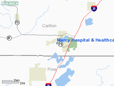
Mercy Hospital & Healthcare Center Heliport |
Location & QuickFacts
| FAA Information Effective: | 2008-09-25 |
| Airport Identifier: | 3MN2 |
| Airport Status: | Operational |
| Longitude/Latitude: | 092-46-31.6190W/46-26-26.6060N
-92.775450/46.440724 (Estimated) |
| Elevation: | 1060 ft / 323.09 m (Estimated) |
| Land: | 1 acres |
| From nearest city: | 1 nautical miles S of Moose Lake, MN |
| Location: | Carlton County, MN |
| Magnetic Variation: | 02E (1995) |
Owner & Manager
| Ownership: | Privately owned |
| Owner: | Mercy Hospital |
| Address: | 710 Kenwood Ave
Moose Lakemn, MN 55767 |
| Phone number: | 218-485-4481 |
| Manager: | Keith Carlson |
| Address: | 710 Kenwood Ave
Moose Lake, MN 55767 |
| Phone number: | 218-485-5520 |
Airport Operations and Facilities
| Airport Use: | Private |
| Wind indicator: | Yes |
| Segmented Circle: | No |
| Control Tower: | No |
| Lighting Schedule: | PHONE REQ
FOR FLOOD LGTS CALL 218-485-4481. |
| Sectional chart: | Green Bay |
| Region: | AGL - Great Lakes |
| Boundary ARTCC: | ZMP - Minneapolis |
| Tie-in FSS: | PNM - Princeton |
| FSS Toll Free: | 1-800-WX-BRIEF |
Runway Information
Helipad H1
| Dimension: | 40 x 40 ft / 12.2 x 12.2 m |
| Surface: | CONC, |
| |
Runway H1 |
Runway |
| Traffic Pattern: | Left | Left |
|
Radio Navigation Aids
| ID |
Type |
Name |
Ch |
Freq |
Var |
Dist |
| MZH | NDB | Moose Lake | | 362.00 | 02E | 1.9 nm |
| COQ | NDB | Cloquet | | 335.00 | 03E | 19.1 nm |
| DL | NDB | Pykla | | 379.00 | 02E | 29.9 nm |
| SUW | NDB | Bong | | 260.00 | 01E | 31.6 nm |
| AIT | NDB | Aitkin | | 397.00 | 03E | 37.8 nm |
| JMR | NDB | Mora | | 327.00 | 03E | 38.9 nm |
| OLG | NDB | Solon Springs | | 388.00 | 01E | 40.6 nm |
| BXR | NDB | Big Doctor | | 203.00 | 02E | 40.9 nm |
| ROS | NDB | Rush City | | 282.00 | 02E | 45.3 nm |
| LKI | TACAN | Lakeside | 011X | | 05E | 34.4 nm |
| RZN | VOR/DME | Siren | 031X | 109.40 | 02E | 40.9 nm |
| DLH | VORTAC | Duluth | 073X | 112.60 | 05E | 32.1 nm |
Remarks
- PRVDD APCH/ DEP 130-170 & 304-333, AREA IS MKD, WIND INDICATOR MAINTAINED & COMPLY WITH FAR PART 126 (B)(2).
Images and information placed above are from
http://www.airport-data.com/airport/3MN2/
We thank them for the data!
| General Info
|
| Country |
United States
|
| State |
MINNESOTA
|
| FAA ID |
3MN2
|
| Latitude |
46-26-26.606N
|
| Longitude |
092-46-31.619W
|
| Elevation |
1060 feet
|
| Near City |
MOOSE LAKE
|
We don't guarantee the information is fresh and accurate. The data may
be wrong or outdated.
For more up-to-date information please refer to other sources.
|
|


