 |
|
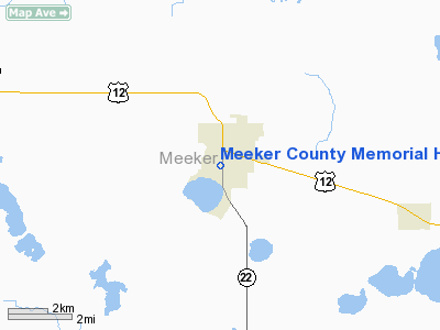
Meeker County Memorial Hospital Heliport |
Location & QuickFacts
| FAA Information Effective: | 2008-09-25 |
| Airport Identifier: | MN65 |
| Airport Status: | Operational |
| Longitude/Latitude: | 094-31-45.9700W/45-07-09.8700N
-94.529436/45.119408 (Estimated) |
| Elevation: | 1135 ft / 345.95 m (Estimated) |
| Land: | 0 acres |
| From nearest city: | 0 nautical miles N of Litchfield, MN |
| Location: | Meeker County, MN |
| Magnetic Variation: | 04E (1990) |
Owner & Manager
| Ownership: | Publicly owned |
| Owner: | Meeker County Memorial Hosp |
| Address: | 612 S Sibley Ave
Litchfield, MN 55355 |
| Phone number: | 612-693-3242 |
| Manager: | Ron Johnson Admin |
| Address: | 612 S Sibley Ave
Litchfield, MN 55355 |
| Phone number: | 612-693-3242 |
Airport Operations and Facilities
| Airport Use: | Private
MEDICAL USE. |
| Wind indicator: | Yes |
| Segmented Circle: | No |
| Control Tower: | No |
| Lighting Schedule: | PHONE REQ
FOR PERIMETER LGTS CALL 612-693-3242. |
| Sectional chart: | Twin Cities |
| Region: | AGL - Great Lakes |
| Boundary ARTCC: | ZMP - Minneapolis |
| Tie-in FSS: | PNM - Princeton |
| FSS Toll Free: | 1-800-WX-BRIEF |
Runway Information
Helipad H1
| Dimension: | 45 x 45 ft / 13.7 x 13.7 m |
| Surface: | CONC, |
| |
Runway H1 |
Runway |
| Traffic Pattern: | Left | Left |
|
Radio Navigation Aids
| ID |
Type |
Name |
Ch |
Freq |
Var |
Dist |
| HCD | NDB | Hutchinson | | 209.00 | 04E | 17.0 nm |
| GYL | NDB | Glencoe | | 407.00 | 03E | 28.6 nm |
| GHW | NDB | Glenwood | | 346.00 | 03E | 45.9 nm |
| PNM | NDB | Princeton | | 368.00 | 03E | 47.3 nm |
| BBB | NDB | Benson | | 239.00 | 05E | 49.1 nm |
| ULM | NDB/DME | New Ulm | 050X | 272.00 | 04E | 48.2 nm |
| ILL | VOR/DME | Willmar | 084X | 113.70 | 04E | 23.8 nm |
| BDH | VOR/DME | Willmar | 84X | 113.70 | 04E | 25.3 nm |
| STC | VOR/DME | St Cloud | 058X | 112.10 | 03E | 32.6 nm |
| RWF | VOR/DME | Redwood Falls | 080X | 113.30 | 07E | 46.8 nm |
| FCM | VOR/DME | Flying Cloud | 055X | 111.80 | 06E | 48.9 nm |
| DWN | VORTAC | Darwin | 027X | 109.00 | 07E | 3.7 nm |
| GEP | VORTAC | Gopher | 120X | 117.30 | 06E | 49.1 nm |
Remarks
- PRVDD HELIPORT CONSTRUCTION CONTINUES IN ACCORDANCE WITH THE CURRENT APPROVED ENGINEERING SPEC; ALL APP/DEPFROM 025 TO 040 AND FROM 190 TO 215. THE TKOFF/LNDG AREA IS APROPLY MKD. A NON-OBSTRUCTING WIND INDICATOR IS MAINTAINED. TWO-WAY RADIO COM BE ESTAB BTWNTHE ACFT AND THE HOSPITAL PRIOR TO LNDG.
Images and information placed above are from
http://www.airport-data.com/airport/MN65/
We thank them for the data!
| General Info
|
| Country |
United States
|
| State |
MINNESOTA
|
| FAA ID |
MN65
|
| Latitude |
45-07-09.870N
|
| Longitude |
094-31-45.970W
|
| Elevation |
1135 feet
|
| Near City |
LITCHFIELD
|
We don't guarantee the information is fresh and accurate. The data may
be wrong or outdated.
For more up-to-date information please refer to other sources.
|
|


