 |
|
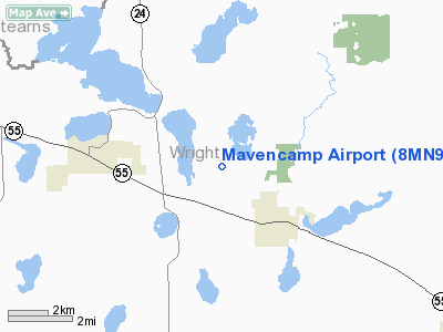
Location & QuickFacts
| FAA Information Effective: | 2008-09-25 |
| Airport Identifier: | 8MN9 |
| Airport Status: | Operational |
| Longitude/Latitude: | 094-02-20.9280W/45-15-24.8750N
-94.039147/45.256910 (Estimated) |
| Elevation: | 1027 ft / 313.03 m (Estimated) |
| Land: | 0 acres |
| From nearest city: | 3 nautical miles NW of Maple Lake, MN |
| Location: | Wright County, MN |
| Magnetic Variation: | 04E (1985) |
Owner & Manager
| Ownership: | Privately owned |
| Owner: | William A Mavencamp |
| Address: | R R 1
Maple Lake, MN 55358 |
| Phone number: | 612-963-3845 |
| Address: |
|
Airport Operations and Facilities
| Airport Use: | Private |
| Wind indicator: | Yes |
| Segmented Circle: | No |
| Control Tower: | No |
| Landing fee charge: | No |
| Sectional chart: | Twin Cities |
| Region: | AGL - Great Lakes |
| Boundary ARTCC: | ZMP - Minneapolis |
| Tie-in FSS: | PNM - Princeton |
| FSS on Airport: | No |
| FSS Toll Free: | 1-800-WX-BRIEF |
Runway Information
Runway 18/36
| Dimension: | 2300 x 100 ft / 701.0 x 30.5 m |
| Surface: | TURF, |
| |
Runway 18 |
Runway 36 |
| Traffic Pattern: | Left | Left |
|
Radio Navigation Aids
| ID |
Type |
Name |
Ch |
Freq |
Var |
Dist |
| PNM | NDB | Princeton | | 368.00 | 03E | 26.0 nm |
| HCD | NDB | Hutchinson | | 209.00 | 04E | 28.1 nm |
| GYL | NDB | Glencoe | | 407.00 | 03E | 29.9 nm |
| CBG | NDB | Cambridge | | 350.00 | 03E | 37.4 nm |
| LXL | NDB | Little Falls | | 359.00 | 03E | 43.6 nm |
| MS | NDB | Narco | | 266.00 | 02E | 47.9 nm |
| STC | VOR/DME | St Cloud | 058X | 112.10 | 03E | 17.6 nm |
| FCM | VOR/DME | Flying Cloud | 055X | 111.80 | 06E | 35.8 nm |
| MSP | VOR/DME | Minneapolis | 100X | 115.30 | 02E | 40.4 nm |
| ILL | VOR/DME | Willmar | 084X | 113.70 | 04E | 45.3 nm |
| BDH | VOR/DME | Willmar | 84X | 113.70 | 04E | 46.8 nm |
| DWN | VORTAC | Darwin | 027X | 109.00 | 07E | 20.3 nm |
| GEP | VORTAC | Gopher | 120X | 117.30 | 06E | 29.0 nm |
| MSP | VOT | Minneapolis St Paul | | 111.00 | | 41.5 nm |
| STP | VOT | St Paul | | 114.40 | | 45.7 nm |
Remarks
- LACK OF RESPONSE BY OWNER TO FURNISH SUFFICIENT INFORMATION TO COMPLETE AIRSPACE ANALYSIS.
Images and information placed above are from
http://www.airport-data.com/airport/8MN9/
We thank them for the data!
| General Info
|
| Country |
United States
|
| State |
MINNESOTA
|
| FAA ID |
8MN9
|
| Latitude |
45-15-24.875N
|
| Longitude |
094-02-20.928W
|
| Elevation |
1027 feet
|
| Near City |
MAPLE LAKE
|
We don't guarantee the information is fresh and accurate. The data may
be wrong or outdated.
For more up-to-date information please refer to other sources.
|
|


