 |
|
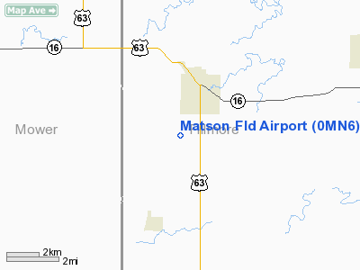
Location & QuickFacts
| FAA Information Effective: | 2008-09-25 |
| Airport Identifier: | 0MN6 |
| Airport Status: | Operational |
| Longitude/Latitude: | 092-24-15.6140W/43-39-43.8690N
-92.404337/43.662186 (Estimated) |
| Elevation: | 1365 ft / 416.05 m (Estimated) |
| Land: | 0 acres |
| From nearest city: | 2 nautical miles SW of Spring Valley, MN |
| Location: | Fillmore County, MN |
| Magnetic Variation: | 03E (1985) |
Owner & Manager
| Ownership: | Privately owned |
| Owner: | R. W. Matson |
| Address: | 21076 121st Ave
Spring Valley, MN 55975 |
| Phone number: | 507-346-2673 |
| Address: |
|
Airport Operations and Facilities
| Airport Use: | Private |
| Wind indicator: | Yes |
| Segmented Circle: | No |
| Control Tower: | No |
| Lighting Schedule: | PHONE REQ
FOR RWY LGTS, PHONE 507-346-2673. |
| Landing fee charge: | No |
| Sectional chart: | Chicago |
| Region: | AGL - Great Lakes |
| Boundary ARTCC: | ZMP - Minneapolis |
| Tie-in FSS: | PNM - Princeton |
| FSS on Airport: | No |
| FSS Toll Free: | 1-800-WX-BRIEF |
Airport Services
| Airframe Repair: | NONE |
| Power Plant Repair: | NONE |
Runway Information
Runway E/W
| Dimension: | 2500 x 150 ft / 762.0 x 45.7 m |
| Surface: | TURF, |
| Edge Lights: | Low |
| |
Runway E |
Runway W |
| Traffic Pattern: | Left | Left |
|
Radio Navigation Aids
| ID |
Type |
Name |
Ch |
Freq |
Var |
Dist |
| CJJ | NDB | Cresco | | 293.00 | 02E | 21.4 nm |
| IY | NDB | Chukk | | 417.00 | 03E | 34.8 nm |
| CCY | NDB | Charles City | | 375.00 | 03E | 36.8 nm |
| DEH | NDB | Decorah | | 236.00 | 01E | 37.3 nm |
| CHU | NDB | Caledonia | | 209.00 | 03E | 40.0 nm |
| RST | VOR/DME | Rochester | 057X | 112.00 | 05E | 11.1 nm |
| JAY | VOR/DME | Austin | 019X | 108.20 | 03E | 23.0 nm |
| ONA | VOR/DME | Winona | 051X | 111.40 | 01E | 39.2 nm |
| AEL | VOR/DME | Albert Lea | 035X | 109.80 | 05E | 42.0 nm |
| ODI | VORTAC | Nodine | 126X | 117.90 | 01E | 43.3 nm |
| UKN | VORTAC | Waukon | 113X | 116.60 | 05E | 44.2 nm |
Images and information placed above are from
http://www.airport-data.com/airport/0MN6/
We thank them for the data!
| General Info
|
| Country |
United States
|
| State |
MINNESOTA
|
| FAA ID |
0MN6
|
| Latitude |
43-39-43.869N
|
| Longitude |
092-24-15.614W
|
| Elevation |
1365 feet
|
| Near City |
SPRING VALLEY
|
We don't guarantee the information is fresh and accurate. The data may
be wrong or outdated.
For more up-to-date information please refer to other sources.
|
|


