 |
|
Location & QuickFacts
| FAA Information Effective: | 2008-09-25 |
| Airport Identifier: | MY42 |
| Airport Status: | Operational |
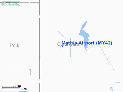
| Longitude/Latitude: | 095-31-37.0400W/47-51-49.8450N
-95.526956/47.863846 (Estimated) |
| Elevation: | 1170 ft / 356.62 m (Estimated) |
| Land: | 0 acres |
| From nearest city: | 8 nautical miles N of Gonvick, MN |
| Location: | Clearwater County, MN |
| Magnetic Variation: | 05E (1985) |
Owner & Manager
| Ownership: | Privately owned |
| Owner: | Gary Mathis |
| Address: | 12156- 590th Street
Gonvick, MN 56644 |
| Phone number: | 218-487-5358 |
| Address: |
|
Airport Operations and Facilities
| Airport Use: | Private |
| Wind indicator: | Yes |
| Segmented Circle: | No |
| Control Tower: | No |
| Sectional chart: | Twin Cities |
| Region: | AGL - Great Lakes |
| Boundary ARTCC: | ZMP - Minneapolis |
| Tie-in FSS: | PNM - Princeton |
| FSS Toll Free: | 1-800-WX-BRIEF |
Runway Information
Runway 11/29
| Dimension: | 2000 x 65 ft / 609.6 x 19.8 m |
| Surface: | TURF, |
| |
Runway 11 |
Runway 29 |
| Traffic Pattern: | Left | Left |
|
Radio Navigation Aids
| ID |
Type |
Name |
Ch |
Freq |
Var |
Dist |
| FSE | NDB | Fosston | | 224.00 | 05E | 19.2 nm |
| CKN | NDB | Crookston | | 400.00 | 07E | 43.9 nm |
| TVF | VOR/DME | Thief River Falls | 021X | 108.40 | 08E | 29.3 nm |
| BJI | VORTAC | Bemidji | 023X | 108.60 | 04E | 26.7 nm |
Remarks
- FILED FOR RECORD PURPOSES ONLY.
Images and information placed above are from
http://www.airport-data.com/airport/MY42/
We thank them for the data!
| General Info
|
| Country |
United States
|
| State |
MINNESOTA
|
| FAA ID |
MY42
|
| Latitude |
47-51-49.845N
|
| Longitude |
095-31-37.040W
|
| Elevation |
1170 feet
|
| Near City |
GONVICK
|
We don't guarantee the information is fresh and accurate. The data may
be wrong or outdated.
For more up-to-date information please refer to other sources.
|
|


