 |
|
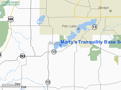
Marty's Tranquility Base Seaplane Base |
Location & QuickFacts
| FAA Information Effective: | 2008-09-25 |
| Airport Identifier: | MN76 |
| Airport Status: | Operational |
| Longitude/Latitude: | 093-28-18.8240W/44-41-59.8670N
-93.471896/44.699963 (Estimated) |
| Elevation: | 911 ft / 277.67 m (Estimated) |
| Land: | 1 acres |
| From nearest city: | 2 nautical miles SW of Prior Lake, MN |
| Location: | Scott County, MN |
| Magnetic Variation: | 03E (1985) |
Owner & Manager
| Ownership: | Privately owned |
| Owner: | C. M. Coddington |
| Address: | 2630 South Shore Dr.
Prior Lake, MN 55372 |
| Phone number: | 952-447-4438 |
| Manager: | C. M. Coddington |
| Address: | 2630 South Shore Dr.
Prior Lake, MN 55372 |
| Phone number: | 952-447-4438 |
Airport Operations and Facilities
| Airport Use: | Private |
| Segmented Circle: | No |
| Control Tower: | No |
| Sectional chart: | Twin Cities |
| Region: | AGL - Great Lakes |
| Boundary ARTCC: | ZMP - Minneapolis |
| Tie-in FSS: | PNM - Princeton |
| FSS on Airport: | No |
| FSS Toll Free: | 1-800-WX-BRIEF |
Runway Information
Runway 08W/26W
| Dimension: | 8100 x 300 ft / 2468.9 x 91.4 m |
| Surface: | WATER, Good Condition |
| |
Runway 08W |
Runway 26W |
| Traffic Pattern: | Left | Left |
|
Radio Navigation Aids
| ID |
Type |
Name |
Ch |
Freq |
Var |
Dist |
| MS | NDB | Narco | | 266.00 | 02E | 17.9 nm |
| PPI | NDB | Hopey | | 400.00 | 03E | 24.9 nm |
| GYL | NDB | Glencoe | | 407.00 | 03E | 26.5 nm |
| ACQ | NDB | Waseca | | 371.00 | 02E | 38.0 nm |
| HCD | NDB | Hutchinson | | 209.00 | 04E | 40.0 nm |
| RNH | NDB | New Richmond | | 257.00 | 02E | 48.1 nm |
| OEO | NDB | Osceola | | 233.00 | 01E | 49.6 nm |
| ULM | NDB/DME | New Ulm | 050X | 272.00 | 04E | 49.6 nm |
| FCM | VOR/DME | Flying Cloud | 055X | 111.80 | 06E | 7.6 nm |
| MSP | VOR/DME | Minneapolis | 100X | 115.30 | 02E | 15.5 nm |
| FOW | VOR/DME | Halfway | 049X | 111.20 | 02E | 30.1 nm |
| MKT | VOR/DME | Mankato | 045X | 110.80 | 07E | 34.5 nm |
| FGT | VORTAC | Farmington | 104X | 115.70 | 06E | 13.1 nm |
| GEP | VORTAC | Gopher | 120X | 117.30 | 06E | 27.1 nm |
| DWN | VORTAC | Darwin | 027X | 109.00 | 07E | 47.9 nm |
| MSP | VOT | Minneapolis St Paul | | 111.00 | | 15.6 nm |
| STP | VOT | St Paul | | 114.40 | | 22.8 nm |
Remarks
- MOORING AVBL; MUST HAVE OWN ANCHOR.
- RAMP NOT AVBL.
- INADEQUATE TRAFFIC PATTERN AIRSPACE WITH SPRING LAKE SEAPLANE BASE SHICH IS ON THE SAME BODY OF WATER.
Images and information placed above are from
http://www.airport-data.com/airport/MN76/
We thank them for the data!
| General Info
|
| Country |
United States
|
| State |
MINNESOTA
|
| FAA ID |
MN76
|
| Latitude |
44-41-59.867N
|
| Longitude |
093-28-18.824W
|
| Elevation |
911 feet
|
| Near City |
PRIOR LAKE
|
We don't guarantee the information is fresh and accurate. The data may
be wrong or outdated.
For more up-to-date information please refer to other sources.
|
|


