 |
|
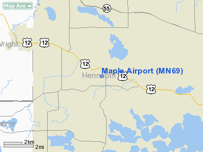
Location & QuickFacts
| FAA Information Effective: | 2008-09-25 |
| Airport Identifier: | MN69 |
| Airport Status: | Operational |
| Longitude/Latitude: | 093-40-18.8620W/45-00-09.8660N
-93.671906/45.002741 (Estimated) |
| Elevation: | 1026 ft / 312.72 m (Surveyed) |
| Land: | 0 acres |
| From nearest city: | 1 nautical miles SW of Maple Plain, MN |
| Location: | Hennepin County, MN |
| Magnetic Variation: | 03E (1985) |
Owner & Manager
| Ownership: | Privately owned |
| Owner: | Hilltop Farm |
| Address: | 6325 County Rd 6
Maple Plain, MN 55359 |
| Phone number: | 763-479-2274 |
| Manager: | Marvin D. Johnson |
| Address: | 6325 County Rd 6
Maple Plain, MN 55359 |
| Phone number: | 763-479-2274
PHONE: 612-840-3433 |
Airport Operations and Facilities
| Airport Use: | Private |
| Wind indicator: | Yes |
| Segmented Circle: | No |
| Control Tower: | No |
| Landing fee charge: | No |
| Sectional chart: | Twin Cities |
| Region: | AGL - Great Lakes |
| Boundary ARTCC: | ZMP - Minneapolis |
| Tie-in FSS: | PNM - Princeton |
| FSS on Airport: | No |
| FSS Toll Free: | 1-800-WX-BRIEF |
Airport Services
| Airframe Repair: | NONE |
| Power Plant Repair: | NONE |
Runway Information
Runway 11/29
| Dimension: | 3400 x 100 ft / 1036.3 x 30.5 m |
| Surface: | TURF, |
| |
Runway 11 |
Runway 29 |
| Traffic Pattern: | Right | Right |
|
Radio Navigation Aids
| ID |
Type |
Name |
Ch |
Freq |
Var |
Dist |
| GYL | NDB | Glencoe | | 407.00 | 03E | 22.8 nm |
| MS | NDB | Narco | | 266.00 | 02E | 26.9 nm |
| HCD | NDB | Hutchinson | | 209.00 | 04E | 31.5 nm |
| PPI | NDB | Hopey | | 400.00 | 03E | 32.0 nm |
| PNM | NDB | Princeton | | 368.00 | 03E | 33.9 nm |
| CBG | NDB | Cambridge | | 350.00 | 03E | 37.6 nm |
| OEO | NDB | Osceola | | 233.00 | 01E | 45.6 nm |
| RNH | NDB | New Richmond | | 257.00 | 02E | 49.1 nm |
| FCM | VOR/DME | Flying Cloud | 055X | 111.80 | 06E | 14.0 nm |
| MSP | VOR/DME | Minneapolis | 100X | 115.30 | 02E | 19.6 nm |
| STC | VOR/DME | St Cloud | 058X | 112.10 | 03E | 36.7 nm |
| MKT | VOR/DME | Mankato | 045X | 110.80 | 07E | 48.2 nm |
| FOW | VOR/DME | Halfway | 049X | 111.20 | 02E | 49.7 nm |
| GEP | VORTAC | Gopher | 120X | 117.30 | 06E | 15.3 nm |
| FGT | VORTAC | Farmington | 104X | 115.70 | 06E | 30.6 nm |
| DWN | VORTAC | Darwin | 027X | 109.00 | 07E | 33.6 nm |
| MSP | VOT | Minneapolis St Paul | | 111.00 | | 20.7 nm |
| STP | VOT | St Paul | | 114.40 | | 26.3 nm |
Remarks
- PRVDD THRS LCTD/DSPLCD & MKD TO PRVD 20:1 SLOPE.
Images and information placed above are from
http://www.airport-data.com/airport/MN69/
We thank them for the data!
| General Info
|
| Country |
United States
|
| State |
MINNESOTA
|
| FAA ID |
MN69
|
| Latitude |
45-00-09.866N
|
| Longitude |
093-40-18.862W
|
| Elevation |
1026 feet
|
| Near City |
MAPLE PLAIN
|
We don't guarantee the information is fresh and accurate. The data may
be wrong or outdated.
For more up-to-date information please refer to other sources.
|
|


