 |
|
Maple Lake Municipal Airport |
| Maple Lake Municipal Airport |
| IATA: none – ICAO: KMGG – FAA LID: MGG |
| Summary |
| Airport type |
Public |
| Owner |
City of Maple Lake |
| Serves |
Maple Lake, Minnesota |
| Elevation AMSL |
1,028 ft / 313 m |
| Coordinates |
45°14′10″N 093°59′08″W / 45.23611°N 93.98556°W / 45.23611; -93.98556 |
| Runways |
| Direction |
Length |
Surface |
| ft |
m |
| 10/28 |
2,796 |
852 |
Asphalt |
| 4W/22W |
8,000 |
2,438 |
Water |
| Statistics (2007) |
| Aircraft operations |
20,800 |
| Based aircraft |
54 |
| Source: Federal Aviation Administration |
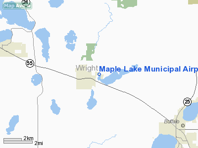
Maple Lake Municipal Airport (ICAO: KMGG, FAA LID: MGG) is a city-owned, public-use airport located one nautical mile (2 km) northeast of the central business district of Maple Lake, a city in Wright County, Minnesota, United States. It is located on Maple Lake and is also known as Maple Lake Municipal Airport & Seaplane Base.
Although most U.S. airports use the same three-letter location identifier for the FAA and IATA, Maple Lake Municipal Airport is assigned MGG by the FAA but has no designation from the IATA (which assigned MGG to Margarima, Papua New Guinea).
Facilities and aircraft
Maple Lake Municipal Airport covers an area of 56 acres (23 ha) at an elevation of 1,028 feet (313 m) above mean sea level. It has one runway designated 10/28 with a 2,796 x 60 ft (852 x 18 m) asphalt surface. It also has one seaplane landing area designated 4W/22W which measures 8,000 x 2,000 ft (2,438 x 610 m).
For the 12-month period ending June 30, 2007, the airport had 20,800 aircraft operations, an average of 56 per day: 91% general aviation, 5% air taxi and 4% military. At that time there were 54 aircraft based at this airport: 76% single-engine, 13% multi-engine and 11% ultralight.
The above content comes from Wikipedia and is published under free licenses – click here to read more.
Location & QuickFacts
| FAA Information Effective: | 2008-09-25 |
| Airport Identifier: | MGG |
| Airport Status: | Operational |
| Longitude/Latitude: | 093-59-08.1200W/45-14-09.5740N
-93.985589/45.235993 (Estimated) |
| Elevation: | 1028 ft / 313.33 m (Surveyed) |
| Land: | 56 acres |
| From nearest city: | 1 nautical miles NE of Maple Lake, MN |
| Location: | Wright County, MN |
| Magnetic Variation: | 03E (2000) |
Owner & Manager
| Ownership: | Publicly owned |
| Owner: | City Of Maple Lake |
| Address: | Box 757, City Hall
Maple Lake, MN 55358 |
| Phone number: | 320-963-3611 |
| Manager: | Gerald Sawatzke |
| Address: | Box 757, 10 Maple Avenue S.
Maple Lake, MN 55358 |
| Phone number: | 320-963-3738 |
Airport Operations and Facilities
| Airport Use: | Open to public |
| Wind indicator: | Yes |
| Segmented Circle: | No |
| Control Tower: | No |
| Lighting Schedule: | DUSK-DAWN |
| Beacon Color: | Clear-Green (lighted land airport) |
| Landing fee charge: | No |
| Sectional chart: | Twin Cities |
| Region: | AGL - Great Lakes |
| Boundary ARTCC: | ZMP - Minneapolis |
| Tie-in FSS: | PNM - Princeton |
| FSS on Airport: | No |
| FSS Toll Free: | 1-800-WX-BRIEF |
| NOTAMs Facility: | MGG (NOTAM-d service avaliable) |
Airport Communications
| CTAF: | 122.800 |
| Unicom: | 122.800 |
Airport Services
| Fuel available: | 100LL |
| Airframe Repair: | MINOR |
| Power Plant Repair: | MINOR |
| Bottled Oxygen: | NONE |
| Bulk Oxygen: | NONE |
Runway Information
Runway 04W/22W
| Dimension: | 8000 x 2000 ft / 2438.4 x 609.6 m |
| Surface: | WATER, |
| |
Runway 04W |
Runway 22W |
| Traffic Pattern: | Right | Right |
|
Runway 10/28
| Dimension: | 2796 x 60 ft / 852.2 x 18.3 m |
| Surface: | ASPH, Good Condition |
| Edge Lights: | Non-standard lighting system
NSTD LIRL: 400 FOOT SPACING BTWN LIGHTS. |
| |
Runway 10 |
Runway 28 |
| Longitude: | 093-59-27.2350W | 093-58-49.0410W |
| Latitude: | 45-14-12.4900N | 45-14-06.6770N |
| Elevation: | 1024.00 ft | 1028.00 ft |
| Alignment: | 102 | 127 |
| Traffic Pattern: | Left | Left |
| Markings: | Non-precision instrument, Good Condition | Non-precision instrument, Good Condition |
| Displaced threshold: | 100.00 ft | 0.00 ft |
| Runway End Identifier: | No | No |
| Centerline Lights: | No | No |
| Touchdown Lights: | No | No |
| Obstruction: | 35 ft tree, 565.0 ft from runway, 130 ft left of centerline, 10:1 slope to clear
RWY 10 APCH RATIO 13:1 TO DSPLCD THLD. | 10 ft hill, 201.0 ft from runway, 125 ft right of centerline
40 FT SILOS (LIGHTED), 870 FT FM RY END, 280 FT R, 16:1 & TREES +48 FT, 1175 FT FM RY END, 300 FT L, 20:1.
10 FT HILL 190 FT FM RY END 125 FT R. |
|
Radio Navigation Aids
| ID |
Type |
Name |
Ch |
Freq |
Var |
Dist |
| PNM | NDB | Princeton | | 368.00 | 03E | 25.4 nm |
| HCD | NDB | Hutchinson | | 209.00 | 04E | 28.4 nm |
| GYL | NDB | Glencoe | | 407.00 | 03E | 28.9 nm |
| CBG | NDB | Cambridge | | 350.00 | 03E | 36.1 nm |
| MS | NDB | Narco | | 266.00 | 02E | 45.3 nm |
| LXL | NDB | Little Falls | | 359.00 | 03E | 45.5 nm |
| PPI | NDB | Hopey | | 400.00 | 03E | 49.4 nm |
| JMR | NDB | Mora | | 327.00 | 03E | 49.6 nm |
| STC | VOR/DME | St Cloud | 058X | 112.10 | 03E | 19.1 nm |
| FCM | VOR/DME | Flying Cloud | 055X | 111.80 | 06E | 33.4 nm |
| MSP | VOR/DME | Minneapolis | 100X | 115.30 | 02E | 37.8 nm |
| ILL | VOR/DME | Willmar | 084X | 113.70 | 04E | 47.4 nm |
| BDH | VOR/DME | Willmar | 84X | 113.70 | 04E | 48.9 nm |
| DWN | VORTAC | Darwin | 027X | 109.00 | 07E | 21.8 nm |
| GEP | VORTAC | Gopher | 120X | 117.30 | 06E | 26.5 nm |
| FGT | VORTAC | Farmington | 104X | 115.70 | 06E | 49.9 nm |
| MSP | VOT | Minneapolis St Paul | | 111.00 | | 39.0 nm |
| STP | VOT | St Paul | | 114.40 | | 43.1 nm |
Remarks
- BLDGS/TREES/PLINES ALL SIDES OF LAKE. AVOID SWIMMING BEACH ON SOUTH SHORE OF LAKE.
- ONLY ONE TKOF/LNDG PER FLT OPN. NO TGL OR TRAINING.
- ULTRALIGHTS ON & INVOF ARPT.
- MIGRATORY WATERFOWL ON & INVOF ARPT.
Images and information placed above are from
http://www.airport-data.com/airport/MGG/
We thank them for the data!
| General Info
|
| Country |
United States
|
| State |
MINNESOTA
|
| FAA ID |
MGG
|
| Latitude |
45-14-09.574N
|
| Longitude |
093-59-08.120W
|
| Elevation |
1028 feet
|
| Near City |
MAPLE LAKE
|
We don't guarantee the information is fresh and accurate. The data may
be wrong or outdated.
For more up-to-date information please refer to other sources.
|
|


