 |
|
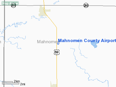
Location & QuickFacts
| FAA Information Effective: | 2008-09-25 |
| Airport Identifier: | 3N8 |
| Airport Status: | Operational |
| Longitude/Latitude: | 095-55-46.2000W/47-15-34.1000N
-95.929500/47.259472 (Estimated) |
| Elevation: | 1244 ft / 379.17 m (Estimated) |
| Land: | 181 acres |
| From nearest city: | 3 nautical miles SS of Mahnomen, MN |
| Location: | Mahnomen County, MN |
| Magnetic Variation: | 05E (1985) |
Owner & Manager
| Ownership: | Publicly owned |
| Owner: | County Of Mahnomen |
| Address: | County Auditor Box 379
Mahnomen, MN 56557 |
| Phone number: | 218-935-5669 |
| Manager: | Bill Nelson |
| Address: | 601 - 6th St Sw
Mahnomen, MN 56557 |
| Phone number: | 218-935-5650
OR CALL 218-935-2563. |
Airport Operations and Facilities
| Airport Use: | Open to public |
| Wind indicator: | Yes |
| Segmented Circle: | No |
| Control Tower: | No |
| Lighting Schedule: | DUSK-DAWN |
| Beacon Color: | Clear-Green (lighted land airport) |
| Landing fee charge: | No |
| Sectional chart: | Twin Cities |
| Region: | AGL - Great Lakes |
| Boundary ARTCC: | ZMP - Minneapolis |
| Tie-in FSS: | PNM - Princeton |
| FSS on Airport: | No |
| FSS Toll Free: | 1-800-WX-BRIEF |
| NOTAMs Facility: | PNM (NOTAM-d service avaliable) |
| Federal Agreements: | N |
Airport Communications
Airport Services
| Fuel available: | 100LLMOGAS
FOR FUEL CALL 218-935-5650 OR 5076. |
| Airframe Repair: | NONE |
| Power Plant Repair: | NONE |
| Bottled Oxygen: | NONE |
| Bulk Oxygen: | NONE |
Runway Information
Runway 17/35
| Dimension: | 3210 x 150 ft / 978.4 x 45.7 m |
| Surface: | TURF, Good Condition |
| Edge Lights: | Non-standard lighting system
NSTD LIRL DUE TO SPACING. |
| |
Runway 17 |
Runway 35 |
| Longitude: | 095-55-50.9700W | 095-55-41.4500W |
| Latitude: | 47-15-49.6200N | 47-15-18.6000N |
| Traffic Pattern: | Left | Left |
| Obstruction: | , 50:1 slope to clear | 44 ft trees, 1100.0 ft from runway, 75 ft left of centerline, 25:1 slope to clear |
|
Radio Navigation Aids
| ID |
Type |
Name |
Ch |
Freq |
Var |
Dist |
| FSE | NDB | Fosston | | 224.00 | 05E | 20.9 nm |
| AA | NDB | Kenie | | 365.00 | 06E | 39.2 nm |
| CKN | NDB | Crookston | | 400.00 | 07E | 44.6 nm |
| PK | NDB | Spida | | 269.00 | 04E | 46.7 nm |
| DTL | VOR/DME | Detroit Lakes | 049X | 111.20 | 05E | 26.1 nm |
| PKD | VOR/DME | Park Rapids | 043X | 110.60 | 04E | 41.3 nm |
| TVF | VOR/DME | Thief River Falls | 021X | 108.40 | 08E | 49.8 nm |
| BJI | VORTAC | Bemidji | 023X | 108.60 | 04E | 41.4 nm |
| FAR | VORTAC | Fargo | 109X | 116.20 | 09E | 48.5 nm |
Remarks
- ULTRALIGHT TRAFFIC ON & INVOF ARPT.
Images and information placed above are from
http://www.airport-data.com/airport/3N8/
We thank them for the data!
| General Info
|
| Country |
United States
|
| State |
MINNESOTA
|
| FAA ID |
3N8
|
| Latitude |
47-15-35.858N
|
| Longitude |
095-55-41.152W
|
| Elevation |
1244 feet
|
| Near City |
MAHNOMEN
|
We don't guarantee the information is fresh and accurate. The data may
be wrong or outdated.
For more up-to-date information please refer to other sources.
|
|


