 |
|
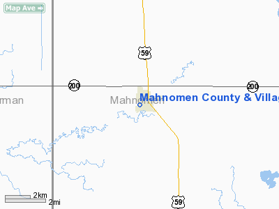
Mahnomen County & Village Hospital Heliport |
Location & QuickFacts
| FAA Information Effective: | 2008-09-25 |
| Airport Identifier: | MN25 |
| Airport Status: | Operational |
| Longitude/Latitude: | 095-58-26.1550W/47-18-42.8590N
-95.973932/47.311905 (Estimated) |
| Elevation: | 1234 ft / 376.12 m (Estimated) |
| Land: | 1 acres |
| From nearest city: | 0 nautical miles W of Mahnomen, MN |
| Location: | Mahnomen County, MN |
| Magnetic Variation: | 06E (1985) |
Owner & Manager
| Ownership: | Publicly owned |
| Owner: | City & County |
| Address: | Box 396 Co Rd 125
Mahnomen, MN 56557 |
| Phone number: | 218-935-2511 |
| Manager: | Sarah M. Voss |
| Address: | Box 396 Co Rd 125
Mahnomen, MN 56557 |
| Phone number: | 281-935-2511 |
Airport Operations and Facilities
| Airport Use: | Private
MEDICAL USE. |
| Wind indicator: | Yes |
| Segmented Circle: | No |
| Control Tower: | No |
| Sectional chart: | Twin Cities |
| Region: | AGL - Great Lakes |
| Boundary ARTCC: | ZMP - Minneapolis |
| Tie-in FSS: | PNM - Princeton |
| FSS Toll Free: | 1-800-WX-BRIEF |
Runway Information
Helipad H1
| Dimension: | 40 x 40 ft / 12.2 x 12.2 m |
| Surface: | CONC, |
| |
Runway H1 |
Runway |
| Traffic Pattern: | Left | Left |
|
Radio Navigation Aids
| ID |
Type |
Name |
Ch |
Freq |
Var |
Dist |
| FSE | NDB | Fosston | | 224.00 | 05E | 18.6 nm |
| AA | NDB | Kenie | | 365.00 | 06E | 38.9 nm |
| CKN | NDB | Crookston | | 400.00 | 07E | 41.0 nm |
| PK | NDB | Spida | | 269.00 | 04E | 50.0 nm |
| DTL | VOR/DME | Detroit Lakes | 049X | 111.20 | 05E | 29.4 nm |
| PKD | VOR/DME | Park Rapids | 043X | 110.60 | 04E | 44.5 nm |
| TVF | VOR/DME | Thief River Falls | 021X | 108.40 | 08E | 46.3 nm |
| BJI | VORTAC | Bemidji | 023X | 108.60 | 04E | 41.7 nm |
| FAR | VORTAC | Fargo | 109X | 116.20 | 09E | 49.2 nm |
Remarks
- PROVIDED APP/DEP FROM 150 TO 280 DEGS; AREA IS MARKED; WIND INDICATOR IS MAINTAINED; REMOVE TWO ASH TREES AT ENTRANCE TO HELIPAD; PROVIDE RED OBSTRUCTION LIGHTS ATOP TELEPHONE POLES & ATHLETIC FIELD LIGHTS N & W OF HELIPAD.
Images and information placed above are from
http://www.airport-data.com/airport/MN25/
We thank them for the data!
| General Info
|
| Country |
United States
|
| State |
MINNESOTA
|
| FAA ID |
MN25
|
| Latitude |
47-18-42.859N
|
| Longitude |
095-58-26.155W
|
| Elevation |
1234 feet
|
| Near City |
MAHNOMEN
|
We don't guarantee the information is fresh and accurate. The data may
be wrong or outdated.
For more up-to-date information please refer to other sources.
|
|


