 |
|
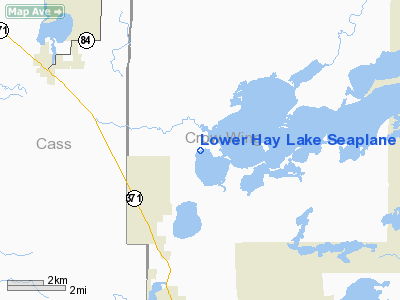
Lower Hay Lake Seaplane Base |
Location & QuickFacts
| FAA Information Effective: | 2008-09-25 |
| Airport Identifier: | 0MN3 |
| Airport Status: | Operational |
| Longitude/Latitude: | 094-17-33.0000W/46-40-40.0000N
-94.292500/46.677778 (Estimated) |
| Elevation: | 1230 ft / 374.90 m (Estimated) |
| Land: | 715 acres |
| From nearest city: | 3 nautical miles NE of Jenkins, MN |
| Location: | Crow Wing County, MN |
| Magnetic Variation: | 03E (1995) |
Owner & Manager
| Ownership: | Privately owned |
| Owner: | Paul K. Schroeder |
| Address: | 36261 Spruce Trail
Pine River, MN 56474 |
| Phone number: | 218-568-4134 |
| Manager: | Paul K. Schroeder |
| Address: | 36261 Spruce Trail
Pine River, MN 56474 |
| Phone number: | 218-568-4134 |
Airport Operations and Facilities
| Airport Use: | Private |
| Segmented Circle: | No |
| Control Tower: | No |
| Sectional chart: | Twin Cities |
| Region: | AGL - Great Lakes |
| Boundary ARTCC: | ZMP - Minneapolis |
| Tie-in FSS: | PNM - Princeton |
| FSS Toll Free: | 1-800-WX-BRIEF |
Runway Information
Runway 06/24
| Dimension: | 5000 x 100 ft / 1524.0 x 30.5 m |
| Surface: | WATER, |
| |
Runway 06 |
Runway 24 |
| Traffic Pattern: | Left | Left |
| Obstruction: | 50 ft trees, 1000.0 ft from runway | 50 ft trees, 1000.0 ft from runway |
|
Runway 15/33
| Dimension: | 5000 x 100 ft / 1524.0 x 30.5 m |
| Surface: | WATER, |
| |
Runway 15 |
Runway 33 |
| Traffic Pattern: | Left | Left |
| Obstruction: | 50 ft trees, 1000.0 ft from runway | 50 ft trees, 1000.0 ft from runway |
|
Radio Navigation Aids
| ID |
Type |
Name |
Ch |
Freq |
Var |
Dist |
| PWC | NDB | Pine River | | 330.00 | 03E | 4.8 nm |
| XVG | NDB | Longville | | 392.00 | 04E | 19.4 nm |
| AIT | NDB | Aitkin | | 397.00 | 03E | 26.7 nm |
| SAZ | NDB | Staples | | 257.00 | 04E | 27.7 nm |
| PK | NDB | Spida | | 269.00 | 04E | 29.6 nm |
| XCR | NDB | Ripley | | 404.00 | 03E | 36.1 nm |
| LXL | NDB | Little Falls | | 359.00 | 03E | 43.8 nm |
| RYM | TACAN | Camp Ripley | 048X | | 03E | 35.4 nm |
| PKD | VOR/DME | Park Rapids | 043X | 110.60 | 04E | 34.7 nm |
| GPZ | VOR/DME | Grand Rapids | 051X | 111.40 | 06E | 44.1 nm |
| BRD | VORTAC | Brainerd | 116X | 116.90 | 03E | 22.7 nm |
Remarks
- MIN 20:1 APCH CLNC OVR OBSTNS; REF TO 14 CFR PART 91.115.
Images and information placed above are from
http://www.airport-data.com/airport/0MN3/
We thank them for the data!
| General Info
|
| Country |
United States
|
| State |
MINNESOTA
|
| FAA ID |
0MN3
|
| Latitude |
46-40-40.000N
|
| Longitude |
094-17-33.000W
|
| Elevation |
1230 feet
|
| Near City |
JENKINS
|
We don't guarantee the information is fresh and accurate. The data may
be wrong or outdated.
For more up-to-date information please refer to other sources.
|
|


