 |
|
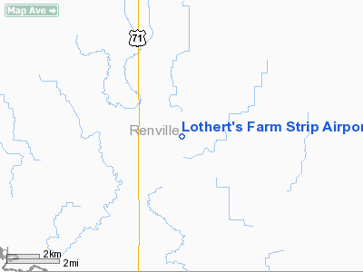
Lothert's Farm Strip Airport |
Location & QuickFacts
| FAA Information Effective: | 2008-09-25 |
| Airport Identifier: | 56MN |
| Airport Status: | Operational |
| Longitude/Latitude: | 094-57-40.9850W/44-38-43.8590N
-94.961385/44.645516 (Estimated) |
| Elevation: | 1015 ft / 309.37 m (Estimated) |
| Land: | 0 acres |
| From nearest city: | 6 nautical miles N of Morton, MN |
| Location: | Renville County, MN |
| Magnetic Variation: | 05E (1985) |
Owner & Manager
| Ownership: | Privately owned |
| Owner: | William Lothert |
| Address: | Rr 1, Box 73
Olivia, MN 56277 |
| Phone number: | 507-697-6208 |
| Manager: | Shawn Tisdell |
| Address: | 35626 730th Ave
Olivia, MN 56277 |
| Phone number: | 507-697-6274
320-212-9596 (CELL) |
Airport Operations and Facilities
| Airport Use: | Private |
| Segmented Circle: | No |
| Control Tower: | No |
| Sectional chart: | Twin Cities |
| Region: | AGL - Great Lakes |
| Boundary ARTCC: | ZMP - Minneapolis |
| Tie-in FSS: | PNM - Princeton |
| FSS on Airport: | No |
| FSS Toll Free: | 1-800-WX-BRIEF |
Runway Information
Runway E/W
| Dimension: | 2000 x 100 ft / 609.6 x 30.5 m |
| Surface: | TURF, |
| |
Runway E |
Runway W |
| Traffic Pattern: | Left | Left |
| Obstruction: | | 30 ft pline, 550.0 ft from runway |
|
Radio Navigation Aids
| ID |
Type |
Name |
Ch |
Freq |
Var |
Dist |
| HCD | NDB | Hutchinson | | 209.00 | 04E | 27.8 nm |
| GYL | NDB | Glencoe | | 407.00 | 03E | 38.0 nm |
| JYG | NDB | St James | | 260.00 | 04E | 43.4 nm |
| MWM | NDB | Windom | | 203.00 | 03E | 44.7 nm |
| ULM | NDB/DME | New Ulm | 050X | 272.00 | 04E | 28.0 nm |
| RWF | VOR/DME | Redwood Falls | 080X | 113.30 | 07E | 12.9 nm |
| ILL | VOR/DME | Willmar | 084X | 113.70 | 04E | 28.9 nm |
| BDH | VOR/DME | Willmar | 84X | 113.70 | 04E | 29.2 nm |
| MVE | VOR/DME | Montevideo | 053X | 111.60 | 05E | 37.6 nm |
| MML | VOR/DME | Marshall | 047X | 111.00 | 05E | 38.8 nm |
| DWN | VORTAC | Darwin | 027X | 109.00 | 07E | 34.3 nm |
Remarks
- FILED FOR RECORD PURPOSES ONLY.
Images and information placed above are from
http://www.airport-data.com/airport/56MN/
We thank them for the data!
| General Info
|
| Country |
United States
|
| State |
MINNESOTA
|
| FAA ID |
56MN
|
| Latitude |
44-38-43.859N
|
| Longitude |
094-57-40.985W
|
| Elevation |
1015 feet
|
| Near City |
MORTON
|
We don't guarantee the information is fresh and accurate. The data may
be wrong or outdated.
For more up-to-date information please refer to other sources.
|
|


